Harding Topo Map South Dakota
To zoom in, hover over the map of Harding
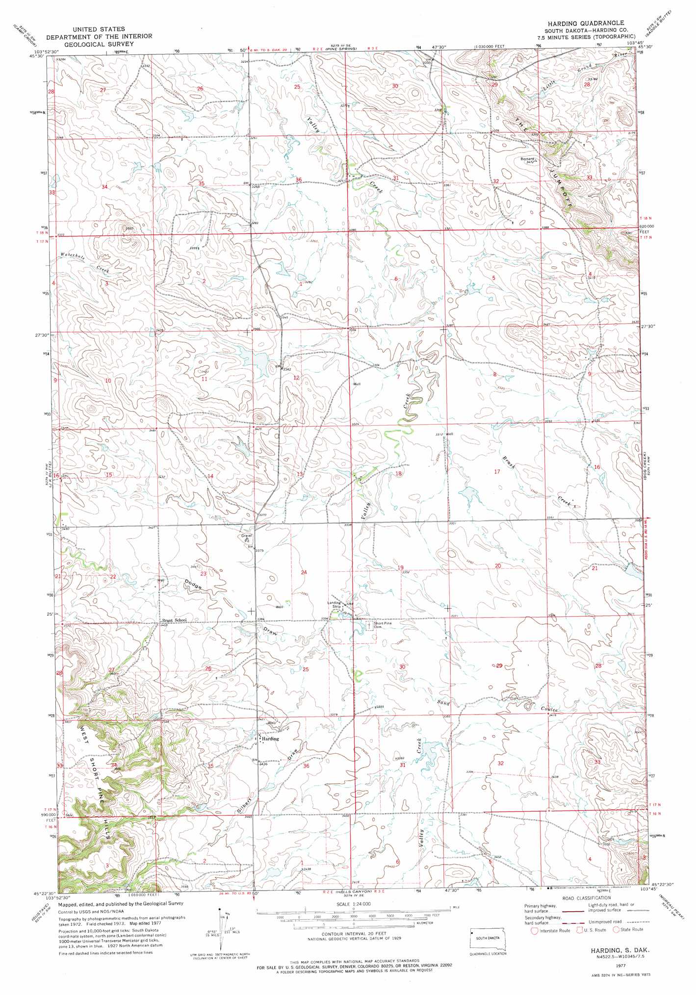
USGS Topo Quad 45103d7 - 1:24,000 scale
| Topo Map Name: | Harding |
| USGS Topo Quad ID: | 45103d7 |
| Print Size: | ca. 21 1/4" wide x 27" high |
| Southeast Coordinates: | 45.375° N latitude / 103.75° W longitude |
| Map Center Coordinates: | 45.4375° N latitude / 103.8125° W longitude |
| U.S. State: | SD |
| Filename: | o45103d7.jpg |
| Download Map JPG Image: | Harding topo map 1:24,000 scale |
| Map Type: | Topographic |
| Topo Series: | 7.5´ |
| Map Scale: | 1:24,000 |
| Source of Map Images: | United States Geological Survey (USGS) |
| Alternate Map Versions: |
Harding SD 1977, updated 1977 Download PDF Buy paper map Harding SD 1993, updated 1996 Download PDF Buy paper map Harding SD 2012 Download PDF Buy paper map Harding SD 2015 Download PDF Buy paper map |
| FStopo: | US Forest Service topo Harding is available: Download FStopo PDF Download FStopo TIF |
1:24,000 Topo Quads surrounding Harding
North Slick Creek |
Caroline Butte |
Gallup Creek |
Lahti Butte |
Mckenzie Butte |
Capitol Rock |
Camp Crook |
Pine Spring |
Saddle Butte |
Buffalo |
Capitol |
J K Butte |
Harding |
Bog Creek |
Redig Ne |
Cactus Creek East |
Gustave |
Hells Canyon |
Moreau Peak |
Redig |
Elkhorn Creek East |
Indian Butte |
Alkali Creek West |
Alkali Creek East |
Lone Tree Draw West |
> Back to 45103a1 at 1:100,000 scale
> Back to 45102a1 at 1:250,000 scale
> Back to U.S. Topo Maps home
Harding topo map: Gazetteer
Harding: Cliffs
The Jumpoff elevation 1038m 3405′Harding: Dams
Floyd Cooper Dam elevation 1013m 3323′John Catron Number 1 Dam elevation 1037m 3402′
John Catron Number 2 Dam elevation 1027m 3369′
Harding: Populated Places
Harding elevation 1043m 3421′Harding: Streams
Brush Creek elevation 1003m 3290′Harding: Valleys
Dodge Draw elevation 1023m 3356′Gilbert Draw elevation 1023m 3356′
Sand Coulee elevation 1024m 3359′
Harding digital topo map on disk
Buy this Harding topo map showing relief, roads, GPS coordinates and other geographical features, as a high-resolution digital map file on DVD:
Eastern Montana & Western North Dakota
Buy digital topo maps: Eastern Montana & Western North Dakota