Belle Creek South Topo Map Montana
To zoom in, hover over the map of Belle Creek South
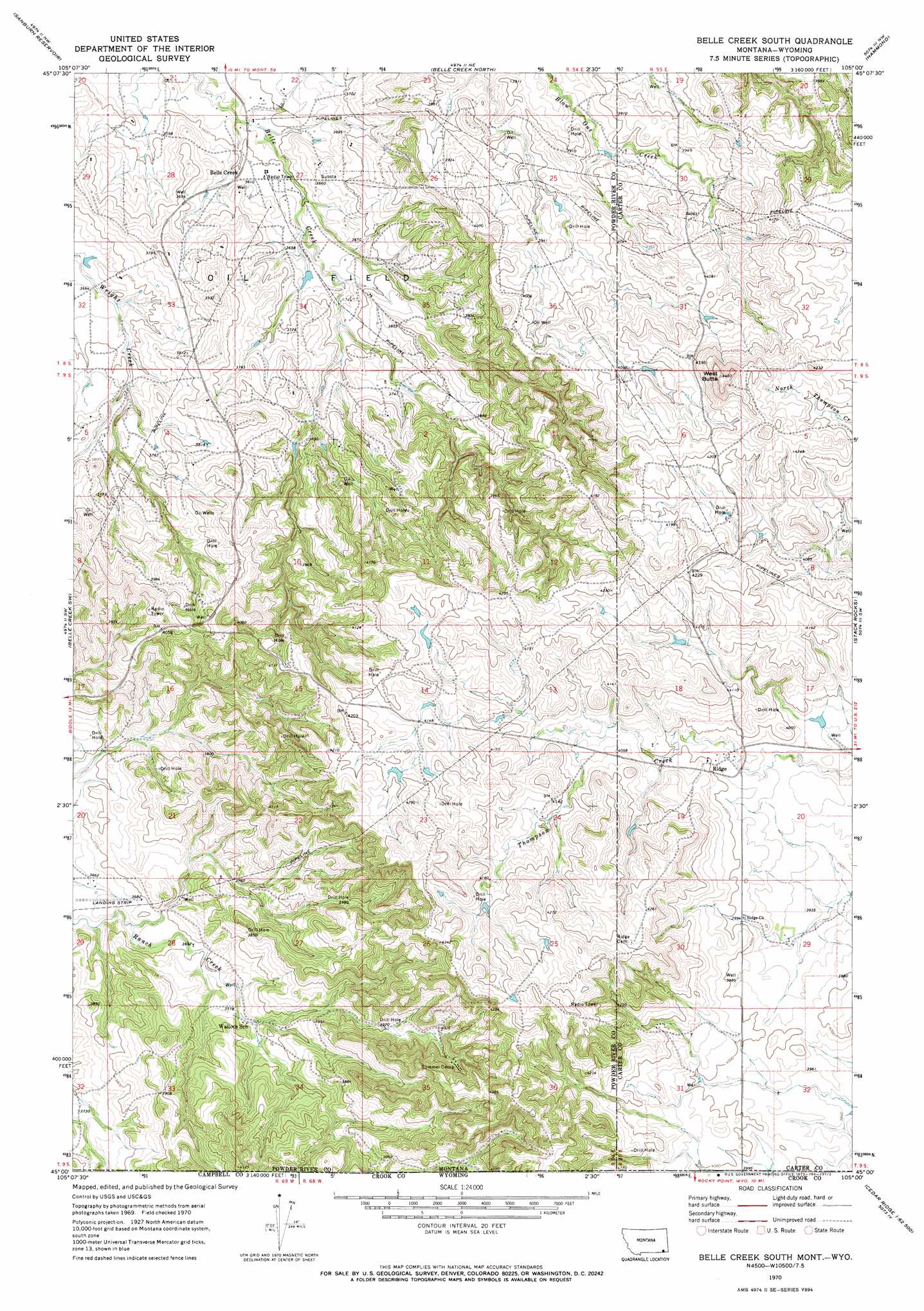
USGS Topo Quad 45105a1 - 1:24,000 scale
| Topo Map Name: | Belle Creek South |
| USGS Topo Quad ID: | 45105a1 |
| Print Size: | ca. 21 1/4" wide x 27" high |
| Southeast Coordinates: | 45° N latitude / 105° W longitude |
| Map Center Coordinates: | 45.0625° N latitude / 105.0625° W longitude |
| U.S. States: | MT, WY |
| Filename: | o45105a1.jpg |
| Download Map JPG Image: | Belle Creek South topo map 1:24,000 scale |
| Map Type: | Topographic |
| Topo Series: | 7.5´ |
| Map Scale: | 1:24,000 |
| Source of Map Images: | United States Geological Survey (USGS) |
| Alternate Map Versions: |
Belle Creek South MT 1970, updated 1973 Download PDF Buy paper map Belle Creek South MT 2011 Download PDF Buy paper map Belle Creek South MT 2014 Download PDF Buy paper map |
1:24,000 Topo Quads surrounding Belle Creek South
Fighting Butte |
Dry Creek Butte |
Boyes |
Knudson Draw |
Phillipi Reservoir |
Pine Creek |
Sanburn Reservoir |
Belle Creek North |
Hammond |
Greasy Hill |
Biddle |
Belle Creek Sw |
Belle Creek South |
Stack Rocks |
Hammond Se |
Nipple Butte |
Mitten Butte |
Rockypoint |
Moulton Creek |
Storm Draw |
Tuttle Draw |
Bowman Hill |
Bonnie Reservoir |
Cedar Ridge |
Wood Canyon |
> Back to 45105a1 at 1:100,000 scale
> Back to 45104a1 at 1:250,000 scale
> Back to U.S. Topo Maps home
Belle Creek South topo map: Gazetteer
Belle Creek South: Airports
Belle Creek Airport elevation 1103m 3618′Belle Creek South: Populated Places
Ridge elevation 1210m 3969′Belle Creek South: Post Offices
Ridge Post Office (historical) elevation 1211m 3973′Belle Creek South: Springs
08S55E29CD__01 Spring elevation 1281m 4202′Belle Creek South: Summits
West Butte elevation 1345m 4412′Belle Creek South: Wells
08S54E27BBCA01 Well elevation 1094m 3589′08S54E27CBB_01 Well elevation 1108m 3635′
08S55E31AA__01 Well elevation 1231m 4038′
09S54E02BCAD01 Well elevation 1171m 3841′
09S54E05DAAA01 Well elevation 1179m 3868′
09S54E16CD__01 Well elevation 1141m 3743′
09S55E19AAAB01 Well elevation 1208m 3963′
Belle Creek South digital topo map on disk
Buy this Belle Creek South topo map showing relief, roads, GPS coordinates and other geographical features, as a high-resolution digital map file on DVD:
Eastern Montana & Western North Dakota
Buy digital topo maps: Eastern Montana & Western North Dakota