Hammond Se Topo Map Montana
To zoom in, hover over the map of Hammond Se
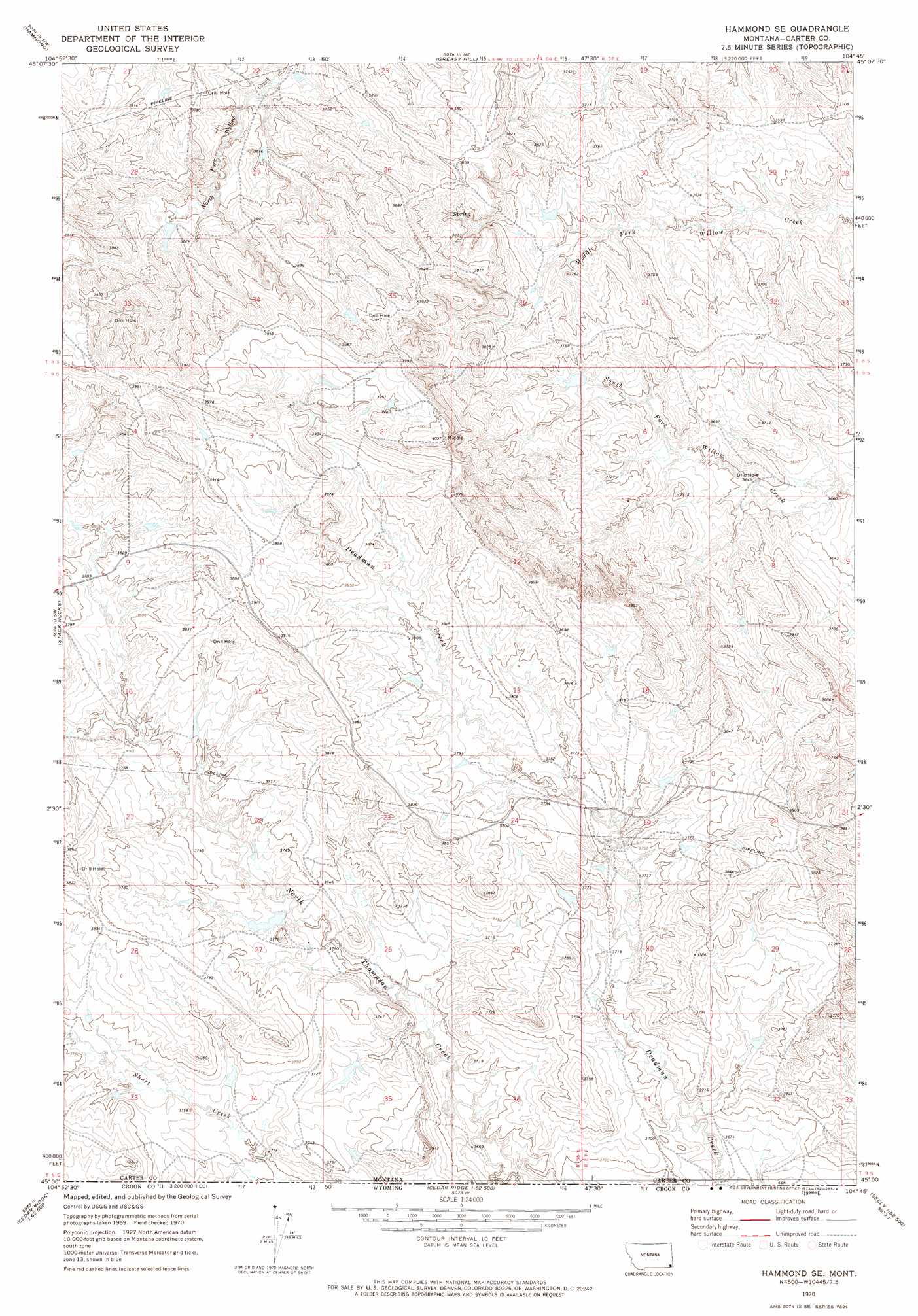
USGS Topo Quad 45104a7 - 1:24,000 scale
| Topo Map Name: | Hammond Se |
| USGS Topo Quad ID: | 45104a7 |
| Print Size: | ca. 21 1/4" wide x 27" high |
| Southeast Coordinates: | 45° N latitude / 104.75° W longitude |
| Map Center Coordinates: | 45.0625° N latitude / 104.8125° W longitude |
| U.S. State: | MT |
| Filename: | o45104a7.jpg |
| Download Map JPG Image: | Hammond Se topo map 1:24,000 scale |
| Map Type: | Topographic |
| Topo Series: | 7.5´ |
| Map Scale: | 1:24,000 |
| Source of Map Images: | United States Geological Survey (USGS) |
| Alternate Map Versions: |
Hammond SE MT 1970, updated 1973 Download PDF Buy paper map Hammond SE MT 2011 Download PDF Buy paper map Hammond SE MT 2014 Download PDF Buy paper map |
1:24,000 Topo Quads surrounding Hammond Se
Boyes |
Knudson Draw |
Phillipi Reservoir |
Tip Top Butte |
Potato Buttes |
Belle Creek North |
Hammond |
Greasy Hill |
Black Point |
Black Point Ne |
Belle Creek South |
Stack Rocks |
Hammond Se |
Cochran Reservoir |
Gomer Draw |
Rockypoint |
Moulton Creek |
Storm Draw |
Page Draw |
Gaff Creek |
Bonnie Reservoir |
Cedar Ridge |
Wood Canyon |
Strawberry Hill |
Seely |
> Back to 45104a1 at 1:100,000 scale
> Back to 45104a1 at 1:250,000 scale
> Back to U.S. Topo Maps home
Hammond Se topo map: Gazetteer
Hammond Se: Airports
Lanning Ranch Airport elevation 1212m 3976′Hammond Se: Dams
Aces Wild Dam elevation 1135m 3723′Cochran Dam elevation 1190m 3904′
Edward Lanning Number 1 Dam elevation 1179m 3868′
Edward Lanning Number 2 Dam elevation 1190m 3904′
Jerk Number 2 Dam elevation 1164m 3818′
Lemon Hart Dam elevation 1147m 3763′
Pilister Number 2 Dam elevation 1128m 3700′
The Pinta Dam elevation 1120m 3674′
Hammond Se digital topo map on disk
Buy this Hammond Se topo map showing relief, roads, GPS coordinates and other geographical features, as a high-resolution digital map file on DVD:
Eastern Montana & Western North Dakota
Buy digital topo maps: Eastern Montana & Western North Dakota