Goodnoe Hills Topo Map Washington
To zoom in, hover over the map of Goodnoe Hills
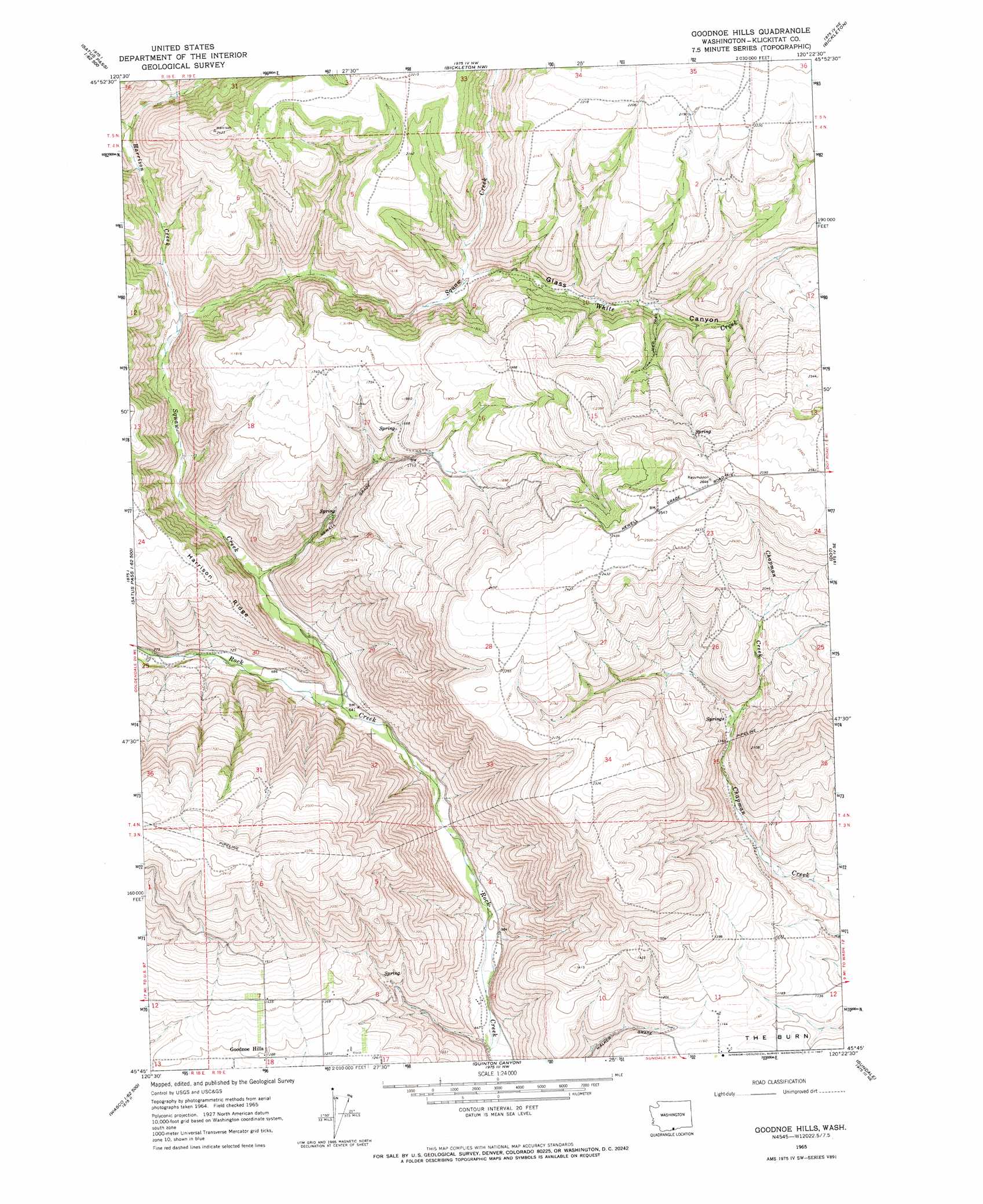
USGS Topo Quad 45120g4 - 1:24,000 scale
| Topo Map Name: | Goodnoe Hills |
| USGS Topo Quad ID: | 45120g4 |
| Print Size: | ca. 21 1/4" wide x 27" high |
| Southeast Coordinates: | 45.75° N latitude / 120.375° W longitude |
| Map Center Coordinates: | 45.8125° N latitude / 120.4375° W longitude |
| U.S. State: | WA |
| Filename: | o45120g4.jpg |
| Download Map JPG Image: | Goodnoe Hills topo map 1:24,000 scale |
| Map Type: | Topographic |
| Topo Series: | 7.5´ |
| Map Scale: | 1:24,000 |
| Source of Map Images: | United States Geological Survey (USGS) |
| Alternate Map Versions: |
Goodnoe Hills WA 1965, updated 1967 Download PDF Buy paper map Goodnoe Hills WA 2011 Download PDF Buy paper map Goodnoe Hills WA 2013 Download PDF Buy paper map |
1:24,000 Topo Quads surrounding Goodnoe Hills
Logy Creek Sw |
Kusshi Creek |
Poisel Butte Sw |
Poisel Butte Se |
Bluelight |
Status Pass |
Lone Pine Butte |
Bickleton Nw |
Bickleton |
Crider Valley |
Luna Butte |
Luna Gulch |
Goodnoe Hills |
Dot |
Wood Gulch |
Rufus |
Quinton |
Sundale Nw |
Sundale |
Arlington |
Wasco |
Klondike |
Mcdonald |
Turner Butte |
Shutler Flat |
> Back to 45120e1 at 1:100,000 scale
> Back to 45120a1 at 1:250,000 scale
> Back to U.S. Topo Maps home
Goodnoe Hills topo map: Gazetteer
Goodnoe Hills: Populated Places
Goodnoe Hills elevation 395m 1295′Goodnoe Hills: Streams
Harrison Creek elevation 301m 987′Squaw Creek elevation 192m 629′
White Creek elevation 397m 1302′
Goodnoe Hills: Valleys
Glass Canyon elevation 396m 1299′Goodnoe Hills digital topo map on disk
Buy this Goodnoe Hills topo map showing relief, roads, GPS coordinates and other geographical features, as a high-resolution digital map file on DVD: