Luna Butte Topo Map Washington
To zoom in, hover over the map of Luna Butte
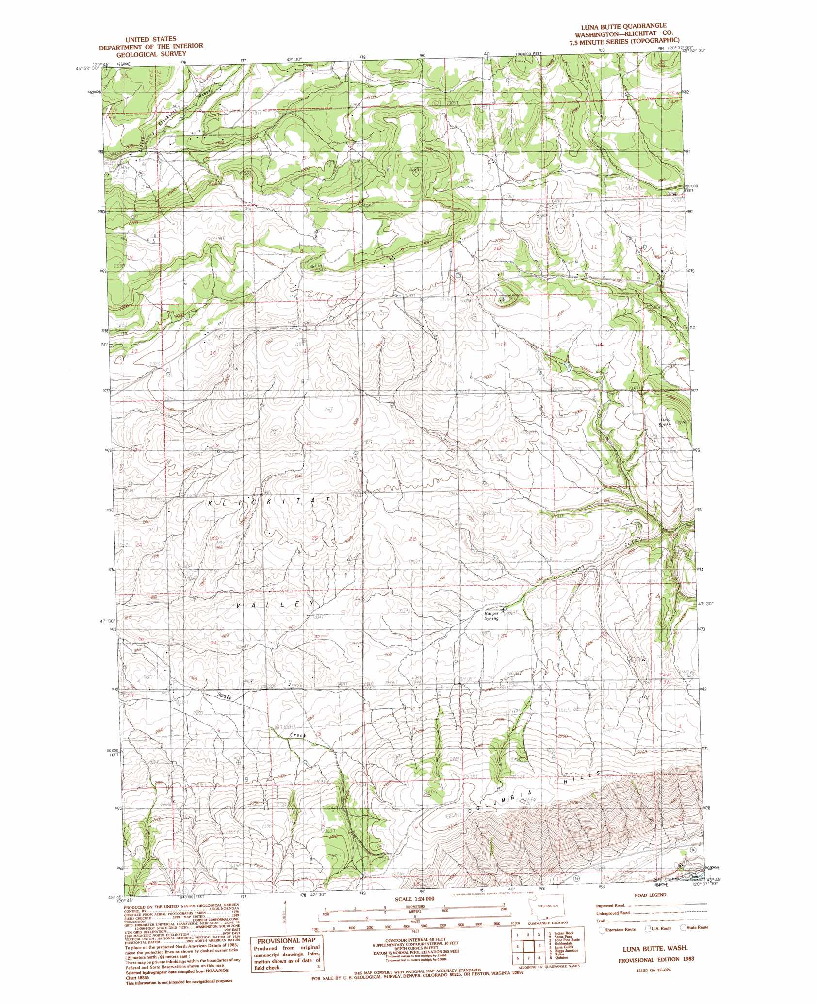
USGS Topo Quad 45120g6 - 1:24,000 scale
| Topo Map Name: | Luna Butte |
| USGS Topo Quad ID: | 45120g6 |
| Print Size: | ca. 21 1/4" wide x 27" high |
| Southeast Coordinates: | 45.75° N latitude / 120.625° W longitude |
| Map Center Coordinates: | 45.8125° N latitude / 120.6875° W longitude |
| U.S. State: | WA |
| Filename: | o45120g6.jpg |
| Download Map JPG Image: | Luna Butte topo map 1:24,000 scale |
| Map Type: | Topographic |
| Topo Series: | 7.5´ |
| Map Scale: | 1:24,000 |
| Source of Map Images: | United States Geological Survey (USGS) |
| Alternate Map Versions: |
Luna Butte WA 1983, updated 1983 Download PDF Buy paper map Luna Butte WA 2011 Download PDF Buy paper map Luna Butte WA 2013 Download PDF Buy paper map |
1:24,000 Topo Quads surrounding Luna Butte
Hagerty Butte |
Stagman Butte |
Logy Creek Sw |
Kusshi Creek |
Poisel Butte Sw |
White Pine Buttes |
Indian Rock |
Status Pass |
Lone Pine Butte |
Bickleton Nw |
Centerville |
Goldendale |
Luna Butte |
Luna Gulch |
Goodnoe Hills |
Wishram |
Biggs Junction |
Rufus |
Quinton |
Sundale Nw |
Emerson |
Locust Grove |
Wasco |
Klondike |
Mcdonald |
> Back to 45120e1 at 1:100,000 scale
> Back to 45120a1 at 1:250,000 scale
> Back to U.S. Topo Maps home
Luna Butte topo map: Gazetteer
Luna Butte: Airports
Hillcrest Airport elevation 681m 2234′Luna Butte: Springs
Harper Spring elevation 575m 1886′Luna Butte: Summits
Luna Butte elevation 677m 2221′Luna Butte digital topo map on disk
Buy this Luna Butte topo map showing relief, roads, GPS coordinates and other geographical features, as a high-resolution digital map file on DVD: