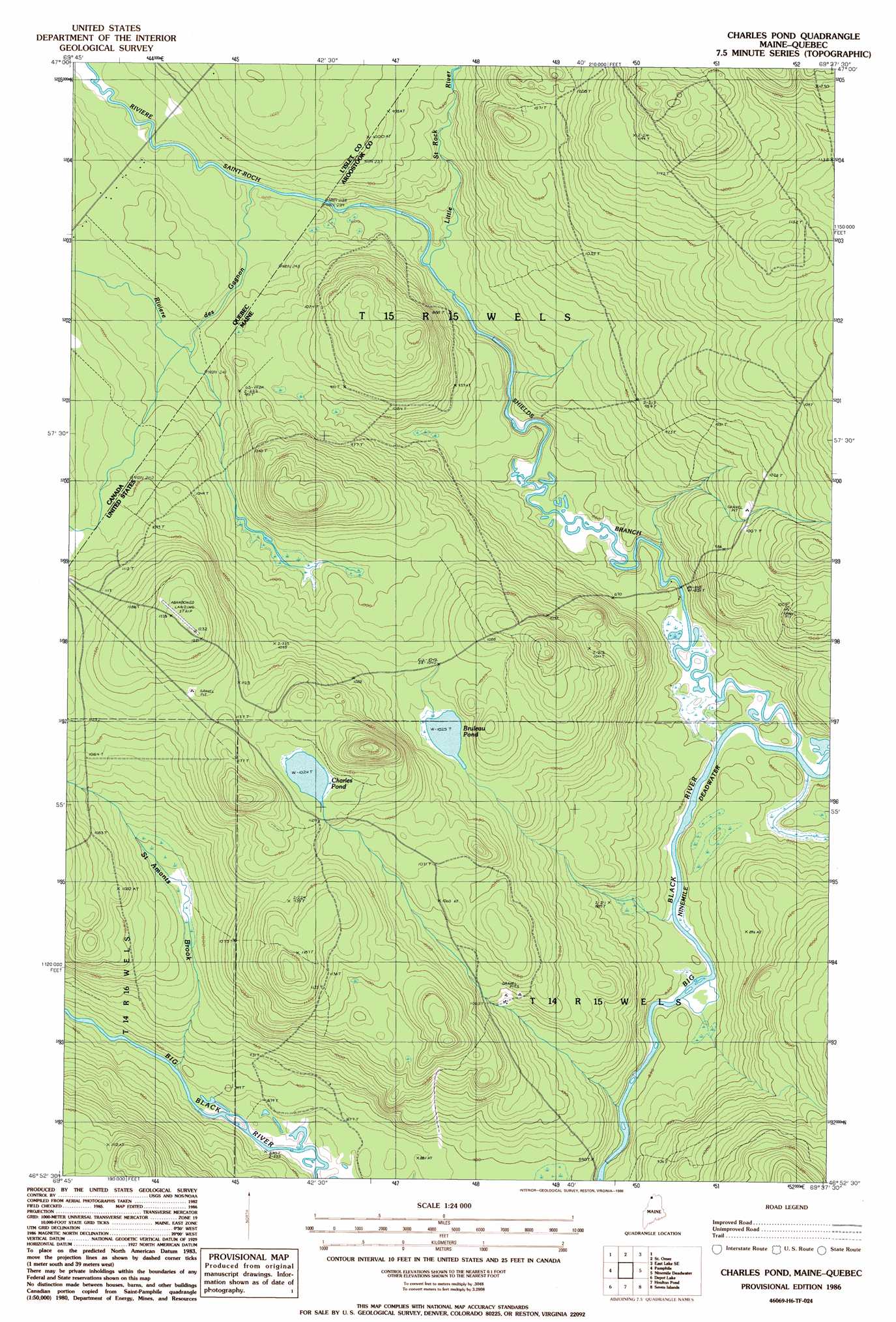
Charles Pond Topo Map Maine
To zoom in, hover over the map of Charles Pond
USGS Topo Quad 46069h6 - 1:24,000 scale
| Topo Map Name: | Charles Pond |
| USGS Topo Quad ID: | 46069h6 |
| Print Size: | ca. 21 1/4" wide x 27" high |
| Southeast Coordinates: | 46.875° N latitude / 69.625° W longitude |
| Map Center Coordinates: | 46.9375° N latitude / 69.6875° W longitude |
| U.S. State: | ME |
| Filename: | o46069h6.jpg |
| Download Map JPG Image: | Charles Pond topo map 1:24,000 scale |
| Map Type: | Topographic |
| Topo Series: | 7.5´ |
| Map Scale: | 1:24,000 |
| Source of Map Images: | United States Geological Survey (USGS) |
| Alternate Map Versions: |
Charles Pond ME 1977, updated 1983 Download PDF Buy paper map Charles Pond ME 1986, updated 1986 Download PDF Buy paper map Charles Pond ME 2011 Download PDF Buy paper map Charles Pond ME 2014 Download PDF Buy paper map |
1:24,000 Topo Quads surrounding Charles Pond
East Lake |
Rocky Mountain Nw |
|||
Saint Omer |
East Lake Se |
Rocky Mountain Sw |
||
Saint Pamphile |
Charles Pond |
Ninemile Deadwater |
Big Black Rapids |
|
Saint Adalbert |
Depot Lake |
Houlton Pond |
Seven Islands |
Blue Brook |
Burntland Pond |
Maryl Pond |
Ninemile Bridge |
Ugh Lake |
Cunliffe Lake |
> Back to 46069e1 at 1:100,000 scale
> Back to 46068a1 at 1:250,000 scale
> Back to U.S. Topo Maps home
Charles Pond topo map: Gazetteer
Charles Pond: Lakes
Bruleau Pond elevation 312m 1023′Charles Pond elevation 343m 1125′
Charles Pond: Streams
Little Saint Roch River elevation 264m 866′Saint Amants Brook elevation 268m 879′
Shields Branch elevation 255m 836′
Charles Pond digital topo map on disk
Buy this Charles Pond topo map showing relief, roads, GPS coordinates and other geographical features, as a high-resolution digital map file on DVD:
Maine, New Hampshire, Rhode Island & Eastern Massachusetts
Buy digital topo maps: Maine, New Hampshire, Rhode Island & Eastern Massachusetts