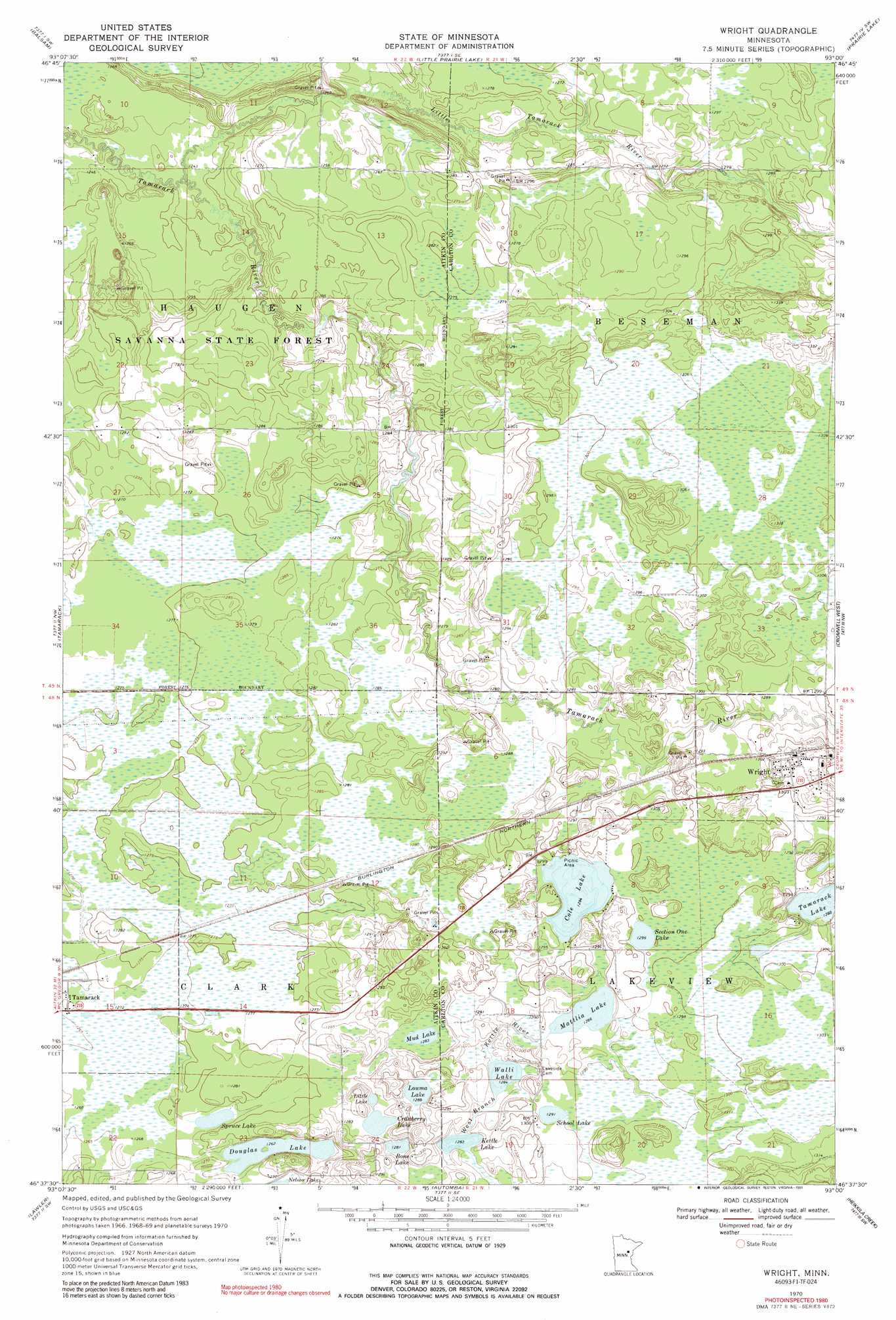
Wright Topo Map Minnesota
To zoom in, hover over the map of Wright
USGS Topo Quad 46093f1 - 1:24,000 scale
| Topo Map Name: | Wright |
| USGS Topo Quad ID: | 46093f1 |
| Print Size: | ca. 21 1/4" wide x 27" high |
| Southeast Coordinates: | 46.625° N latitude / 93° W longitude |
| Map Center Coordinates: | 46.6875° N latitude / 93.0625° W longitude |
| U.S. State: | MN |
| Filename: | o46093f1.jpg |
| Download Map JPG Image: | Wright topo map 1:24,000 scale |
| Map Type: | Topographic |
| Topo Series: | 7.5´ |
| Map Scale: | 1:24,000 |
| Source of Map Images: | United States Geological Survey (USGS) |
| Alternate Map Versions: |
Wright MN 1970, updated 1972 Download PDF Buy paper map Wright MN 1970, updated 1991 Download PDF Buy paper map Wright MN 2010 Download PDF Buy paper map Wright MN 2013 Download PDF Buy paper map Wright MN 2016 Download PDF Buy paper map |
1:24,000 Topo Quads surrounding Wright
Ball Bluff |
Vanduse Lake |
Island |
Floodwood |
Mccarty River |
Libby |
Balsam |
Little Prairie Lake |
Prairie Lake |
Gowan |
Minnewawa |
Tamarack |
Wright |
Cromwell West |
Cromwell East |
Mcgregor |
Lawler |
Automba |
Heikkila Creek |
Cromwell Se |
Thor Ne |
Split Rock Lake |
Ronald |
Kettle River |
Moose Lake |
> Back to 46093e1 at 1:100,000 scale
> Back to 46092a1 at 1:250,000 scale
> Back to U.S. Topo Maps home
Wright topo map: Gazetteer
Wright: Lakes
Bone Lake elevation 390m 1279′Cole Lake elevation 393m 1289′
Cranberry Lake elevation 390m 1279′
Douglas Lake elevation 384m 1259′
Kettle Lake elevation 391m 1282′
Little Lake elevation 389m 1276′
Louma Lake elevation 391m 1282′
Mattlia Lake elevation 391m 1282′
Mud Lake elevation 390m 1279′
School Lake elevation 393m 1289′
Section One Lake elevation 394m 1292′
Spruce Lake elevation 385m 1263′
Walli Lake elevation 391m 1282′
Wright: Populated Places
Wright elevation 398m 1305′Wright: Post Offices
Wright Post Office elevation 398m 1305′Wright: Streams
Little Tamarack River elevation 378m 1240′Wright digital topo map on disk
Buy this Wright topo map showing relief, roads, GPS coordinates and other geographical features, as a high-resolution digital map file on DVD: