Yablonski Ranch Topo Map Montana
To zoom in, hover over the map of Yablonski Ranch
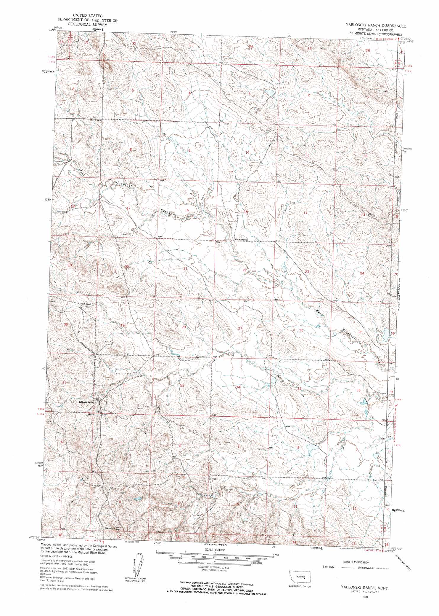
USGS Topo Quad 46107f4 - 1:24,000 scale
| Topo Map Name: | Yablonski Ranch |
| USGS Topo Quad ID: | 46107f4 |
| Print Size: | ca. 21 1/4" wide x 27" high |
| Southeast Coordinates: | 46.625° N latitude / 107.375° W longitude |
| Map Center Coordinates: | 46.6875° N latitude / 107.4375° W longitude |
| U.S. State: | MT |
| Filename: | o46107f4.jpg |
| Download Map JPG Image: | Yablonski Ranch topo map 1:24,000 scale |
| Map Type: | Topographic |
| Topo Series: | 7.5´ |
| Map Scale: | 1:24,000 |
| Source of Map Images: | United States Geological Survey (USGS) |
| Alternate Map Versions: |
Yablonski Ranch MT 1960, updated 1962 Download PDF Buy paper map Yablonski Ranch MT 1960, updated 1962 Download PDF Buy paper map Yablonski Ranch MT 2011 Download PDF Buy paper map Yablonski Ranch MT 2014 Download PDF Buy paper map |
1:24,000 Topo Quads surrounding Yablonski Ranch
Dutton Ranch |
Mcwilliams Springs |
Mcginnis Butte |
Emma Butte |
School Butte |
Kincheloe Ranch |
Regnal Coulee |
Mcginnis Butte Sw |
Mcginnis Butte Se |
Hole-In-The-Rock |
Grebe Ranch |
Hecker Ranch |
Yablonski Ranch |
Black Sea Reservoir |
Hagen Ranch |
Guthridge Ranch |
Sumatra |
Ingomar West |
Ingomar East |
Thebes |
Weed Creek East |
Ruskosky Ridge |
Mckonkey Creek |
Steie Ranch |
Ahles |
> Back to 46107e1 at 1:100,000 scale
> Back to 46106a1 at 1:250,000 scale
> Back to U.S. Topo Maps home
Yablonski Ranch topo map: Gazetteer
Yablonski Ranch: Dams
Bethel College Number 3 Dam elevation 896m 2939′Big Timber Number 7 Dam elevation 919m 3015′
J-K-Boyd Number 1 Dam elevation 917m 3008′
L Galt Number 19 Dam elevation 918m 3011′
Yablonski Ranch digital topo map on disk
Buy this Yablonski Ranch topo map showing relief, roads, GPS coordinates and other geographical features, as a high-resolution digital map file on DVD:
Eastern Montana & Western North Dakota
Buy digital topo maps: Eastern Montana & Western North Dakota