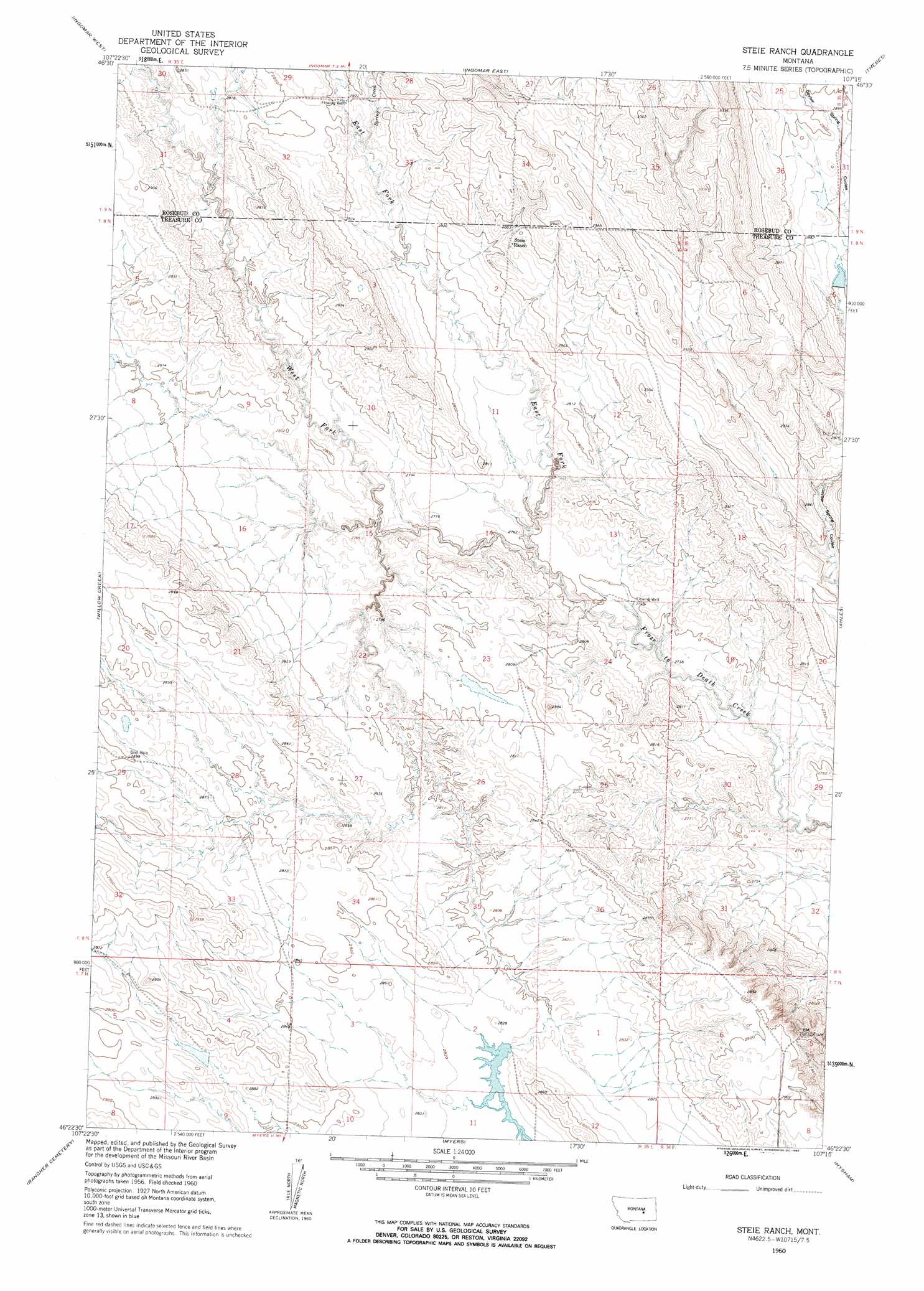
Steie Ranch Topo Map Montana
To zoom in, hover over the map of Steie Ranch
USGS Topo Quad 46107d3 - 1:24,000 scale
| Topo Map Name: | Steie Ranch |
| USGS Topo Quad ID: | 46107d3 |
| Print Size: | ca. 21 1/4" wide x 27" high |
| Southeast Coordinates: | 46.375° N latitude / 107.25° W longitude |
| Map Center Coordinates: | 46.4375° N latitude / 107.3125° W longitude |
| U.S. State: | MT |
| Filename: | o46107d3.jpg |
| Download Map JPG Image: | Steie Ranch topo map 1:24,000 scale |
| Map Type: | Topographic |
| Topo Series: | 7.5´ |
| Map Scale: | 1:24,000 |
| Source of Map Images: | United States Geological Survey (USGS) |
| Alternate Map Versions: |
Steie Ranch MT 1960, updated 1962 Download PDF Buy paper map Steie Ranch MT 2011 Download PDF Buy paper map Steie Ranch MT 2014 Download PDF Buy paper map |
1:24,000 Topo Quads surrounding Steie Ranch
Hecker Ranch |
Yablonski Ranch |
Black Sea Reservoir |
Hagen Ranch |
Brown Coulee |
Sumatra |
Ingomar West |
Ingomar East |
Thebes |
Zempel Lake |
Ruskosky Ridge |
Mckonkey Creek |
Steie Ranch |
Ahles |
Vananda |
Devils Kitchen |
Rancher Cemetery |
Myers |
Hysham |
Sanders |
Custer |
Bighorn |
Eldering Ranch |
Scraper Coulee |
Woods Water |
> Back to 46107a1 at 1:100,000 scale
> Back to 46106a1 at 1:250,000 scale
> Back to U.S. Topo Maps home
Steie Ranch topo map: Gazetteer
Steie Ranch: Dams
Bassett Dam elevation 870m 2854′Froze-to-Death Number 11 Dam elevation 851m 2791′
Froze-to-Death Number 3 Dam elevation 875m 2870′
Froze-to-Death Number 4 Dam elevation 859m 2818′
Montana Number 18 Dam elevation 876m 2874′
Rockwell Dam elevation 872m 2860′
Steie Ranch: Streams
East Fork Froze to Death Creek elevation 835m 2739′Spring Creek elevation 860m 2821′
West Fork Froze to Death Creek elevation 835m 2739′
Steie Ranch: Wells
09N35E34AB__01 Well elevation 906m 2972′09N35E34BA__01 Well elevation 910m 2985′
Steie Ranch digital topo map on disk
Buy this Steie Ranch topo map showing relief, roads, GPS coordinates and other geographical features, as a high-resolution digital map file on DVD:
Eastern Montana & Western North Dakota
Buy digital topo maps: Eastern Montana & Western North Dakota