Ruskosky Ridge Topo Map Montana
To zoom in, hover over the map of Ruskosky Ridge
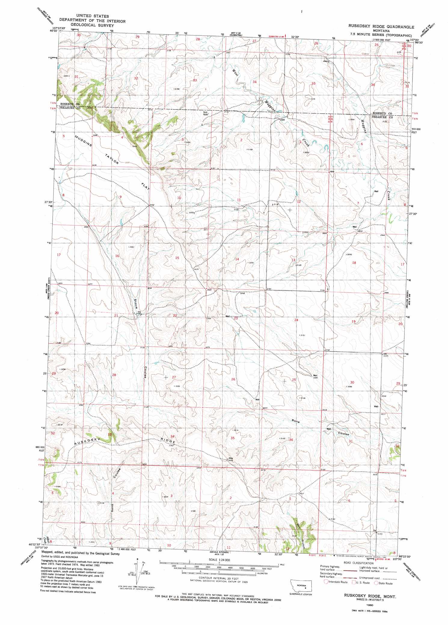
USGS Topo Quad 46107d5 - 1:24,000 scale
| Topo Map Name: | Ruskosky Ridge |
| USGS Topo Quad ID: | 46107d5 |
| Print Size: | ca. 21 1/4" wide x 27" high |
| Southeast Coordinates: | 46.375° N latitude / 107.5° W longitude |
| Map Center Coordinates: | 46.4375° N latitude / 107.5625° W longitude |
| U.S. State: | MT |
| Filename: | o46107d5.jpg |
| Download Map JPG Image: | Ruskosky Ridge topo map 1:24,000 scale |
| Map Type: | Topographic |
| Topo Series: | 7.5´ |
| Map Scale: | 1:24,000 |
| Source of Map Images: | United States Geological Survey (USGS) |
| Alternate Map Versions: |
Ruskosky Ridge MT 1980, updated 1980 Download PDF Buy paper map Ruskosky Ridge MT 2011 Download PDF Buy paper map Ruskosky Ridge MT 2014 Download PDF Buy paper map |
1:24,000 Topo Quads surrounding Ruskosky Ridge
Melstone Ne |
Grebe Ranch |
Hecker Ranch |
Yablonski Ranch |
Black Sea Reservoir |
Melstone |
Guthridge Ranch |
Sumatra |
Ingomar West |
Ingomar East |
Weed Creek West |
Weed Creek East |
Ruskosky Ridge |
Mckonkey Creek |
Steie Ranch |
Mailbox Hill |
Mexican Buttes |
Devils Kitchen |
Rancher Cemetery |
Myers |
Mud Butte |
Coal Bank Creek |
Custer |
Bighorn |
Eldering Ranch |
> Back to 46107a1 at 1:100,000 scale
> Back to 46106a1 at 1:250,000 scale
> Back to U.S. Topo Maps home
Ruskosky Ridge topo map: Gazetteer
Ruskosky Ridge: Flats
Muggins Taylor Flat elevation 1030m 3379′Ruskosky Ridge: Ridges
Ruskosky Ridge elevation 989m 3244′Ruskosky Ridge: Streams
West Muggins Creek elevation 897m 2942′Ruskosky Ridge: Wells
08N33E12CBBD01 Well elevation 946m 3103′08N33E23BDCD01 Well elevation 1009m 3310′
08N33E26A___01 Well elevation 955m 3133′
08N34E06DBAB01 Well elevation 900m 2952′
Ruskosky Ridge digital topo map on disk
Buy this Ruskosky Ridge topo map showing relief, roads, GPS coordinates and other geographical features, as a high-resolution digital map file on DVD:
Eastern Montana & Western North Dakota
Buy digital topo maps: Eastern Montana & Western North Dakota