P K Ranch Sw Topo Map Montana
To zoom in, hover over the map of P K Ranch Sw
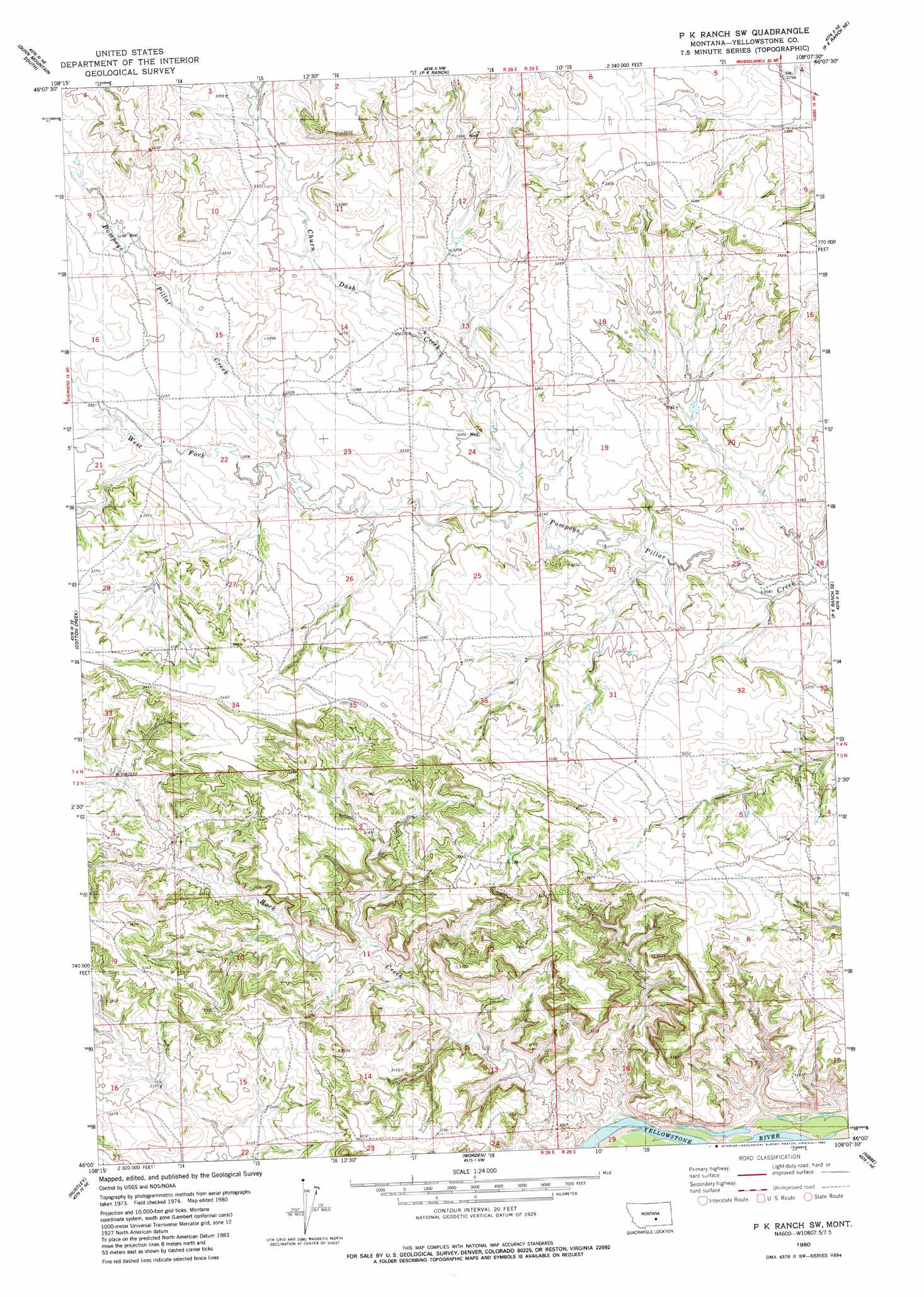
USGS Topo Quad 46108a2 - 1:24,000 scale
| Topo Map Name: | P K Ranch Sw |
| USGS Topo Quad ID: | 46108a2 |
| Print Size: | ca. 21 1/4" wide x 27" high |
| Southeast Coordinates: | 46° N latitude / 108.125° W longitude |
| Map Center Coordinates: | 46.0625° N latitude / 108.1875° W longitude |
| U.S. State: | MT |
| Filename: | o46108a2.jpg |
| Download Map JPG Image: | P K Ranch Sw topo map 1:24,000 scale |
| Map Type: | Topographic |
| Topo Series: | 7.5´ |
| Map Scale: | 1:24,000 |
| Source of Map Images: | United States Geological Survey (USGS) |
| Alternate Map Versions: |
P K Ranch SW MT 1980, updated 1980 Download PDF Buy paper map P K Ranch SW MT 2011 Download PDF Buy paper map P K Ranch SW MT 2014 Download PDF Buy paper map |
1:24,000 Topo Quads surrounding P K Ranch Sw
Signal Mountain |
Dunn Mountain North |
Cherry Spring |
Steamboat Butte |
Pine View |
Park Coulee |
Dunn Mountain South |
P K Ranch |
P K Ranch Ne |
Bull Mountain Nw |
North Fork Crooked Creek East |
Cotton Creek |
P K Ranch Sw |
P K Ranch Se |
Big Marys Island |
Rattlesnake Butte |
Huntley |
Worden |
Nibbe |
Pompeys Pillar |
Billings East |
Cottonwood Creek |
Indian Arrow |
Gails Coulee |
Corinth |
> Back to 46108a1 at 1:100,000 scale
> Back to 46108a1 at 1:250,000 scale
> Back to U.S. Topo Maps home
P K Ranch Sw topo map: Gazetteer
P K Ranch Sw: Streams
Churn Dash Creek elevation 956m 3136′Rock Creek elevation 891m 2923′
West Fork Pompeys Pillar Creek elevation 973m 3192′
P K Ranch Sw: Wells
03N29E08DDAC01 Well elevation 996m 3267′04N28E12CDDB01 Well elevation 993m 3257′
04N28E14DAAA01 Well elevation 982m 3221′
04N28E15B___01 Well elevation 1006m 3300′
04N28E34BAAA01 Well elevation 1051m 3448′
04N29E20BBCD01 Well elevation 972m 3188′
P K Ranch Sw digital topo map on disk
Buy this P K Ranch Sw topo map showing relief, roads, GPS coordinates and other geographical features, as a high-resolution digital map file on DVD: