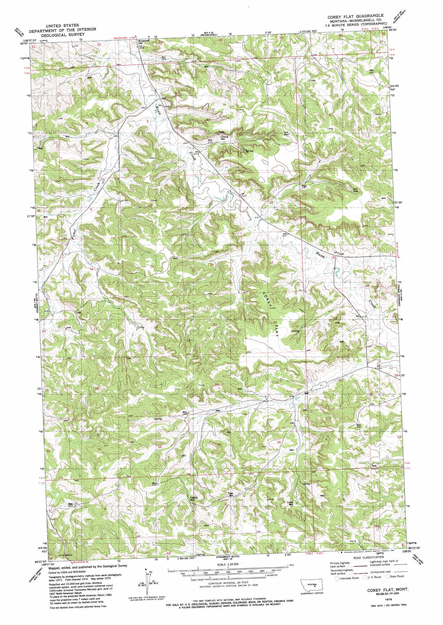
Corey Flat Topo Map Montana
To zoom in, hover over the map of Corey Flat
USGS Topo Quad 46108d1 - 1:24,000 scale
| Topo Map Name: | Corey Flat |
| USGS Topo Quad ID: | 46108d1 |
| Print Size: | ca. 21 1/4" wide x 27" high |
| Southeast Coordinates: | 46.375° N latitude / 108° W longitude |
| Map Center Coordinates: | 46.4375° N latitude / 108.0625° W longitude |
| U.S. State: | MT |
| Filename: | o46108d1.jpg |
| Download Map JPG Image: | Corey Flat topo map 1:24,000 scale |
| Map Type: | Topographic |
| Topo Series: | 7.5´ |
| Map Scale: | 1:24,000 |
| Source of Map Images: | United States Geological Survey (USGS) |
| Alternate Map Versions: |
Corey Flat MT 1979, updated 1986 Download PDF Buy paper map Corey Flat MT 2011 Download PDF Buy paper map Corey Flat MT 2014 Download PDF Buy paper map |
1:24,000 Topo Quads surrounding Corey Flat
Jim Coulee |
Musselshell Nw |
Akers Ranch |
Melstone Nw |
Melstone Ne |
Big Wall East |
Delphia |
Musselshell |
Queens Point |
Melstone |
Gage Ne |
Chimney Butte |
Corey Flat |
Chandler Spring |
Weed Creek West |
Dunn Mountain North |
Cherry Spring |
Steamboat Butte |
Pine View |
Mailbox Hill |
Dunn Mountain South |
P K Ranch |
P K Ranch Ne |
Bull Mountain Nw |
Mud Butte |
> Back to 46108a1 at 1:100,000 scale
> Back to 46108a1 at 1:250,000 scale
> Back to U.S. Topo Maps home
Corey Flat topo map: Gazetteer
Corey Flat: Flats
Cory Flat elevation 1052m 3451′Corey Flat: Streams
Fishel Creek elevation 933m 3061′Corey Flat: Wells
08N29E22CBAA01 Well elevation 1008m 3307′08N29E23AADD01 Well elevation 996m 3267′
08N29E33CAA_01 Well elevation 1081m 3546′
08N29E36DBDA01 Well elevation 1014m 3326′
08N30E06CDBD01 Well elevation 992m 3254′
08N30E07BCA_01 Well elevation 987m 3238′
08N30E32CCCC01 Well elevation 1036m 3398′
09N29E33CBBD01 Well elevation 934m 3064′
Page Well elevation 1050m 3444′
Tripod Well elevation 1046m 3431′
Corey Flat digital topo map on disk
Buy this Corey Flat topo map showing relief, roads, GPS coordinates and other geographical features, as a high-resolution digital map file on DVD: