Delphia Topo Map Montana
To zoom in, hover over the map of Delphia
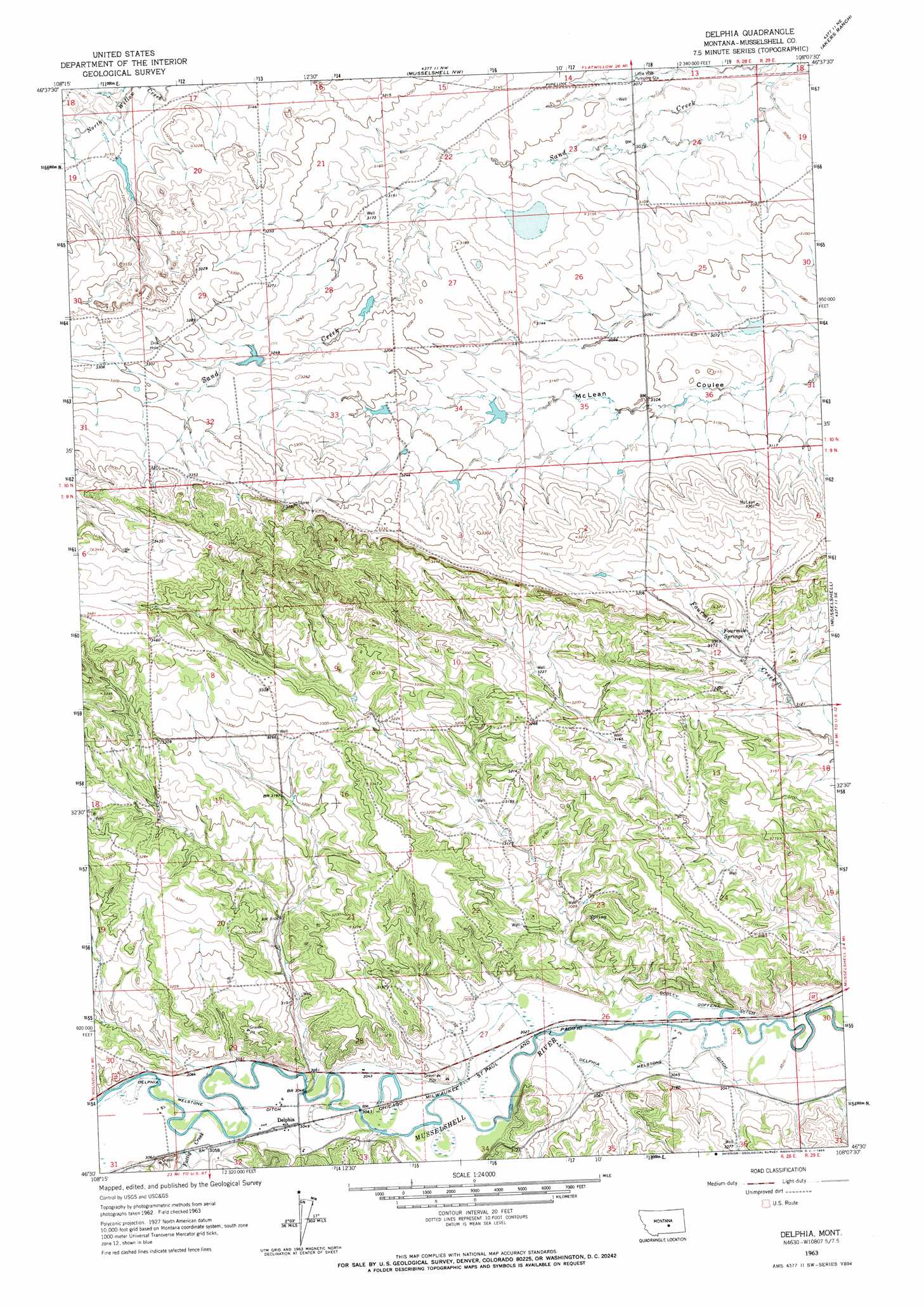
USGS Topo Quad 46108e2 - 1:24,000 scale
| Topo Map Name: | Delphia |
| USGS Topo Quad ID: | 46108e2 |
| Print Size: | ca. 21 1/4" wide x 27" high |
| Southeast Coordinates: | 46.5° N latitude / 108.125° W longitude |
| Map Center Coordinates: | 46.5625° N latitude / 108.1875° W longitude |
| U.S. State: | MT |
| Filename: | o46108e2.jpg |
| Download Map JPG Image: | Delphia topo map 1:24,000 scale |
| Map Type: | Topographic |
| Topo Series: | 7.5´ |
| Map Scale: | 1:24,000 |
| Source of Map Images: | United States Geological Survey (USGS) |
| Alternate Map Versions: |
Delphia MT 1963, updated 1966 Download PDF Buy paper map Delphia MT 2011 Download PDF Buy paper map Delphia MT 2014 Download PDF Buy paper map |
1:24,000 Topo Quads surrounding Delphia
Flatwillow |
Crowley Dam |
Kelley |
Mud Spring |
Maxwell Ranch |
Big Wall Nw |
Jim Coulee |
Musselshell Nw |
Akers Ranch |
Melstone Nw |
Big Wall West |
Big Wall East |
Delphia |
Musselshell |
Queens Point |
Gage |
Gage Ne |
Chimney Butte |
Corey Flat |
Chandler Spring |
Signal Mountain |
Dunn Mountain North |
Cherry Spring |
Steamboat Butte |
Pine View |
> Back to 46108e1 at 1:100,000 scale
> Back to 46108a1 at 1:250,000 scale
> Back to U.S. Topo Maps home
Delphia topo map: Gazetteer
Delphia: Dams
Gofara Number 3 Dam elevation 959m 3146′Jamgo Number 1 Dam elevation 966m 3169′
Montana Number 32 Dam elevation 935m 3067′
WB Goffena Number 1 Dam elevation 988m 3241′
Delphia: Populated Places
Delphia elevation 931m 3054′Delphia: Post Offices
Delphia Post Office (historical) elevation 931m 3054′Delphia: Springs
Fourmile Springs elevation 961m 3152′Delphia: Streams
Fattig Creek elevation 930m 3051′Delphia: Wells
08N28E28BBBD01 Well elevation 943m 3093′09N28E20CDDD01 Well elevation 969m 3179′
09N29E31BABD01 Well elevation 942m 3090′
Delphia digital topo map on disk
Buy this Delphia topo map showing relief, roads, GPS coordinates and other geographical features, as a high-resolution digital map file on DVD: