Toppenish Topo Map Washington
To zoom in, hover over the map of Toppenish
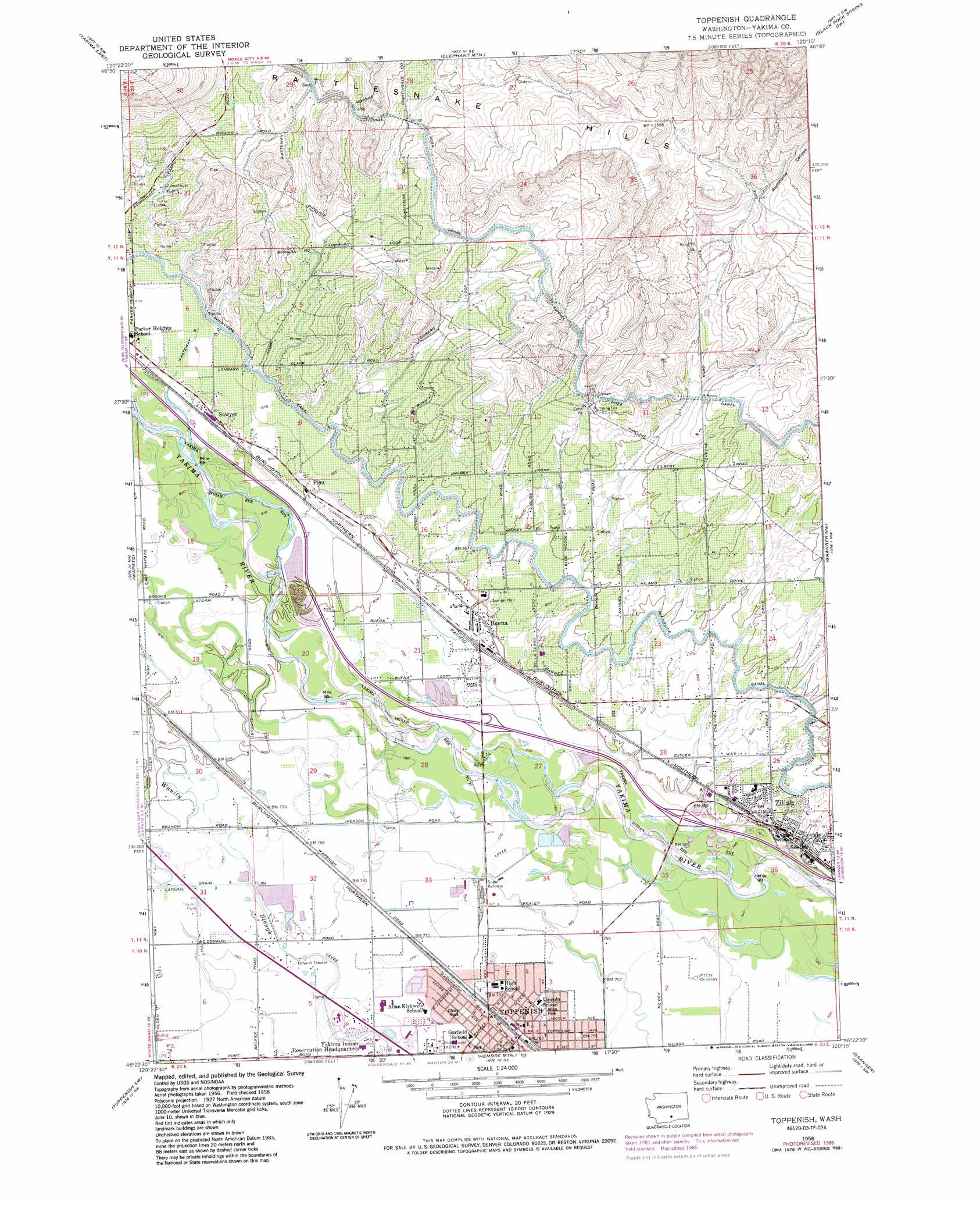
USGS Topo Quad 46120d3 - 1:24,000 scale
| Topo Map Name: | Toppenish |
| USGS Topo Quad ID: | 46120d3 |
| Print Size: | ca. 21 1/4" wide x 27" high |
| Southeast Coordinates: | 46.375° N latitude / 120.25° W longitude |
| Map Center Coordinates: | 46.4375° N latitude / 120.3125° W longitude |
| U.S. State: | WA |
| Filename: | o46120d3.jpg |
| Download Map JPG Image: | Toppenish topo map 1:24,000 scale |
| Map Type: | Topographic |
| Topo Series: | 7.5´ |
| Map Scale: | 1:24,000 |
| Source of Map Images: | United States Geological Survey (USGS) |
| Alternate Map Versions: |
Toppenish WA 1958, updated 1960 Download PDF Buy paper map Toppenish WA 1958, updated 1975 Download PDF Buy paper map Toppenish WA 1958, updated 1985 Download PDF Buy paper map Toppenish WA 2011 Download PDF Buy paper map Toppenish WA 2013 Download PDF Buy paper map |
1:24,000 Topo Quads surrounding Toppenish
Selah |
Pomona |
Selah Springs |
Black Rock Spring Nw |
Black Rock Spring Ne |
Yakima West |
Yakima East |
Elephant Mountain |
Black Rock Spring Sw |
Black Rock Spring |
Harrah |
Wapato |
Toppenish |
Granger Nw |
Granger Ne |
Harrah Se |
Toppenish Sw |
Hembre Mountain |
Granger |
Sunnyside |
Logy Creek Ne |
Poisel Butte Nw |
Poisel Butte |
Bluelight Nw |
Mabton West |
> Back to 46120a1 at 1:100,000 scale
> Back to 46120a1 at 1:250,000 scale
> Back to U.S. Topo Maps home
Toppenish topo map: Gazetteer
Toppenish: Airports
Buena Airport elevation 248m 813′Toppenish: Canals
Wasteway 3 elevation 341m 1118′Toppenish: Populated Places
Buena elevation 242m 793′Flint elevation 251m 823′
Sawyer elevation 254m 833′
Toppenish elevation 231m 757′
Wesley Junction elevation 240m 787′
Zillah elevation 249m 816′
Toppenish: Valleys
Racehorse Canyon elevation 393m 1289′Toppenish digital topo map on disk
Buy this Toppenish topo map showing relief, roads, GPS coordinates and other geographical features, as a high-resolution digital map file on DVD: