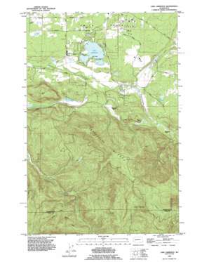
Lake Lawrence Topo Map Washington
To zoom in, hover over the map of Lake Lawrence
USGS Topo Quad 46122g5 - 1:24,000 scale
| Topo Map Name: | Lake Lawrence |
| USGS Topo Quad ID: | 46122g5 |
| Print Size: | ca. 21 1/4" wide x 27" high |
| Southeast Coordinates: | 46.75° N latitude / 122.5° W longitude |
| Map Center Coordinates: | 46.8125° N latitude / 122.5625° W longitude |
| U.S. State: | WA |
| Filename: | o46122g5.jpg |
| Download Map JPG Image: | Lake Lawrence topo map 1:24,000 scale |
| Map Type: | Topographic |
| Topo Series: | 7.5´ |
| Map Scale: | 1:24,000 |
| Source of Map Images: | United States Geological Survey (USGS) |
| Alternate Map Versions: |
Lake Lawrence WA 1959, updated 1966 Download PDF Buy paper map Lake Lawrence WA 1959, updated 1976 Download PDF Buy paper map Lake Lawrence WA 1990, updated 1995 Download PDF Buy paper map Lake Lawrence WA 2011 Download PDF Buy paper map Lake Lawrence WA 2013 Download PDF Buy paper map |
1:24,000 Topo Quads surrounding Lake Lawrence
> Back to 46122e1 at 1:100,000 scale
> Back to 46122a1 at 1:250,000 scale
> Back to U.S. Topo Maps home
Lake Lawrence topo map: Gazetteer
Lake Lawrence: Airports
Cougar Mountain Airfield elevation 140m 459′Lake Lawrence: Dams
Cougar Mountain Farm Dam elevation 141m 462′Lake Lawrence Dam elevation 135m 442′
Prince Dam elevation 151m 495′
Lake Lawrence: Flats
Smith Prairie elevation 150m 492′Lake Lawrence: Lakes
Lake Lawrence elevation 128m 419′Reichel Lake elevation 150m 492′
Lake Lawrence: Reservoirs
Lake Lawrence elevation 135m 442′Nelda Lake elevation 141m 462′
Lake Lawrence: Ridges
Porcupine Ridge elevation 686m 2250′Shell Rock Ridge elevation 298m 977′
Lake Lawrence: Streams
Fall Creek elevation 159m 521′Hospital Creek elevation 228m 748′
Hull Creek elevation 163m 534′
Laramie Creek elevation 186m 610′
Pipeline Creek elevation 136m 446′
Run Creek elevation 176m 577′
Lake Lawrence: Summits
Clam Mountain elevation 831m 2726′Jonas Hill elevation 353m 1158′
Lake Lawrence digital topo map on disk
Buy this Lake Lawrence topo map showing relief, roads, GPS coordinates and other geographical features, as a high-resolution digital map file on DVD:


