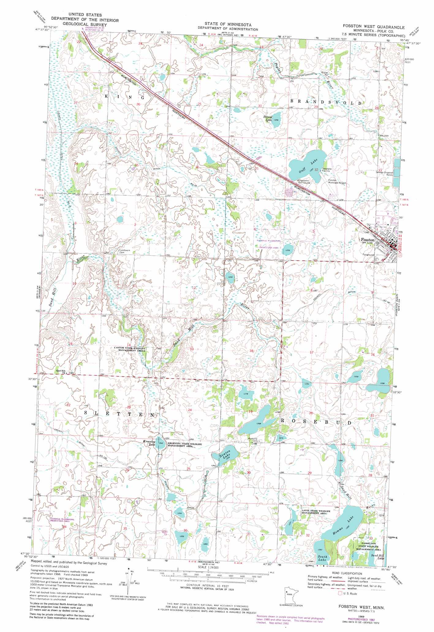
Fosston West Topo Map Minnesota
To zoom in, hover over the map of Fosston West
USGS Topo Quad 47095e7 - 1:24,000 scale
| Topo Map Name: | Fosston West |
| USGS Topo Quad ID: | 47095e7 |
| Print Size: | ca. 21 1/4" wide x 27" high |
| Southeast Coordinates: | 47.5° N latitude / 95.75° W longitude |
| Map Center Coordinates: | 47.5625° N latitude / 95.8125° W longitude |
| U.S. State: | MN |
| Filename: | o47095e7.jpg |
| Download Map JPG Image: | Fosston West topo map 1:24,000 scale |
| Map Type: | Topographic |
| Topo Series: | 7.5´ |
| Map Scale: | 1:24,000 |
| Source of Map Images: | United States Geological Survey (USGS) |
| Alternate Map Versions: |
Fosston West MN 1969, updated 1971 Download PDF Buy paper map Fosston West MN 1969, updated 1982 Download PDF Buy paper map Fosston West MN 2010 Download PDF Buy paper map Fosston West MN 2013 Download PDF Buy paper map Fosston West MN 2016 Download PDF Buy paper map |
1:24,000 Topo Quads surrounding Fosston West
Brooks |
Oklee Sw |
Oklee |
Trail |
Gully |
Erskine |
Mcintosh |
Mcintosh Ne |
Olga |
Gonvick |
Union Lake |
Winger |
Fosston West |
Fosston East |
Fosston Se |
Faith Ne |
Bejou |
Mahnomen Ne |
Ebro Nw |
Ebro |
Faith |
Mahnomen |
Beaulieu |
North Twin Lake |
Roy Lake |
> Back to 47095e1 at 1:100,000 scale
> Back to 47094a1 at 1:250,000 scale
> Back to U.S. Topo Maps home
Fosston West topo map: Gazetteer
Fosston West: Airports
Fosston Municipal Airport elevation 387m 1269′Fosston West: Canals
County Ditch Number Fiftyfive elevation 378m 1240′County Ditch Number Fortyeight elevation 387m 1269′
County Ditch Number Fortynine elevation 382m 1253′
County Ditch Number One Hundred Thirtythree elevation 375m 1230′
County Ditch Number Sixteen elevation 369m 1210′
Fosston West: Lakes
Homme Lake elevation 385m 1263′Kroening Lake elevation 379m 1243′
Newton Lake elevation 384m 1259′
Ouff Lake elevation 383m 1256′
South Lake elevation 385m 1263′
Strand Lake elevation 383m 1256′
Fosston West: Parks
Castor State Wildlife Management Areas elevation 381m 1250′Hasselton State Wildlife Management Area elevation 390m 1279′
Kroening State Wildlife Management Area elevation 384m 1259′
Lavoi State Wildlife Management Area elevation 388m 1272′
Fosston West: Populated Places
Fosston elevation 394m 1292′West View Court elevation 394m 1292′
Fosston West: Post Offices
Fosston Post Office elevation 394m 1292′Fosston West digital topo map on disk
Buy this Fosston West topo map showing relief, roads, GPS coordinates and other geographical features, as a high-resolution digital map file on DVD: