Faith Ne Topo Map Minnesota
To zoom in, hover over the map of Faith Ne
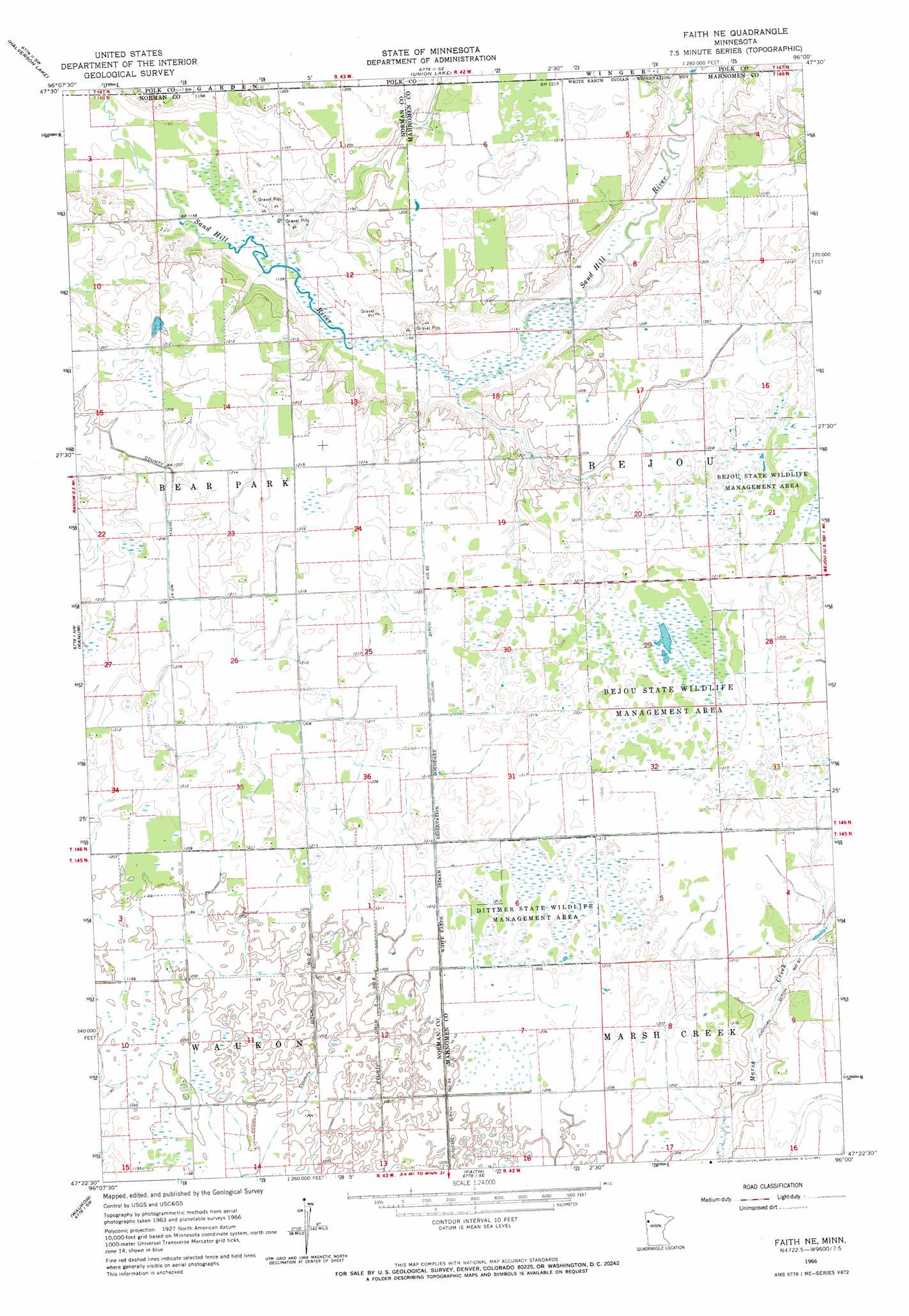
USGS Topo Quad 47096d1 - 1:24,000 scale
| Topo Map Name: | Faith Ne |
| USGS Topo Quad ID: | 47096d1 |
| Print Size: | ca. 21 1/4" wide x 27" high |
| Southeast Coordinates: | 47.375° N latitude / 96° W longitude |
| Map Center Coordinates: | 47.4375° N latitude / 96.0625° W longitude |
| U.S. State: | MN |
| Filename: | o47096d1.jpg |
| Download Map JPG Image: | Faith Ne topo map 1:24,000 scale |
| Map Type: | Topographic |
| Topo Series: | 7.5´ |
| Map Scale: | 1:24,000 |
| Source of Map Images: | United States Geological Survey (USGS) |
| Alternate Map Versions: |
Faith NE MN 1966, updated 1967 Download PDF Buy paper map Faith NE MN 2011 Download PDF Buy paper map Faith NE MN 2013 Download PDF Buy paper map Faith NE MN 2016 Download PDF Buy paper map |
1:24,000 Topo Quads surrounding Faith Ne
Dugdale |
Mentor |
Erskine |
Mcintosh |
Mcintosh Ne |
Fertile |
Halverson Lake |
Union Lake |
Winger |
Fosston West |
Flaming |
Ranum |
Faith Ne |
Bejou |
Mahnomen Ne |
Twin Valley |
Waukon |
Faith |
Mahnomen |
Beaulieu |
Syre |
Flom |
Flom Ne |
Waubun |
Ogema Ne |
> Back to 47096a1 at 1:100,000 scale
> Back to 47096a1 at 1:250,000 scale
> Back to U.S. Topo Maps home
Faith Ne topo map: Gazetteer
Faith Ne: Canals
County Ditch Number Fortyseven elevation 367m 1204′Judicial Ditch Number Fiftyfive elevation 369m 1210′
Faith Ne: Dams
Frog Lake Dam elevation 367m 1204′Faith Ne: Parks
Bejou State Wildlife Management Area elevation 369m 1210′Dittmer State Wildlife Management Area elevation 371m 1217′
Faith Ne: Reservoirs
Frog Lake elevation 367m 1204′Faith Ne digital topo map on disk
Buy this Faith Ne topo map showing relief, roads, GPS coordinates and other geographical features, as a high-resolution digital map file on DVD:
Eastern North Dakota & Eastern South Dakota
Buy digital topo maps: Eastern North Dakota & Eastern South Dakota