Eskay Ne Topo Map Montana
To zoom in, hover over the map of Eskay Ne
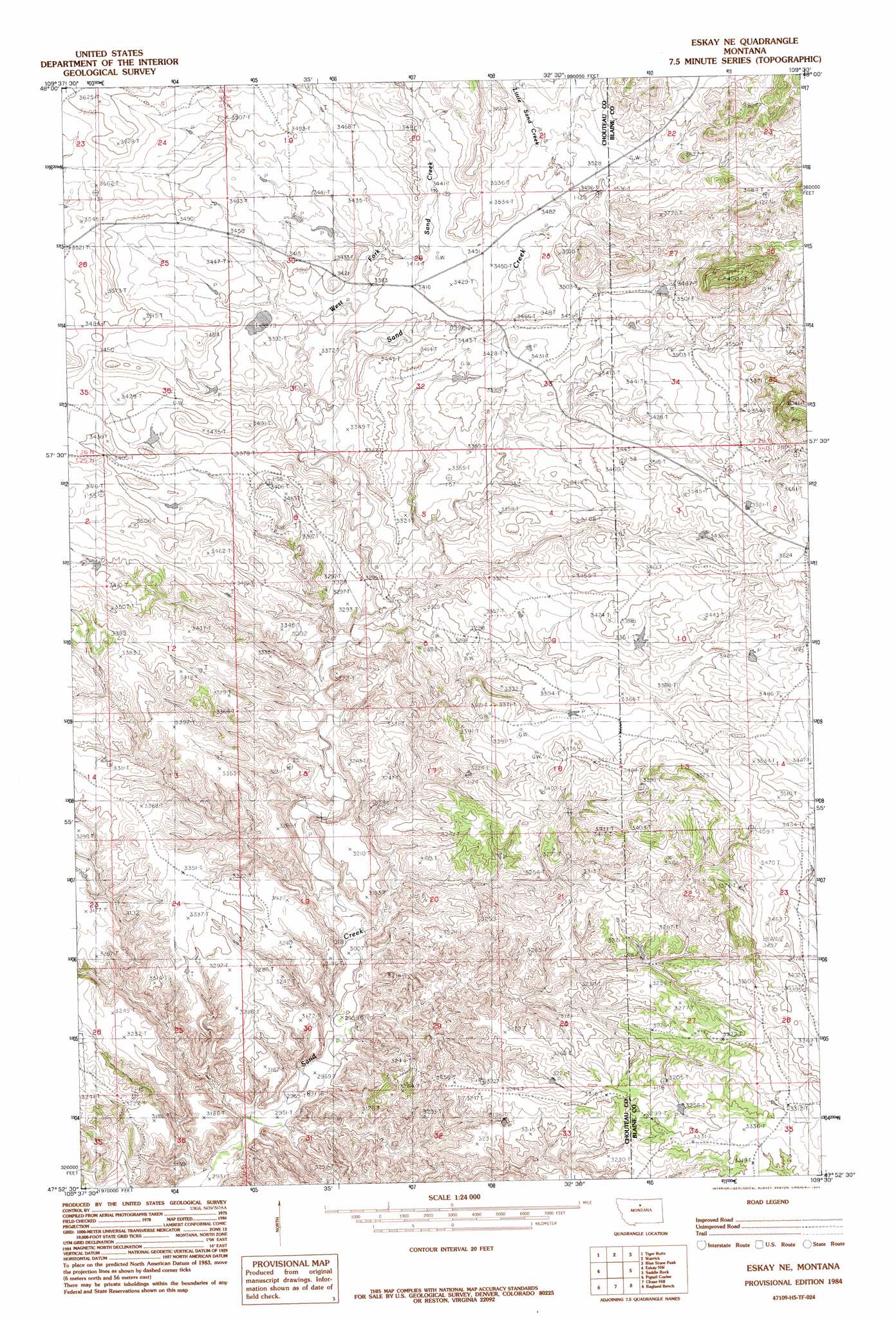
USGS Topo Quad 47109h5 - 1:24,000 scale
| Topo Map Name: | Eskay Ne |
| USGS Topo Quad ID: | 47109h5 |
| Print Size: | ca. 21 1/4" wide x 27" high |
| Southeast Coordinates: | 47.875° N latitude / 109.5° W longitude |
| Map Center Coordinates: | 47.9375° N latitude / 109.5625° W longitude |
| U.S. State: | MT |
| Filename: | o47109h5.jpg |
| Download Map JPG Image: | Eskay Ne topo map 1:24,000 scale |
| Map Type: | Topographic |
| Topo Series: | 7.5´ |
| Map Scale: | 1:24,000 |
| Source of Map Images: | United States Geological Survey (USGS) |
| Alternate Map Versions: |
Eskay NE MT 1984, updated 1984 Download PDF Buy paper map Eskay NE MT 2011 Download PDF Buy paper map Eskay NE MT 2014 Download PDF Buy paper map |
1:24,000 Topo Quads surrounding Eskay Ne
Centennial Mountain |
Bowery Peak |
Big John Butte |
Maddux |
Corrigan Mountain |
Ryan Butte |
Tiger Butte |
Warrick |
Blue Stone Peak |
Williamson Butte |
Seifort Reservoir |
Eskay Nw |
Eskay Ne |
Saddle Rock |
Nolan Reservoir |
Iliad |
Pigtail Coulee |
Chase Hill |
Ragland Bench |
Leroy |
Starve Out Flat |
P N Ranch |
Council Island |
Gallatin Rapids |
Taffy Ridge |
> Back to 47109e1 at 1:100,000 scale
> Back to 47108a1 at 1:250,000 scale
> Back to U.S. Topo Maps home
Eskay Ne topo map: Gazetteer
Eskay Ne: Dams
Yantighem Dam elevation 1046m 3431′Eskay Ne: Streams
Little Sand Creek elevation 1067m 3500′West Fork Sand Creek elevation 1004m 3293′
Eskay Ne: Summits
Echo Butte elevation 1214m 3982′Eskay Ne digital topo map on disk
Buy this Eskay Ne topo map showing relief, roads, GPS coordinates and other geographical features, as a high-resolution digital map file on DVD: