Destruction Island Topo Map Washington
To zoom in, hover over the map of Destruction Island
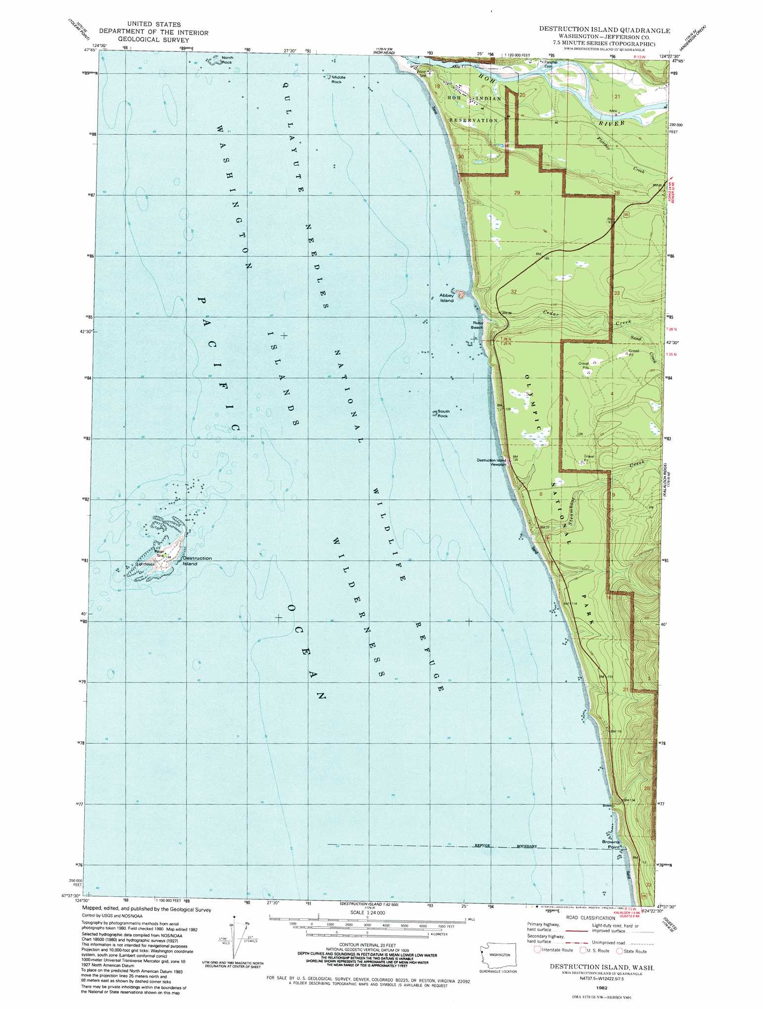
USGS Topo Quad 47124f4 - 1:24,000 scale
| Topo Map Name: | Destruction Island |
| USGS Topo Quad ID: | 47124f4 |
| Print Size: | ca. 21 1/4" wide x 27" high |
| Southeast Coordinates: | 47.625° N latitude / 124.375° W longitude |
| Map Center Coordinates: | 47.6875° N latitude / 124.4375° W longitude |
| U.S. State: | WA |
| Filename: | o47124f4.jpg |
| Download Map JPG Image: | Destruction Island topo map 1:24,000 scale |
| Map Type: | Topographic |
| Topo Series: | 7.5´ |
| Map Scale: | 1:24,000 |
| Source of Map Images: | United States Geological Survey (USGS) |
| Alternate Map Versions: |
Destruction Island WA 1982, updated 1982 Download PDF Buy paper map Destruction Island WA 2011 Download PDF Buy paper map Destruction Island WA 2014 Download PDF Buy paper map |
1:24,000 Topo Quads surrounding Destruction Island
La Push |
Quillayute Prairie |
Forks |
Reade Hill |
Indian Pass |
Toleak Point |
Hoh Head |
Anderson Creek |
Winfield Creek |
|
Destruction Island |
Kalaoch Ridge |
Christmas Creek |
||
Queets |
Salmon River West |
|||
Tunnel Island |
O'Took Prairie |
> Back to 47124e1 at 1:100,000 scale
> Back to 47124a1 at 1:250,000 scale
> Back to U.S. Topo Maps home
Destruction Island topo map: Gazetteer
Destruction Island: Bars
Middle Rock elevation 1m 3′North Rock elevation 0m 0′
South Rock elevation 0m 0′
Destruction Island: Beaches
Ruby Beach elevation 3m 9′Destruction Island: Capes
Browns Point elevation 1m 3′Destruction Island: Islands
Abbey Island elevation 33m 108′Destruction Island elevation 23m 75′
Destruction Island: Populated Places
Hoh elevation 10m 32′Destruction Island: Streams
Cedar Creek elevation 16m 52′Fletcher Creek elevation 7m 22′
Fossil Creek elevation 8m 26′
Hoh River elevation 0m 0′
Sand Creek elevation 32m 104′
Steamboat Creek elevation 1m 3′
Destruction Island: Trails
Beach Trail 5 elevation 8m 26′Beach Trail 6 elevation 20m 65′
Beach Trail 7 elevation 8m 26′
Destruction Island digital topo map on disk
Buy this Destruction Island topo map showing relief, roads, GPS coordinates and other geographical features, as a high-resolution digital map file on DVD: