Coyote Coulee Topo Map Montana
To zoom in, hover over the map of Coyote Coulee
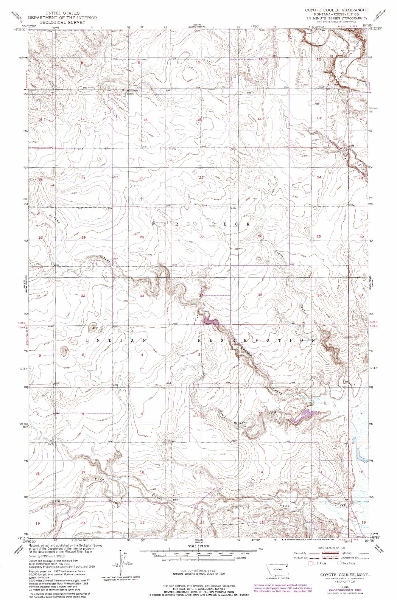
USGS Topo Quad 48104c7 - 1:24,000 scale
| Topo Map Name: | Coyote Coulee |
| USGS Topo Quad ID: | 48104c7 |
| Print Size: | ca. 21 1/4" wide x 27" high |
| Southeast Coordinates: | 48.25° N latitude / 104.75° W longitude |
| Map Center Coordinates: | 48.3125° N latitude / 104.8125° W longitude |
| U.S. State: | MT |
| Filename: | o48104c7.jpg |
| Download Map JPG Image: | Coyote Coulee topo map 1:24,000 scale |
| Map Type: | Topographic |
| Topo Series: | 7.5´ |
| Map Scale: | 1:24,000 |
| Source of Map Images: | United States Geological Survey (USGS) |
| Alternate Map Versions: |
Coyote Coulee MT 1950, updated 1952 Download PDF Buy paper map Coyote Coulee MT 1950, updated 1989 Download PDF Buy paper map Coyote Coulee MT 2011 Download PDF Buy paper map Coyote Coulee MT 2014 Download PDF Buy paper map |
1:24,000 Topo Quads surrounding Coyote Coulee
Pleasant Prairie |
Soo |
Thornwood Ranch |
Flagstaff Hill |
Alkali Coulee |
Hay Creek |
Beam School |
Smoke Creek Ne |
Homestead Nw |
Homestead |
Geddart Lake |
Smoke Creek Sw |
Coyote Coulee |
Rocky Point |
Johnson Lake |
Poplar Ne |
Brockton |
Calais |
Fort Kipp |
Culbertson |
Sprole |
Mortarstone Bluff |
Frog Coulee |
Twomile Creek |
Dugout Creek |
> Back to 48104a1 at 1:100,000 scale
> Back to 48104a1 at 1:250,000 scale
> Back to U.S. Topo Maps home
Coyote Coulee topo map: Gazetteer
Coyote Coulee: Dams
Fort Peck Reservation Number 23 Dam elevation 605m 1984′Coyote Coulee: Streams
Spring Creek elevation 585m 1919′Coyote Coulee: Valleys
Coyote Coulee elevation 587m 1925′South Branch Coulee elevation 586m 1922′
Coyote Coulee: Wells
30N53E12DCCA01 Well elevation 629m 2063′30N53E16BBAA01 Well elevation 652m 2139′
Coyote Coulee digital topo map on disk
Buy this Coyote Coulee topo map showing relief, roads, GPS coordinates and other geographical features, as a high-resolution digital map file on DVD:
Eastern Montana & Western North Dakota
Buy digital topo maps: Eastern Montana & Western North Dakota