Park Rapids Topo Map Washington
To zoom in, hover over the map of Park Rapids
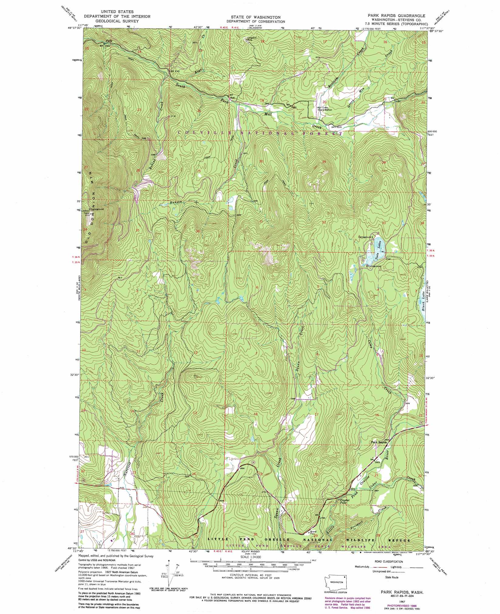
USGS Topo Quad 48117e6 - 1:24,000 scale
| Topo Map Name: | Park Rapids |
| USGS Topo Quad ID: | 48117e6 |
| Print Size: | ca. 21 1/4" wide x 27" high |
| Southeast Coordinates: | 48.5° N latitude / 117.625° W longitude |
| Map Center Coordinates: | 48.5625° N latitude / 117.6875° W longitude |
| U.S. State: | WA |
| Filename: | o48117e6.jpg |
| Download Map JPG Image: | Park Rapids topo map 1:24,000 scale |
| Map Type: | Topographic |
| Topo Series: | 7.5´ |
| Map Scale: | 1:24,000 |
| Source of Map Images: | United States Geological Survey (USGS) |
| Alternate Map Versions: |
Park Rapids WA 1967, updated 1970 Download PDF Buy paper map Park Rapids WA 1967, updated 1977 Download PDF Buy paper map Park Rapids WA 1967, updated 1986 Download PDF Buy paper map Park Rapids WA 1992, updated 1996 Download PDF Buy paper map Park Rapids WA 2011 Download PDF Buy paper map Park Rapids WA 2014 Download PDF Buy paper map |
| FStopo: | US Forest Service topo Park Rapids is available: Download FStopo PDF Download FStopo TIF |
1:24,000 Topo Quads surrounding Park Rapids
China Bend |
Onion Creek |
Spirit |
Deep Lake |
Metaline |
Echo Valley |
Gillette Mountain |
Aladdin |
Aladdin Mountain |
Ione |
Colville |
White Mud Lake |
Park Rapids |
Lake Gillette |
Timber Mountain |
Arden |
Addy Mountain |
Cliff Ridge |
Calispell Peak |
Tacoma Peak |
Dunn Mountain |
Addy |
Chewelah |
Goddards Peak |
Winchester Peak |
> Back to 48117e1 at 1:100,000 scale
> Back to 48116a1 at 1:250,000 scale
> Back to U.S. Topo Maps home
Park Rapids topo map: Gazetteer
Park Rapids: Dams
Little Twin Lakes Dam elevation 1135m 3723′Park Rapids: Falls
Crystal Falls elevation 864m 2834′Park Rapids: Lakes
Black Lake elevation 1125m 3690′Park Rapids: Mines
Longshot Mine elevation 1080m 3543′Park Rapids: Populated Places
Park Rapids elevation 887m 2910′Park Rapids: Reservoirs
Little Twin Lakes elevation 1135m 3723′Twin Lakes elevation 1135m 3723′
Park Rapids: Streams
Bestrom Creek elevation 908m 2979′Camp Creek elevation 888m 2913′
Cedar Creek elevation 870m 2854′
Green Mountain Creek elevation 912m 2992′
Hanson Creek elevation 883m 2896′
Kegel Creek elevation 846m 2775′
Prospect Creek elevation 755m 2477′
Robins Creek elevation 830m 2723′
Park Rapids: Summits
Old Dominion Mountain elevation 1753m 5751′Park Rapids digital topo map on disk
Buy this Park Rapids topo map showing relief, roads, GPS coordinates and other geographical features, as a high-resolution digital map file on DVD: