Mount Annie Topo Map Washington
To zoom in, hover over the map of Mount Annie
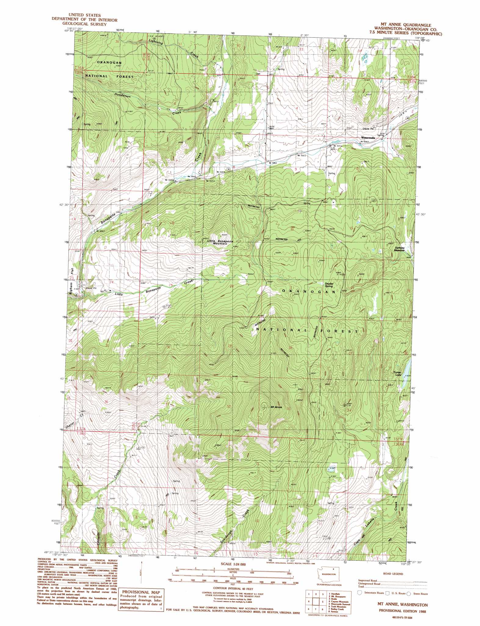
USGS Topo Quad 48119f1 - 1:24,000 scale
| Topo Map Name: | Mount Annie |
| USGS Topo Quad ID: | 48119f1 |
| Print Size: | ca. 21 1/4" wide x 27" high |
| Southeast Coordinates: | 48.625° N latitude / 119° W longitude |
| Map Center Coordinates: | 48.6875° N latitude / 119.0625° W longitude |
| U.S. State: | WA |
| Filename: | o48119f1.jpg |
| Download Map JPG Image: | Mount Annie topo map 1:24,000 scale |
| Map Type: | Topographic |
| Topo Series: | 7.5´ |
| Map Scale: | 1:24,000 |
| Source of Map Images: | United States Geological Survey (USGS) |
| Alternate Map Versions: |
Mt Annie WA 1988, updated 1988 Download PDF Buy paper map Mount Annie WA 2001, updated 2004 Download PDF Buy paper map Mount Annie WA 2011 Download PDF Buy paper map Mount Annie WA 2014 Download PDF Buy paper map |
| FStopo: | US Forest Service topo Mount Annie is available: Download FStopo PDF Download FStopo TIF |
1:24,000 Topo Quads surrounding Mount Annie
Mount Hull |
Molson |
Chesaw |
Buckhorn Mountain |
Toroda |
Burge Mountain |
Havillah |
Mount Bonaparte |
Bodie |
Bodie Mountain |
Barker Mountain |
Cayuse Mountain |
Mount Annie |
Wauconda Summit |
Storm King Mountain |
Synarep |
Tunk Mountain |
Bailey Creek |
Aeneas |
Swan Lake |
Omak Mountain |
Crawfish Lake |
Moses Meadows |
Strawberry Mountain |
Bald Knob |
> Back to 48119e1 at 1:100,000 scale
> Back to 48118a1 at 1:250,000 scale
> Back to U.S. Topo Maps home
Mount Annie topo map: Gazetteer
Mount Annie: Areas
Suttens Meadow elevation 1171m 3841′Mount Annie: Lakes
Turner Lake elevation 1270m 4166′Mount Annie: Populated Places
Wauconda elevation 1090m 3576′Mount Annie: Streams
Henderson Creek elevation 1047m 3435′Lightning Creek elevation 1064m 3490′
Little Bonaparte Creek elevation 983m 3225′
Toroda Creek elevation 1090m 3576′
Mount Annie: Summits
Little Bonaparte Mountain elevation 1382m 4534′Mount Annie elevation 1841m 6040′
Mount Annie digital topo map on disk
Buy this Mount Annie topo map showing relief, roads, GPS coordinates and other geographical features, as a high-resolution digital map file on DVD: