New Jersey topographic maps
These topographic index maps for New Jersey state are provided by the U.S. Geological Survey (USGS) for map sheet identification. To locate the USGS topo quad in New Jersey that you are trying to find, look at the index map of the appropriate map scale.
1:24,000 scale New Jersey topo quads
The index map below is for New Jersey topo quads at 1:24,000 scale. It is zoomable, and you can find the name of the 1:24,000 scale map (sometimes abbreviated as "24k") written diagonally across rectangular boxes that define the borders of the individual 24k map sheets.
Note that a rare few of the 1:24,000 scale (aka 7.5 minute) maps in New Jersey state might actually be at 1:25,000 scale, which is a very minor difference in map scale. Some of these 1:25,000 scale maps also cover a larger area than regular 7.5 minute maps. Those maps are 7.5´x15´ topo quads, and can be identified on the index map below by a larger sized rectangle that is twice as wide as usual (covers twice the longitude). The map names for these sheets are labelled horizontally, not diagonally.
New Jersey Topo Index Map: 1:24,000
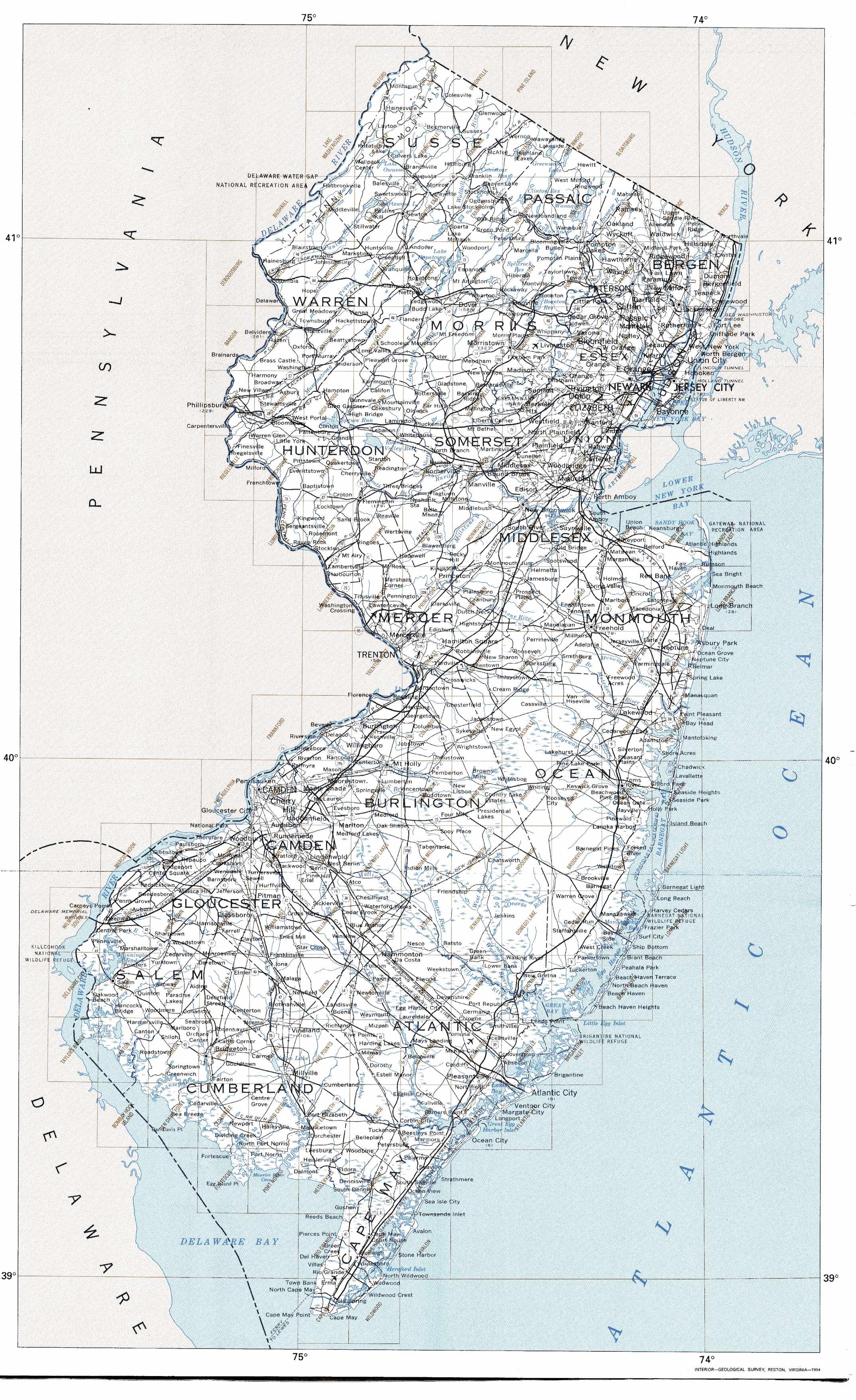
Hover over the index map to the left to view detailed zoom.
You can also download this index map here:
New Jersey topo index map at 1:24,000 Scale
24k NJ topographic maps:
(This is a small selection to get you started. Use the complete list of 250k or 100k maps further below to drill down to your area of choice.)
41074c6 Port Jervis South, NJ
41074b7 Culvers Gap, NJ
41074b6 Branchville, NJ
41074b5 Hamburg, NJ
41074b4 Wawayanda, NJ
41074a8 Flatbrookville, NJ
41074a7 Newton West, NJ
41074a6 Newton East, NJ
41074a5 Franklin, NJ
41074a4 Newfoundland, NJ
41074a3 Wanaque, NJ
41074a2 Ramsey, NJ
41074a1 Park Ridge, NJ
40075h1 Portland, NJ
40074h8 Blairstown, NJ
40074h7 Tranquility, NJ
40074h6 Stanhope, NJ
40074h5 Dover, NJ
40074h4 Boonton, NJ
40074h3 Pompton Plains, NJ
1:250,000 scale New Jersey topo maps
Below you can find the 1:250,000 index map for New Jersey state. These topo maps give a general overview of an area and cover a large area: 1° latitude by 2° longitude. A list of all New Jersey topo map sheets at 250k follows on the right.
New Jersey Topo Index Map: 1:250,000
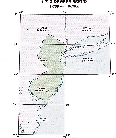
Hover over the index map to the left to view detailed zoom.
You can also download this index map here:
New Jersey topo index map at 1:250,000 Scale
250k NJ topographic maps:
41074a1 Scranton, NJ
40074a1 Newark, NJ
40072a1 New York, NJ
39074a1 Wilmington, NJ
1:100,000 scale New Jersey topo maps
Below you can find the 1:100,000 index map for New Jersey state. These topo maps give a more detailed overview of an area and cover a medium-sized area: 0.5° latitude by 1° longitude. A list of all New Jersey topo map sheets at 100k follows on the right.
New Jersey Topo Index Map: 1:100,000
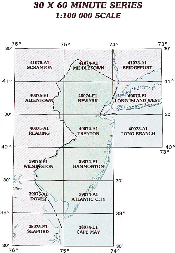
Hover over the index map to the left to view detailed zoom.
You can also download this index map here:
New Jersey topo index map at 1:100,000 Scale
100k NJ topographic maps:
41075a1 Scranton, NJ
41074a1 Middletown, NJ
41073a1 Bridgeport, NJ
40075e1 Allentown, NJ
40074e1 Newark, NJ
40073e1 Long Island West, NJ
40075a1 Reading, NJ
40074a1 Trenton, NJ
40073a1 Long Branch, NJ
39075e1 Wilmington, NJ
39074e1 Hammonton, NJ
39075a1 Dover, NJ
39074a1 Atlantic City, NJ
38075e1 Seaford, NJ
38074e1 Cape May, NJ