Port Isabel Nw Topo Map Texas
To zoom in, hover over the map of Port Isabel Nw
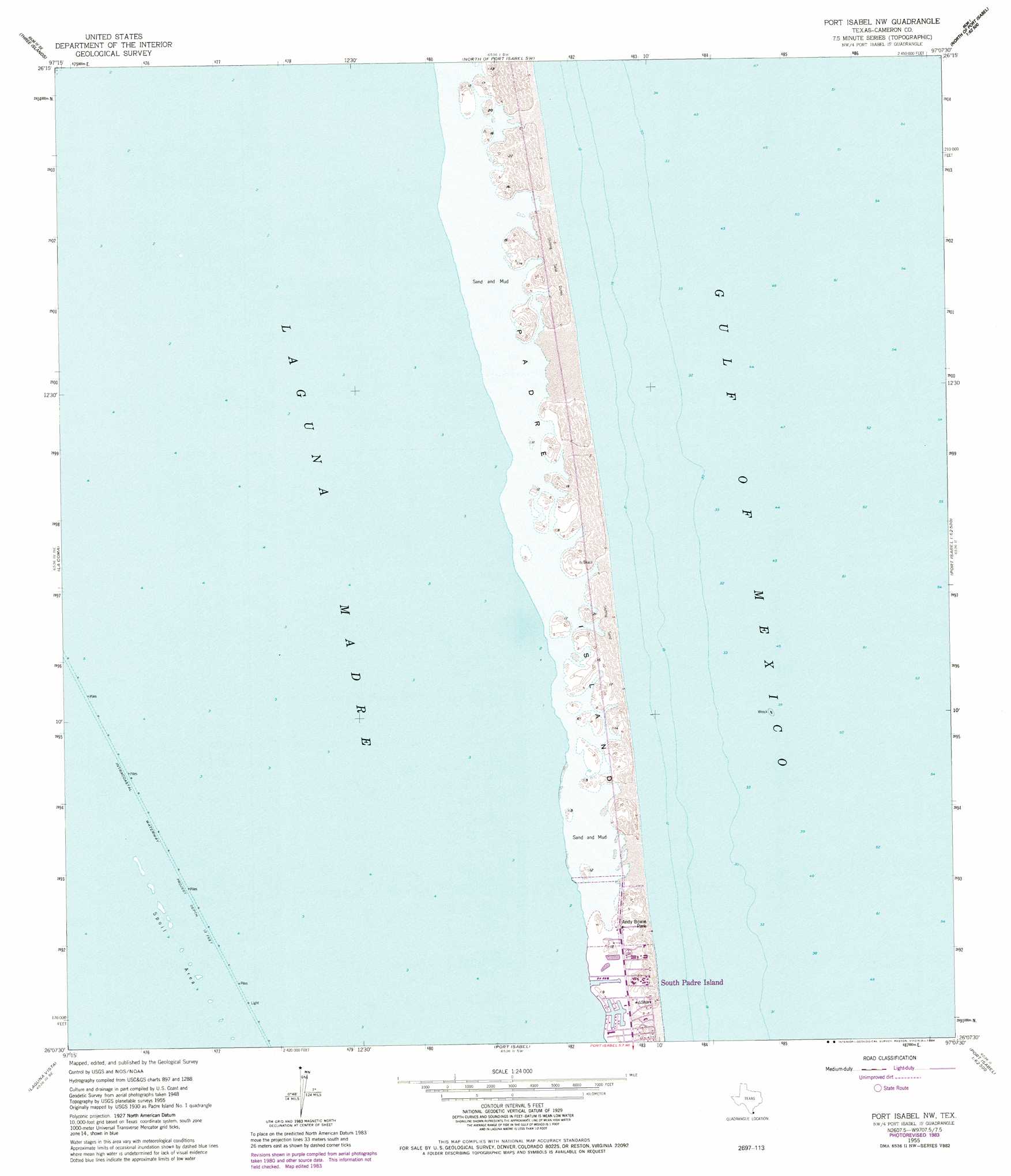
USGS Topo Quad 26097b2 - 1:24,000 scale
| Topo Map Name: | Port Isabel Nw |
| USGS Topo Quad ID: | 26097b2 |
| Print Size: | ca. 21 1/4" wide x 27" high |
| Southeast Coordinates: | 26.125° N latitude / 97.125° W longitude |
| Map Center Coordinates: | 26.1875° N latitude / 97.1875° W longitude |
| U.S. State: | TX |
| Filename: | o26097b2.jpg |
| Download Map JPG Image: | Port Isabel Nw topo map 1:24,000 scale |
| Map Type: | Topographic |
| Topo Series: | 7.5´ |
| Map Scale: | 1:24,000 |
| Source of Map Images: | United States Geological Survey (USGS) |
| Alternate Map Versions: |
Padre Island No. 1 TX 1930 Download PDF Buy paper map Port Isabel NW TX 1955, updated 1956 Download PDF Buy paper map Port Isabel NW TX 1955, updated 1970 Download PDF Buy paper map Port Isabel NW TX 1955, updated 1974 Download PDF Buy paper map Port Isabel NW TX 1955, updated 1984 Download PDF Buy paper map Port Isabel NW TX 2010 Download PDF Buy paper map Port Isabel NW TX 2013 Download PDF Buy paper map Port Isabel NW TX 2016 Download PDF Buy paper map |
1:24,000 Topo Quads surrounding Port Isabel Nw
Hawk Island |
Green Island |
North Of Port Isabel Nw |
||
La Leona |
Three Islands |
North Of Port Isabel Sw |
||
Laguna Atascosa |
La Coma |
Port Isabel Nw |
||
Los Fresnos |
Laguna Vista |
Port Isabel |
||
East Brownsville |
Palmito Hill |
Mouth Of Rio Grande |
> Back to 26097a1 at 1:100,000 scale
> Back to 26096a1 at 1:250,000 scale
> Back to U.S. Topo Maps home
Port Isabel Nw topo map: Gazetteer
Port Isabel Nw: Airports
Southeastern Helicopters Heliport elevation 0m 0′Port Isabel Nw: Parks
Andy Bowie County Park elevation 4m 13′Andy Bowie Park elevation 2m 6′
Port Isabel Nw digital topo map on disk
Buy this Port Isabel Nw topo map showing relief, roads, GPS coordinates and other geographical features, as a high-resolution digital map file on DVD: