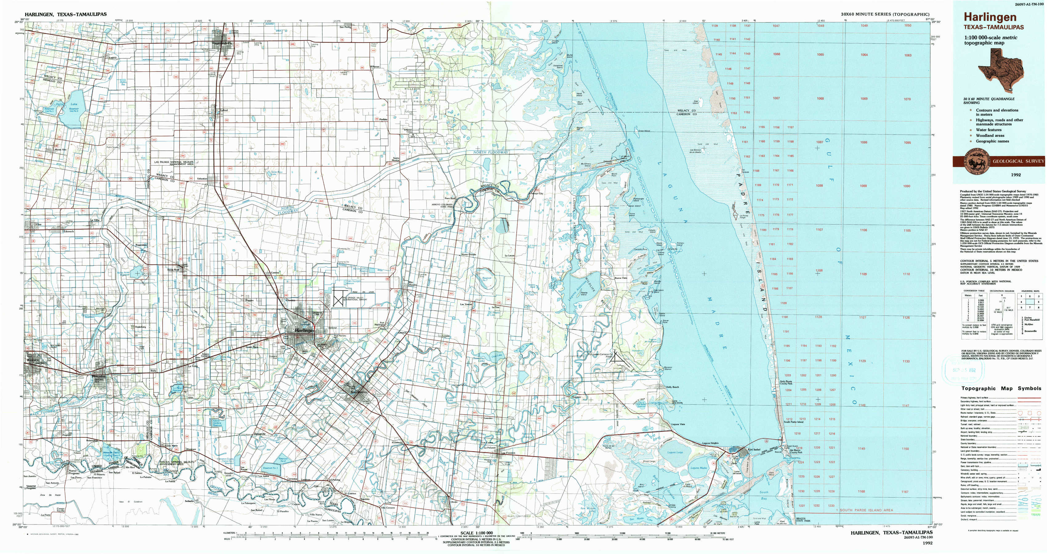
Harlingen Topo Map Texas
To zoom in, hover over the map of Harlingen
USGS Topo Map 26097a1 - 1:100,000 scale
| Topo Map Name: | Harlingen |
| USGS Topo Quad ID: | 26097a1 |
| Print Size: | ca. 39" wide x 24" high |
| Southeast Coordinates: | 26° N latitude / 97° W longitude |
| Map Center Coordinates: | 26.25° N latitude / 97.5° W longitude |
| U.S. State: | TX |
| Filename: | 26097a1.jpg |
| Download Map JPG Image: | Harlingen topo map 1:100,000 scale |
| Map Type: | Topographic |
| Topo Series: | 30´x60´ |
| Map Scale: | 1:100,000 |
| Source of Map Images: | United States Geological Survey (USGS) |
| Alternate Map Versions: |
Harlingen TX 1992, updated 1992 Download PDF Buy paper map |
1:100,000 Topos surrounding Harlingen
Encino |
Port Mansfield |
|
Mc Allen |
Harlingen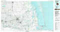 |
|
Brownsville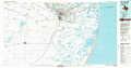 |
> Back to 26096a1 at 1:250,000 scale
> Back to U.S. Topo Maps home
1:24,000 Topo Quads covered by the spatial extent of this 100k map (Harlingen)
|
Lasara 
|
Raymondville 
|
San Perlita South 
|
Willamar 
|
Hawk Island 
|
Green Island 
|
North Of Port Isabel Nw 
|
|
|
Edcouch 
|
Santa Rosa 
|
Willamar Sw 
|
Paso Real 
|
La Leona 
|
Three Islands 
|
North Of Port Isabel Sw 
|
|
|
Mercedes 
|
La Feria 
|
Harlingen 
|
Rio Hondo 
|
Laguna Atascosa 
|
La Coma 
|
Port Isabel Nw 
|
|
|
Progreso 
|
Santa Maria 
|
La Paloma 
|
Olmito 
|
Los Fresnos 
|
Laguna Vista 
|
Port Isabel 
|