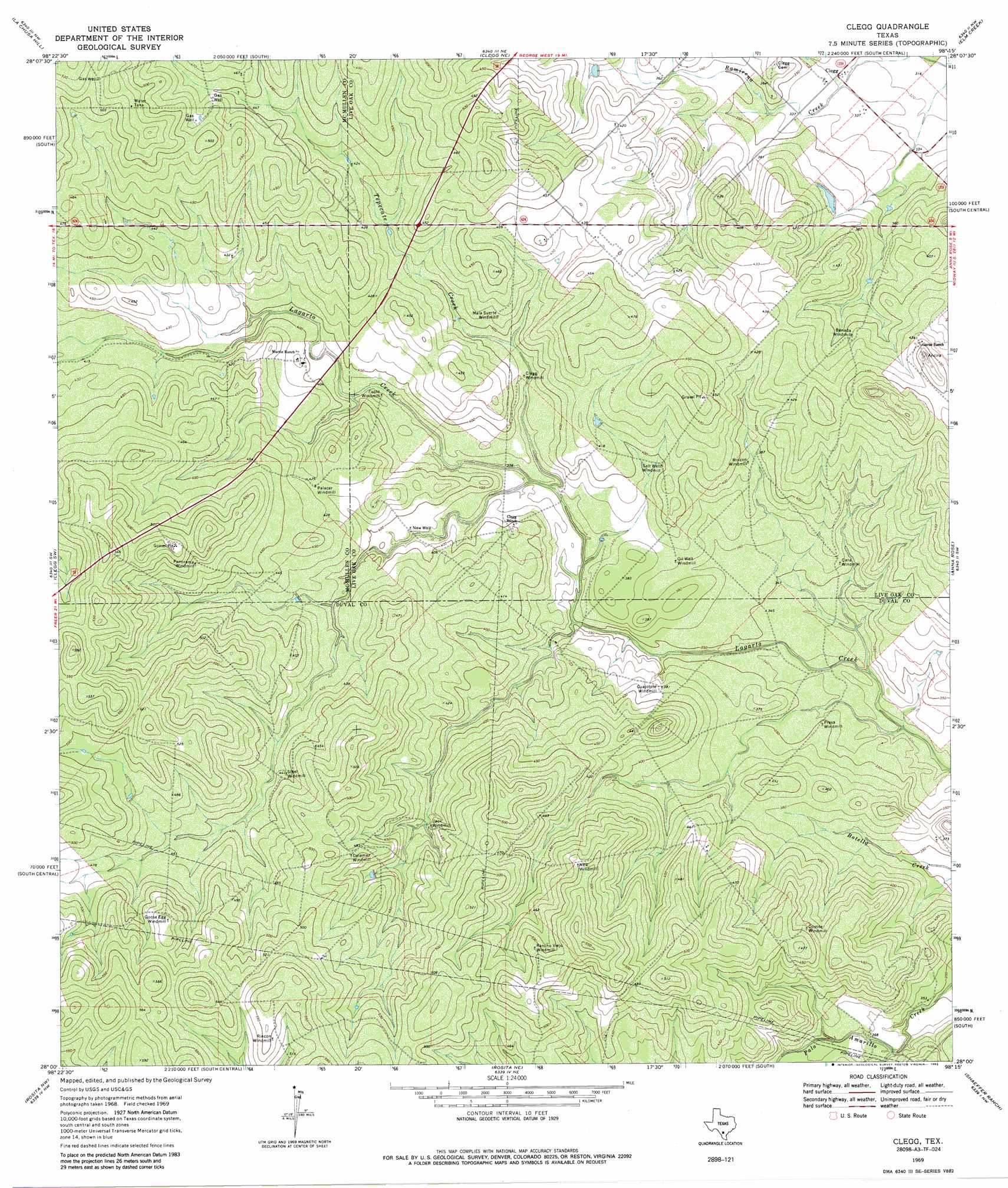
Clegg Topo Map Texas
To zoom in, hover over the map of Clegg
USGS Topo Quad 28098a3 - 1:24,000 scale
| Topo Map Name: | Clegg |
| USGS Topo Quad ID: | 28098a3 |
| Print Size: | ca. 21 1/4" wide x 27" high |
| Southeast Coordinates: | 28° N latitude / 98.25° W longitude |
| Map Center Coordinates: | 28.0625° N latitude / 98.3125° W longitude |
| U.S. State: | TX |
| Filename: | o28098a3.jpg |
| Download Map JPG Image: | Clegg topo map 1:24,000 scale |
| Map Type: | Topographic |
| Topo Series: | 7.5´ |
| Map Scale: | 1:24,000 |
| Source of Map Images: | United States Geological Survey (USGS) |
| Alternate Map Versions: |
Clegg TX 1969, updated 1972 Download PDF Buy paper map Clegg TX 1969, updated 1985 Download PDF Buy paper map Clegg TX 2010 Download PDF Buy paper map Clegg TX 2012 Download PDF Buy paper map Clegg TX 2016 Download PDF Buy paper map |
1:24,000 Topo Quads surrounding Clegg
Fitzpatrick Hollow |
San Caja Hill |
Live Oak Hollow |
Oakville Sw |
George West |
Loma Alta Ne |
La Chusa Hill |
Clegg Ne |
Elm Creek |
Crater Ridge |
Loma Alta |
Clegg Sw |
Clegg |
Anna Rose |
Midway |
Freer North |
Rosita Nw |
Rosita Ne |
Shaeffer Ranch |
San Diego Ne |
Freer South |
Rosita |
Rosita Se |
San Diego |
Alice North |
> Back to 28098a1 at 1:100,000 scale
> Back to 28098a1 at 1:250,000 scale
> Back to U.S. Topo Maps home
Clegg topo map: Gazetteer
Clegg: Populated Places
Clegg elevation 99m 324′Clegg: Streams
Tepecate Creek elevation 110m 360′Clegg: Wells
New Well elevation 119m 390′Clegg digital topo map on disk
Buy this Clegg topo map showing relief, roads, GPS coordinates and other geographical features, as a high-resolution digital map file on DVD: