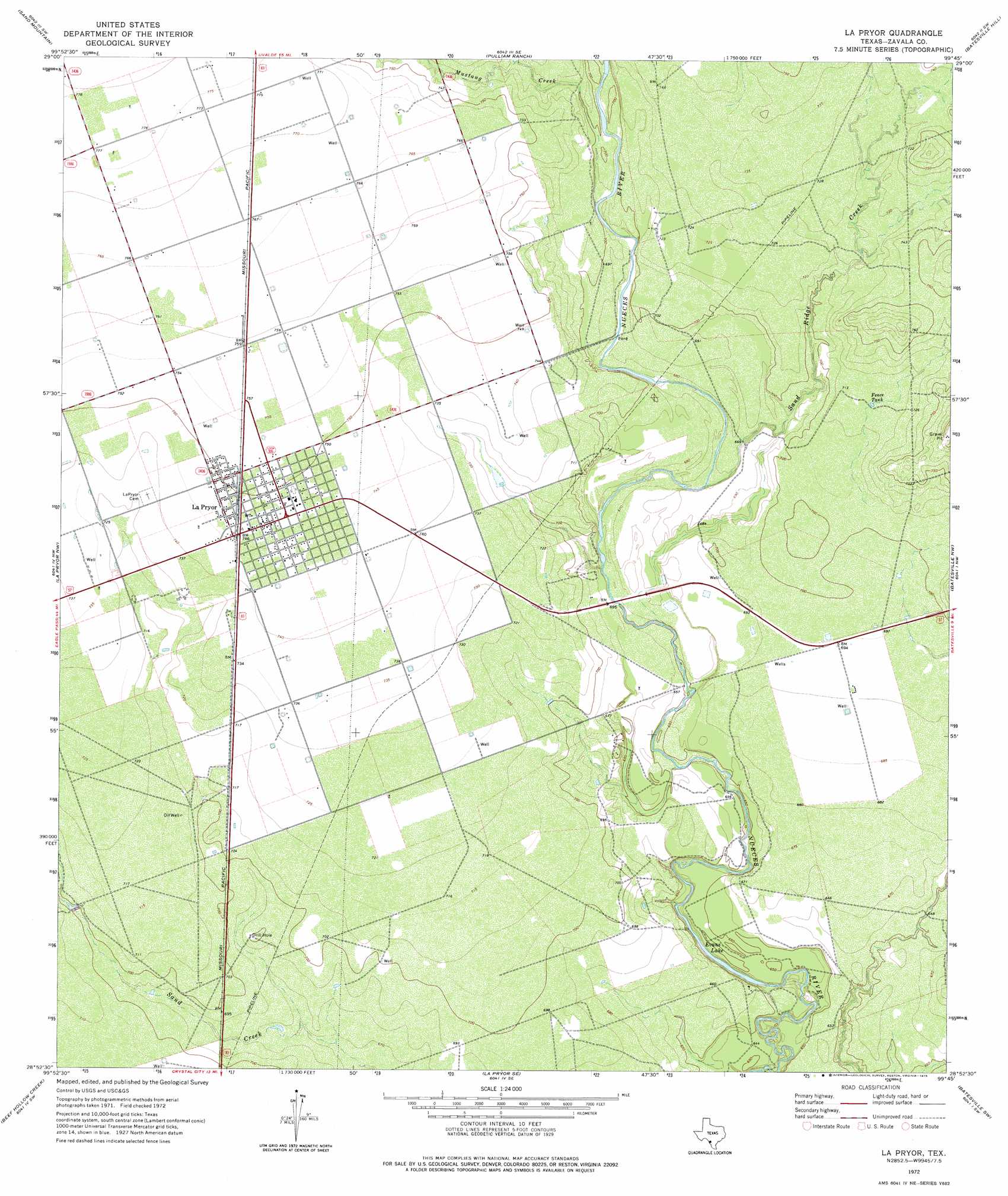
La Pryor Topo Map Texas
To zoom in, hover over the map of La Pryor
USGS Topo Quad 28099h7 - 1:24,000 scale
| Topo Map Name: | La Pryor |
| USGS Topo Quad ID: | 28099h7 |
| Print Size: | ca. 21 1/4" wide x 27" high |
| Southeast Coordinates: | 28.875° N latitude / 99.75° W longitude |
| Map Center Coordinates: | 28.9375° N latitude / 99.8125° W longitude |
| U.S. State: | TX |
| Filename: | o28099h7.jpg |
| Download Map JPG Image: | La Pryor topo map 1:24,000 scale |
| Map Type: | Topographic |
| Topo Series: | 7.5´ |
| Map Scale: | 1:24,000 |
| Source of Map Images: | United States Geological Survey (USGS) |
| Alternate Map Versions: |
La Pryor TX 1972, updated 1975 Download PDF Buy paper map La Pryor TX 2010 Download PDF Buy paper map La Pryor TX 2013 Download PDF Buy paper map La Pryor TX 2016 Download PDF Buy paper map |
1:24,000 Topo Quads surrounding La Pryor
Cline |
Hacienda |
Uvalde |
Garner Field |
Garner Field Ne |
Olmos Creek |
Sand Mountain |
Pulliam Ranch |
Batesville Hill |
Lone Tree Hill |
Chacon Creek Ne |
La Pryor Nw |
La Pryor |
Batesville Nw |
Batesville |
Chacon Creek Se |
Beef Hollow Creek |
La Pryor Se |
Batesville Sw |
Loma Vista |
Cometa |
Carrizo Springs Nw |
Crystal City |
Woodard Lake |
Sugar Creek |
> Back to 28099e1 at 1:100,000 scale
> Back to 28098a1 at 1:250,000 scale
> Back to U.S. Topo Maps home
La Pryor topo map: Gazetteer
La Pryor: Airports
La Paloma Ranch Airport elevation 216m 708′La Pryor: Dams
Knowles Reservoir Dam elevation 200m 656′La Pryor: Lakes
Evans Lake elevation 190m 623′La Pryor: Populated Places
La Pryor elevation 227m 744′La Pryor: Reservoirs
Fence Tank elevation 218m 715′Knowles Reservoir elevation 200m 656′
Tank Number Four elevation 201m 659′
La Pryor: Streams
Mustang Creek elevation 207m 679′Sand Ridge Creek elevation 202m 662′
La Pryor digital topo map on disk
Buy this La Pryor topo map showing relief, roads, GPS coordinates and other geographical features, as a high-resolution digital map file on DVD: