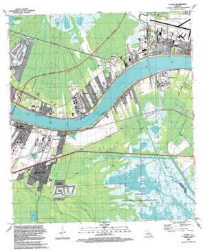
Luling Topo Map Louisiana
To zoom in, hover over the map of Luling
USGS Topo Quad 29090h3 - 1:24,000 scale
| Topo Map Name: | Luling |
| USGS Topo Quad ID: | 29090h3 |
| Print Size: | ca. 21 1/4" wide x 27" high |
| Southeast Coordinates: | 29.875° N latitude / 90.25° W longitude |
| Map Center Coordinates: | 29.9375° N latitude / 90.3125° W longitude |
| U.S. State: | LA |
| Filename: | o29090h3.jpg |
| Download Map JPG Image: | Luling topo map 1:24,000 scale |
| Map Type: | Topographic |
| Topo Series: | 7.5´ |
| Map Scale: | 1:24,000 |
| Source of Map Images: | United States Geological Survey (USGS) |
| Alternate Map Versions: |
Luling LA 1951, updated 1953 Download PDF Buy paper map Luling LA 1951, updated 1958 Download PDF Buy paper map Luling LA 1967, updated 1968 Download PDF Buy paper map Luling LA 1967, updated 1973 Download PDF Buy paper map Luling LA 1967, updated 1980 Download PDF Buy paper map Luling LA 1967, updated 1989 Download PDF Buy paper map Luling LA 1992, updated 1992 Download PDF Buy paper map Luling LA 1998, updated 2000 Download PDF Buy paper map Luling LA 2012 Download PDF Buy paper map Luling LA 2015 Download PDF Buy paper map |
1:24,000 Topo Quads surrounding Luling
> Back to 29090e1 at 1:100,000 scale
> Back to 29090a1 at 1:250,000 scale
> Back to U.S. Topo Maps home
Luling topo map: Gazetteer
Luling: Airports
American Cyanamid Company Helistop Heliport elevation 4m 13′Moisart Heliport elevation 1m 3′
New Orleans International Airport elevation -1m -4′
Saint Charles Airport elevation 2m 6′
Luling: Basins
Davis Crevasse elevation 8m 26′Luling: Bridges
Hale Boggs Memorial Bridge elevation 0m 0′Luling: Canals
Blouin Canal elevation 0m 0′Canal Number Seventeen elevation -2m -7′
Cousin Canal elevation 0m 0′
Cross Bayou Canal elevation 0m 0′
Dusuaus Canal elevation 1m 3′
Ellington Canal elevation 1m 3′
Garland Canal elevation -1m -4′
King Canal elevation 1m 3′
Lanaux Canal elevation 0m 0′
Lanaux Canal elevation 0m 0′
Louisa Canal elevation 0m 0′
Outfall Canal elevation 4m 13′
Peterson Canal elevation 0m 0′
Sauls Canal elevation -1m -4′
Sellers Canal elevation 0m 0′
Luling: Crossings
Interchange 2 elevation 1m 3′Interchange 6 elevation 2m 6′
Luling: Guts
Bayou Cypriere Longue elevation 0m 0′Bayou des Saules elevation 0m 0′
Luling: Lakes
Davis Pond elevation 0m 0′Luling: Levees
Luling Revetment elevation 5m 16′Luling: Oilfields
North Saint Rose Gas Field elevation 0m 0′West Avondale Gas Field (historical) elevation 0m 0′
Luling: Parks
Ama Park elevation 1m 3′Imtt Field elevation 3m 9′
Lagattuta Park elevation 1m 3′
Morgan Park elevation 2m 6′
Morgan Playground elevation 1m 3′
Saint Charles Parish Park elevation 4m 13′
Luling: Populated Places
Almedia elevation 1m 3′Ama elevation 3m 9′
Corso elevation 4m 13′
Davis (historical) elevation 1m 3′
Davis Plantation elevation 0m 0′
Destrehan elevation 3m 9′
Frellsen elevation 2m 6′
Kellogg elevation 3m 9′
Lone Star elevation 2m 6′
Loquer (historical) elevation 3m 9′
Luling elevation 2m 6′
Mimosa Park elevation 1m 3′
Pecan Grove (historical) elevation 2m 6′
Rost elevation 3m 9′
Saint Rose elevation 3m 9′
Salix elevation 0m 0′
South Kenner elevation 3m 9′
Luling: Post Offices
Ama Post Office elevation 3m 9′Saint Rose Post Office elevation 4m 13′
Luling: Swamps
Waggaman Pond (historical) elevation -1m -4′Luling digital topo map on disk
Buy this Luling topo map showing relief, roads, GPS coordinates and other geographical features, as a high-resolution digital map file on DVD:


