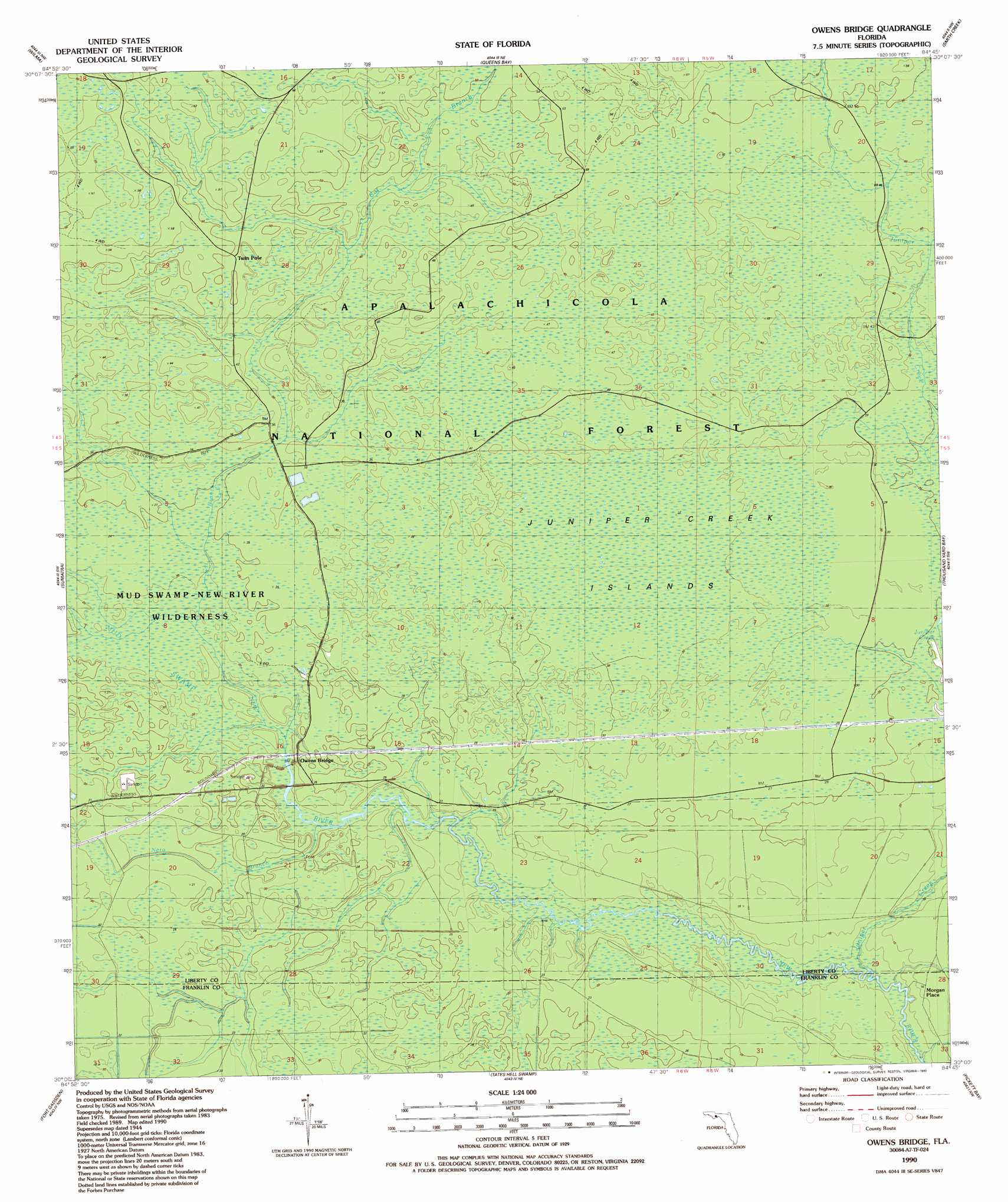
Owens Bridge Topo Map Florida
To zoom in, hover over the map of Owens Bridge
USGS Topo Quad 30084a7 - 1:24,000 scale
| Topo Map Name: | Owens Bridge |
| USGS Topo Quad ID: | 30084a7 |
| Print Size: | ca. 21 1/4" wide x 27" high |
| Southeast Coordinates: | 30° N latitude / 84.75° W longitude |
| Map Center Coordinates: | 30.0625° N latitude / 84.8125° W longitude |
| U.S. State: | FL |
| Filename: | O30084A7.jpg |
| Download Map JPG Image: | Owens Bridge topo map 1:24,000 scale |
| Map Type: | Topographic |
| Topo Series: | 7.5´ |
| Map Scale: | 1:24,000 |
| Source of Map Images: | United States Geological Survey (USGS) |
| Alternate Map Versions: |
Owens Bridge FL 1946, updated 1960 Download PDF Buy paper map Owens Bridge FL 1946, updated 1960 Download PDF Buy paper map Owens Bridge FL 1990, updated 1990 Download PDF Buy paper map Owens Bridge FL 2012 Download PDF Buy paper map Owens Bridge FL 2015 Download PDF Buy paper map |
| FStopo: | US Forest Service topo Owens Bridge is available: Download FStopo PDF Download FStopo TIF |
1:24,000 Topo Quads surrounding Owens Bridge
Estiffanulga |
Woods |
Telogia |
Ward |
Lake Talquin Se |
Orange |
Wilma |
Queens Bay |
Smith Creek |
Bradwell Bay |
Kennedy Creek |
Sumatra |
Owens Bridge |
Thousand Yard Bay |
Sanborn |
Forbes Island |
Fort Gadsden |
Tates Hell Swamp |
Pickett Bay |
Mcintyre |
Jackson River |
Beverly |
Green Point |
Carrabelle |
Dog Island |
> Back to 30084a1 at 1:100,000 scale
> Back to 30084a1 at 1:250,000 scale
> Back to U.S. Topo Maps home
Owens Bridge topo map: Gazetteer
Owens Bridge: Islands
Juniper Creek Islands elevation 11m 36′Owens Bridge: Populated Places
Morgan Place elevation 3m 9′Twin Pole elevation 14m 45′
Owens Bridge: Streams
Cat Branch elevation 6m 19′Juniper Creek elevation 1m 3′
Nero Branch New River elevation 3m 9′
Owens Bridge: Swamps
Mud Swamp elevation 5m 16′Owens Bridge digital topo map on disk
Buy this Owens Bridge topo map showing relief, roads, GPS coordinates and other geographical features, as a high-resolution digital map file on DVD:
Gulf Coast (LA, MS, AL, FL) & Southwestern Georgia
Buy digital topo maps: Gulf Coast (LA, MS, AL, FL) & Southwestern Georgia
 & Southwestern Georgia map DVD")