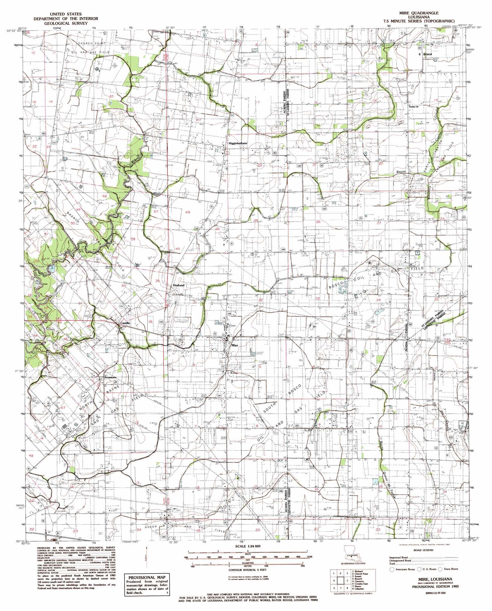
Mire Topo Map Louisiana
To zoom in, hover over the map of Mire
USGS Topo Quad 30092c2 - 1:24,000 scale
| Topo Map Name: | Mire |
| USGS Topo Quad ID: | 30092c2 |
| Print Size: | ca. 21 1/4" wide x 27" high |
| Southeast Coordinates: | 30.25° N latitude / 92.125° W longitude |
| Map Center Coordinates: | 30.3125° N latitude / 92.1875° W longitude |
| U.S. State: | LA |
| Filename: | o30092c2.jpg |
| Download Map JPG Image: | Mire topo map 1:24,000 scale |
| Map Type: | Topographic |
| Topo Series: | 7.5´ |
| Map Scale: | 1:24,000 |
| Source of Map Images: | United States Geological Survey (USGS) |
| Alternate Map Versions: |
Mire LA 1983, updated 1983 Download PDF Buy paper map Mire LA 1998, updated 2002 Download PDF Buy paper map Mire LA 2012 Download PDF Buy paper map Mire LA 2015 Download PDF Buy paper map |
1:24,000 Topo Quads surrounding Mire
Eunice North |
Chataignier |
Lawtell |
Opelousas |
Port Barre |
Eunice South |
Richard |
Church Point |
Sunset |
Arnaudville |
Iota |
Branch |
Mire |
Carencro |
Breaux Bridge |
Crowley West |
Crowley East |
Duson |
Lafayette |
Broussard |
Wright |
Kaplan North |
Leroy |
Milton |
Youngsville |
> Back to 30092a1 at 1:100,000 scale
> Back to 30092a1 at 1:250,000 scale
> Back to U.S. Topo Maps home
Mire topo map: Gazetteer
Mire: Oilfields
Bosco Oil Field elevation 10m 32′Branch Gas Field elevation 10m 32′
North Rayne Oil and Gas Field elevation 9m 29′
South Bosco Oil and Gas Field elevation 11m 36′
South Church Point Oil and Gas Field elevation 11m 36′
Mire: Populated Places
Arceneaux elevation 10m 32′Bristol elevation 16m 52′
Castille elevation 8m 26′
Deshotel elevation 10m 32′
Higginbotham elevation 13m 42′
Mire elevation 11m 36′
Mire: Streams
Coulee Croche elevation 11m 36′Mire digital topo map on disk
Buy this Mire topo map showing relief, roads, GPS coordinates and other geographical features, as a high-resolution digital map file on DVD: