Shoats Creek Topo Map Louisiana
To zoom in, hover over the map of Shoats Creek
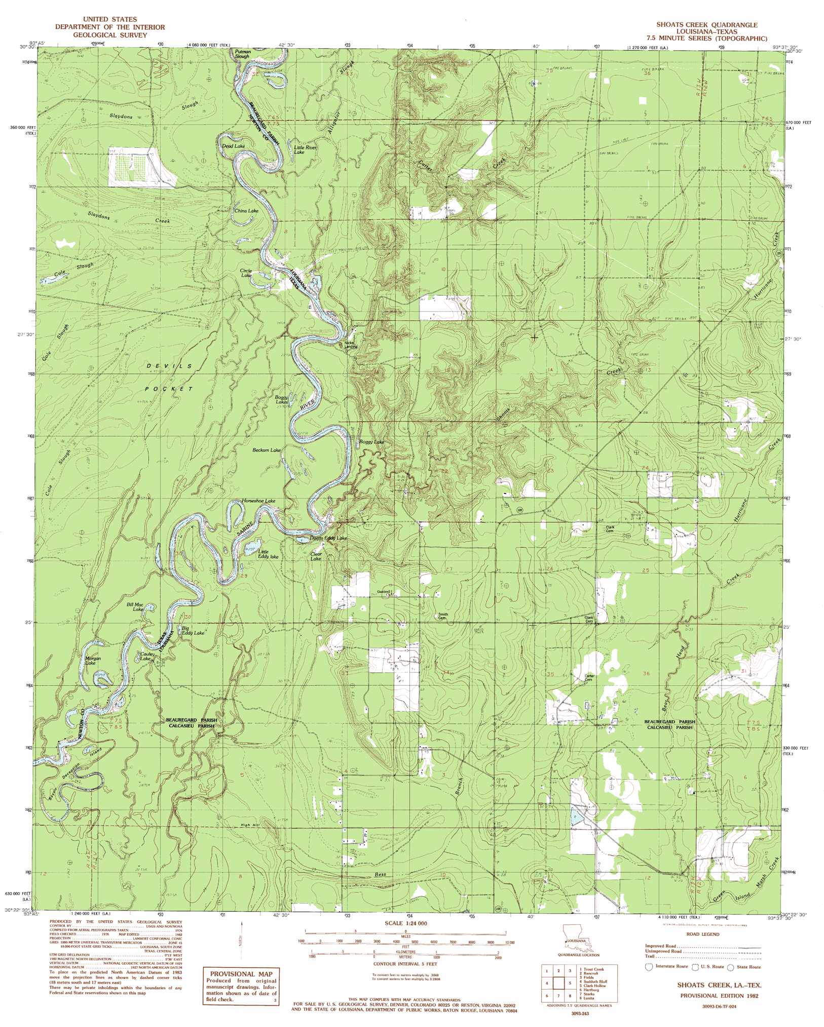
USGS Topo Quad 30093d6 - 1:24,000 scale
| Topo Map Name: | Shoats Creek |
| USGS Topo Quad ID: | 30093d6 |
| Print Size: | ca. 21 1/4" wide x 27" high |
| Southeast Coordinates: | 30.375° N latitude / 93.625° W longitude |
| Map Center Coordinates: | 30.4375° N latitude / 93.6875° W longitude |
| U.S. States: | LA, TX |
| Filename: | o30093d6.jpg |
| Download Map JPG Image: | Shoats Creek topo map 1:24,000 scale |
| Map Type: | Topographic |
| Topo Series: | 7.5´ |
| Map Scale: | 1:24,000 |
| Source of Map Images: | United States Geological Survey (USGS) |
| Alternate Map Versions: |
Shoats Creek LA 1982, updated 1983 Download PDF Buy paper map Shoats Creek LA 2010 Download PDF Buy paper map Shoats Creek LA 2012 Download PDF Buy paper map Shoats Creek LA 2015 Download PDF Buy paper map |
1:24,000 Topo Quads surrounding Shoats Creek
Kirbyville |
Bleakwood |
Bon Wier |
Merryville South |
Singer |
Call Junction |
Trout Creek |
Bancroft |
Fields |
Oretta |
Buna |
Sudduth Bluff |
Shoats Creek |
Clark Hollow |
De Quincy |
Gist |
Hartburg |
Starks |
Lunita |
Brimstone |
Texla |
Mauriceville |
Echo |
Vinton |
Sulphur |
> Back to 30093a1 at 1:100,000 scale
> Back to 30092a1 at 1:250,000 scale
> Back to U.S. Topo Maps home
Shoats Creek topo map: Gazetteer
Shoats Creek: Basins
Devils Pocket elevation 9m 29′Shoats Creek: Crossings
Nicks Ferry (historical) elevation 10m 32′Shoats Creek: Guts
Alligator Slough elevation 11m 36′Slaydons Slough elevation 10m 32′
Shoats Creek: Islands
Bayou Deception Island elevation 9m 29′Shoats Creek: Lakes
Alligator Lake elevation 11m 36′Beckam Lake elevation 10m 32′
Big Eddy Lake elevation 8m 26′
Boggy Lake elevation 10m 32′
Boggy Lakes elevation 9m 29′
Burnt Stump Lake elevation 10m 32′
Cauley Lake elevation 8m 26′
Circle Lake elevation 10m 32′
Clear Lake elevation 9m 29′
Dead Lake elevation 11m 36′
Duetts Eddy Lake elevation 9m 29′
Horseshoe Lake elevation 9m 29′
Little Eddy Lake elevation 9m 29′
Little River Lake elevation 11m 36′
Morgan Lake elevation 8m 26′
Shoats Creek: Oilfields
North Starks Oil Field elevation 16m 52′South Bancroft Gas Field elevation 27m 88′
Shoats Creek: Streams
Carter Creek elevation 10m 32′Green Island Marsh Creek elevation 10m 32′
Hurricane Creek elevation 16m 52′
Shoats Creek elevation 9m 29′
Slaydons Creek elevation 11m 36′
Shoats Creek: Summits
High Hill elevation 11m 36′Shoats Creek digital topo map on disk
Buy this Shoats Creek topo map showing relief, roads, GPS coordinates and other geographical features, as a high-resolution digital map file on DVD: