Devers Topo Map Texas
To zoom in, hover over the map of Devers
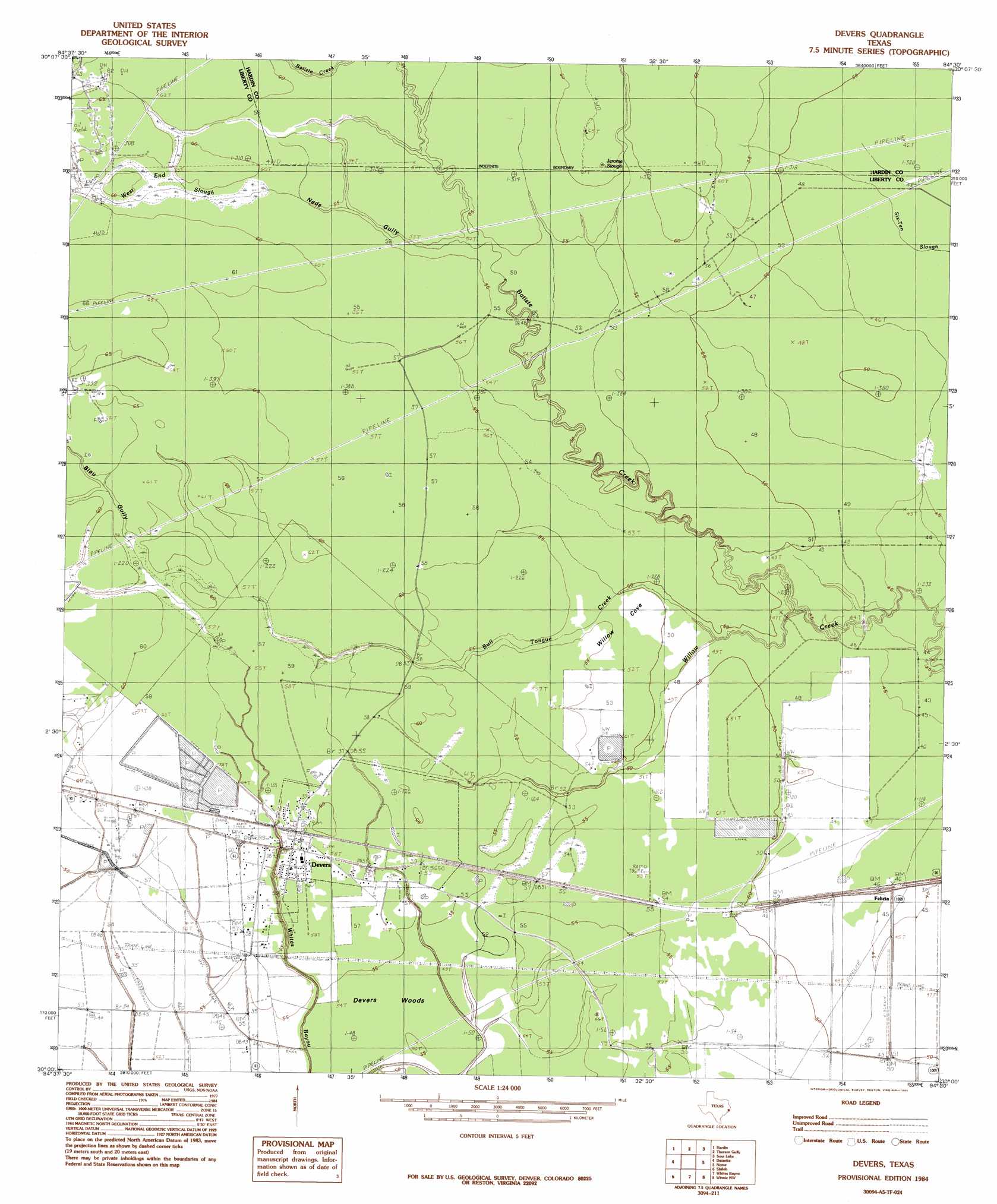
USGS Topo Quad 30094a5 - 1:24,000 scale
| Topo Map Name: | Devers |
| USGS Topo Quad ID: | 30094a5 |
| Print Size: | ca. 21 1/4" wide x 27" high |
| Southeast Coordinates: | 30° N latitude / 94.5° W longitude |
| Map Center Coordinates: | 30.0625° N latitude / 94.5625° W longitude |
| U.S. State: | TX |
| Filename: | o30094a5.jpg |
| Download Map JPG Image: | Devers topo map 1:24,000 scale |
| Map Type: | Topographic |
| Topo Series: | 7.5´ |
| Map Scale: | 1:24,000 |
| Source of Map Images: | United States Geological Survey (USGS) |
| Alternate Map Versions: |
Devers TX 1984, updated 1985 Download PDF Buy paper map Devers TX 2010 Download PDF Buy paper map Devers TX 2013 Download PDF Buy paper map Devers TX 2016 Download PDF Buy paper map |
1:24,000 Topo Quads surrounding Devers
Davis Hill |
Arizona Creek |
Saratoga |
Kountze Sw |
Kountze South |
Capers Ridge |
Hardin |
Thorson Gully |
Sour Lake |
Bevil Oaks |
Liberty |
Daisetta |
Devers |
Nome |
China |
Moss Bluff |
Shiloh |
Whites Bayou |
Winnie Nw |
Fannett West |
Cove |
Anahuac |
Monroe City |
Stowell |
Hamshire |
> Back to 30094a1 at 1:100,000 scale
> Back to 30094a1 at 1:250,000 scale
> Back to U.S. Topo Maps home
Devers topo map: Gazetteer
Devers: Basins
Willow Cove elevation 16m 52′Devers: Dams
Stephen Meche Dam elevation 17m 55′Devers: Flats
Stockpen Prairie elevation 18m 59′Devers: Populated Places
Devers elevation 18m 59′Felicia elevation 15m 49′
Hogpen Crossing elevation 12m 39′
Devers: Reservoirs
Meche Reservoir elevation 17m 55′Devers: Streams
Batiste Creek elevation 13m 42′Bull Tongue Creek elevation 13m 42′
West End Slough elevation 16m 52′
Devers: Swamps
Jerome Slough elevation 18m 59′Devers: Valleys
Blau Gully elevation 18m 59′Neds Gully elevation 16m 52′
Devers: Woods
Devers Woods elevation 16m 52′Devers digital topo map on disk
Buy this Devers topo map showing relief, roads, GPS coordinates and other geographical features, as a high-resolution digital map file on DVD: