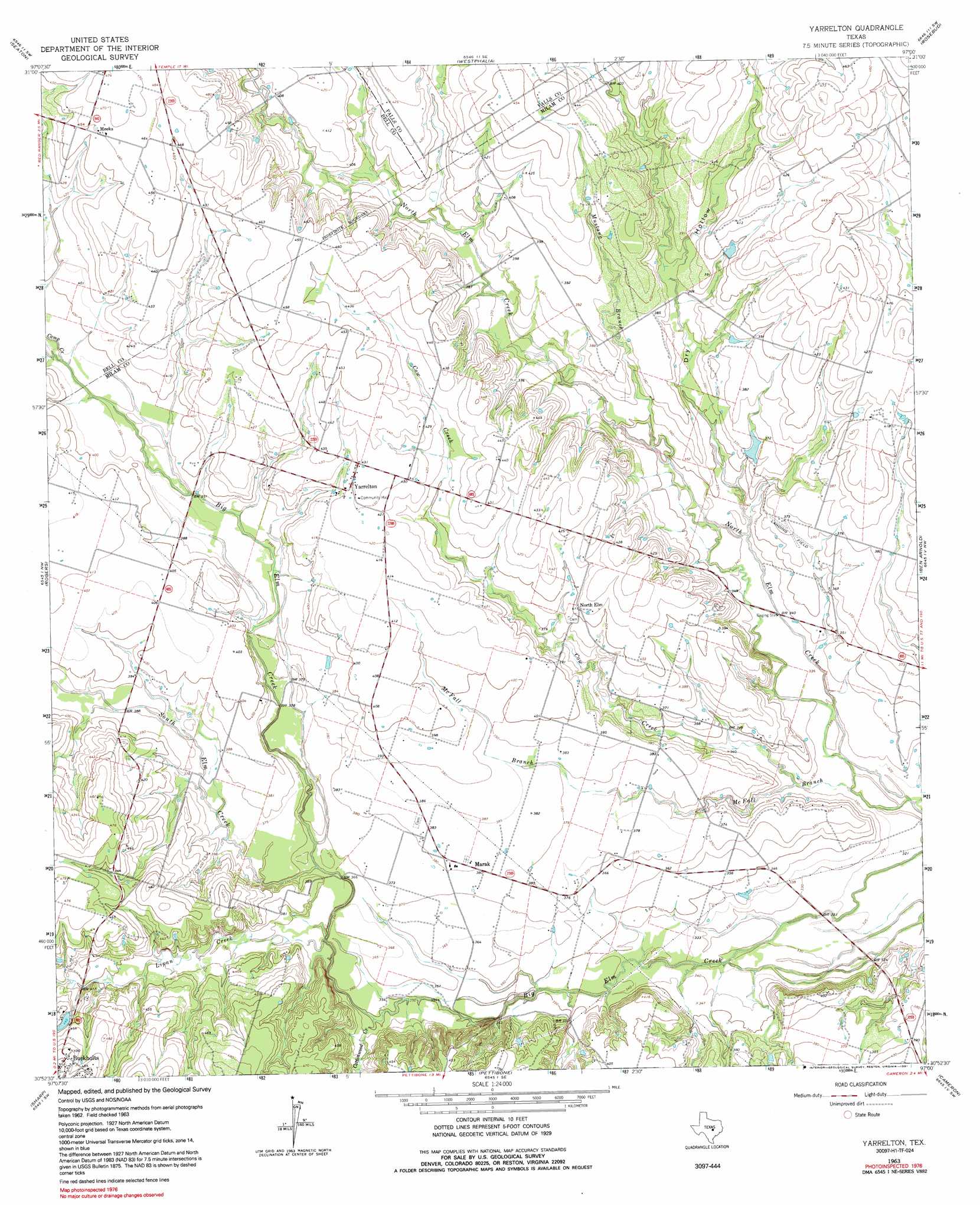
Yarrelton Topo Map Texas
To zoom in, hover over the map of Yarrelton
USGS Topo Quad 30097h1 - 1:24,000 scale
| Topo Map Name: | Yarrelton |
| USGS Topo Quad ID: | 30097h1 |
| Print Size: | ca. 21 1/4" wide x 27" high |
| Southeast Coordinates: | 30.875° N latitude / 97° W longitude |
| Map Center Coordinates: | 30.9375° N latitude / 97.0625° W longitude |
| U.S. State: | TX |
| Filename: | o30097h1.jpg |
| Download Map JPG Image: | Yarrelton topo map 1:24,000 scale |
| Map Type: | Topographic |
| Topo Series: | 7.5´ |
| Map Scale: | 1:24,000 |
| Source of Map Images: | United States Geological Survey (USGS) |
| Alternate Map Versions: |
Yarrelton TX 1963, updated 1965 Download PDF Buy paper map Yarrelton TX 1963, updated 1991 Download PDF Buy paper map Yarrelton TX 2010 Download PDF Buy paper map Yarrelton TX 2013 Download PDF Buy paper map Yarrelton TX 2016 Download PDF Buy paper map |
1:24,000 Topo Quads surrounding Yarrelton
Troy |
Belfalls |
Lott |
Cedar Springs |
Reagan |
Temple |
Seaton |
Westphalia |
Rosebud |
Baileyville |
Little River |
Rogers |
Yarrelton |
Ben Arnold |
Maysfield |
Davilla |
Sharp |
Pettibone |
Cameron |
Hanover |
Friendship |
San Gabriel |
Rockdale West |
Rockdale East |
Milano |
> Back to 30097e1 at 1:100,000 scale
> Back to 30096a1 at 1:250,000 scale
> Back to U.S. Topo Maps home
Yarrelton topo map: Gazetteer
Yarrelton: Airports
Glaser Field elevation 144m 472′Yarrelton: Populated Places
Marak elevation 116m 380′Meeks elevation 140m 459′
North Elm elevation 126m 413′
Yarrelton elevation 132m 433′
Yarrelton: Streams
Camp Creek elevation 119m 390′Cottonwood Creek elevation 107m 351′
Cow Creek elevation 101m 331′
Lipan Creek elevation 107m 351′
McFall Branch elevation 96m 314′
Mustang Creek elevation 107m 351′
South Elm Creek elevation 110m 360′
Yarrelton: Valleys
Dry Hollow elevation 105m 344′Yarrelton digital topo map on disk
Buy this Yarrelton topo map showing relief, roads, GPS coordinates and other geographical features, as a high-resolution digital map file on DVD: