Noxville Topo Map Texas
To zoom in, hover over the map of Noxville
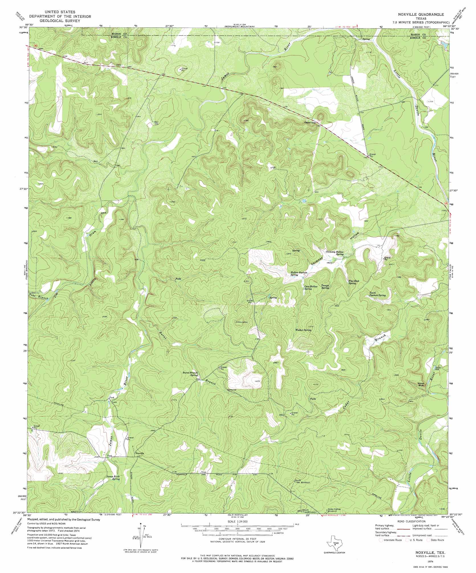
USGS Topo Quad 30099d4 - 1:24,000 scale
| Topo Map Name: | Noxville |
| USGS Topo Quad ID: | 30099d4 |
| Print Size: | ca. 21 1/4" wide x 27" high |
| Southeast Coordinates: | 30.375° N latitude / 99.375° W longitude |
| Map Center Coordinates: | 30.4375° N latitude / 99.4375° W longitude |
| U.S. State: | TX |
| Filename: | o30099d4.jpg |
| Download Map JPG Image: | Noxville topo map 1:24,000 scale |
| Map Type: | Topographic |
| Topo Series: | 7.5´ |
| Map Scale: | 1:24,000 |
| Source of Map Images: | United States Geological Survey (USGS) |
| Alternate Map Versions: |
Noxville TX 1974, updated 1977 Download PDF Buy paper map Noxville TX 2010 Download PDF Buy paper map Noxville TX 2012 Download PDF Buy paper map Noxville TX 2016 Download PDF Buy paper map |
1:24,000 Topo Quads surrounding Noxville
Brewer Hollow |
London |
Sheep Run Creek |
Turtle Creek |
Mason |
Big Draw |
Yates |
Monument Mountain |
Monument Mountain Se |
Panther Creek |
Segovia |
Tobe Branch |
Noxville |
The Falls |
Doss |
Allen Creek |
Mudge Draw |
Old Noxville |
Harper West |
Harper East |
Y O Ranch |
Live Oak Ranch |
Contrary Creek |
Mountain Home |
Nott Branch |
> Back to 30099a1 at 1:100,000 scale
> Back to 30098a1 at 1:250,000 scale
> Back to U.S. Topo Maps home
Noxville topo map: Gazetteer
Noxville: Cliffs
White Bluff elevation 576m 1889′Noxville: Gaps
Cedar Gap elevation 558m 1830′Noxville: Populated Places
Noxville elevation 633m 2076′Noxville: Springs
Burnt Branch Spring elevation 614m 2014′Cave Hollow Spring elevation 584m 1916′
Chimney Hollow Spring elevation 560m 1837′
Flat Rock Spring elevation 584m 1916′
Hollow Pasture Spring elevation 585m 1919′
James River Spring elevation 611m 2004′
South Pasture Spring elevation 589m 1932′
Trough Spring elevation 578m 1896′
Walker Spring elevation 616m 2020′
Noxville: Streams
Burnt Branch elevation 566m 1856′Little Devils River elevation 490m 1607′
Tobe Branch elevation 571m 1873′
Noxville: Valleys
Chimney Hollow elevation 513m 1683′Jim Little Draw elevation 542m 1778′
Noxville digital topo map on disk
Buy this Noxville topo map showing relief, roads, GPS coordinates and other geographical features, as a high-resolution digital map file on DVD: