Mason Topo Map Texas
To zoom in, hover over the map of Mason
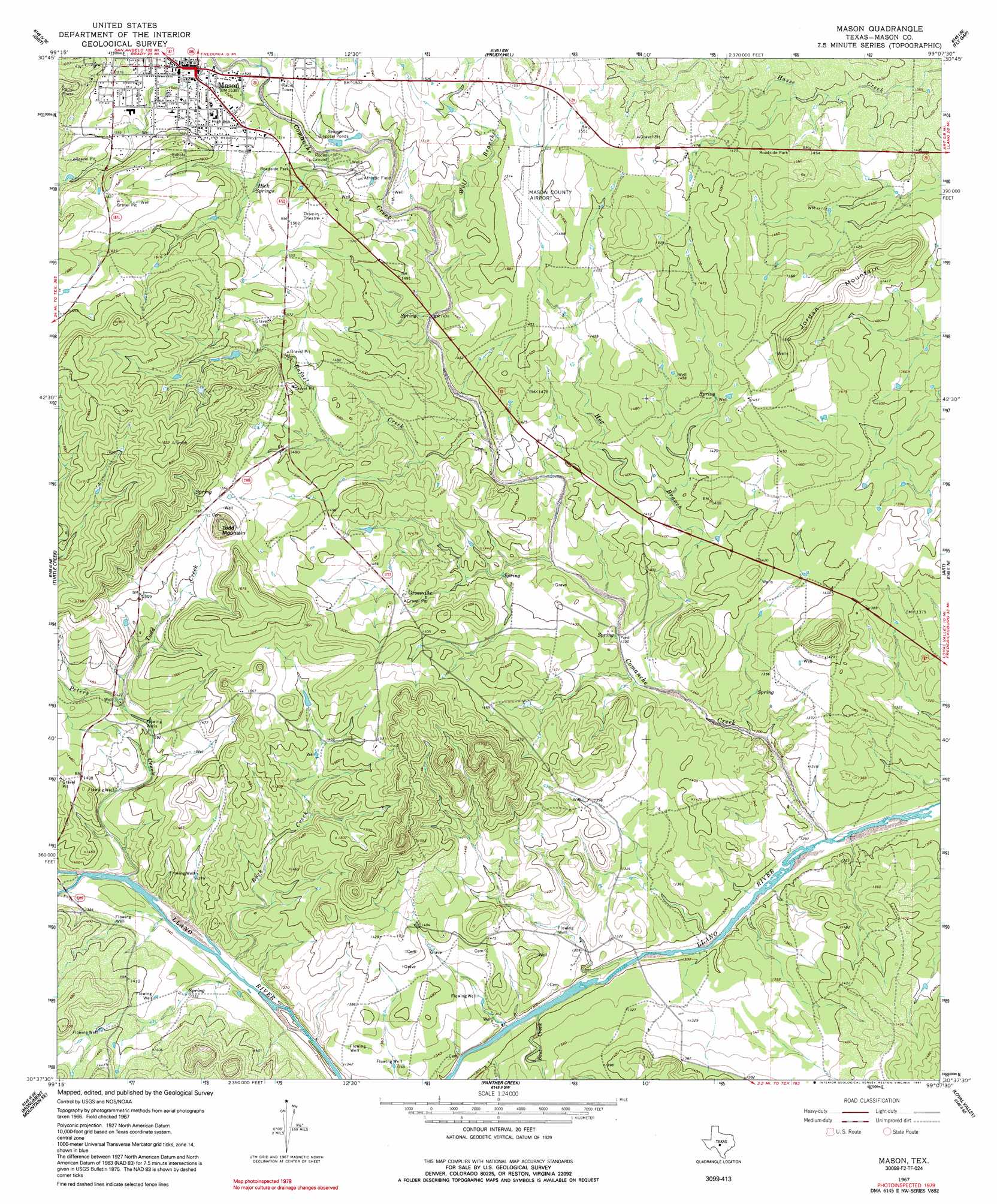
USGS Topo Quad 30099f2 - 1:24,000 scale
| Topo Map Name: | Mason |
| USGS Topo Quad ID: | 30099f2 |
| Print Size: | ca. 21 1/4" wide x 27" high |
| Southeast Coordinates: | 30.625° N latitude / 99.125° W longitude |
| Map Center Coordinates: | 30.6875° N latitude / 99.1875° W longitude |
| U.S. State: | TX |
| Filename: | o30099f2.jpg |
| Download Map JPG Image: | Mason topo map 1:24,000 scale |
| Map Type: | Topographic |
| Topo Series: | 7.5´ |
| Map Scale: | 1:24,000 |
| Source of Map Images: | United States Geological Survey (USGS) |
| Alternate Map Versions: |
Mason TX 1967, updated 1970 Download PDF Buy paper map Mason TX 1967, updated 1991 Download PDF Buy paper map Mason TX 2010 Download PDF Buy paper map Mason TX 2012 Download PDF Buy paper map Mason TX 2016 Download PDF Buy paper map |
1:24,000 Topo Quads surrounding Mason
Calf Creek |
Katemcy |
Spy Rock |
Fredonia |
Pontotoc |
Long Mountain |
Grit |
Purdy Hill |
Fly Gap |
Smoothingiron Mountain |
Sheep Run Creek |
Turtle Creek |
Mason |
Art |
Castell |
Monument Mountain |
Monument Mountain Se |
Panther Creek |
Loyal Valley |
House Mountain |
Noxville |
The Falls |
Doss |
Cherry Spring |
Cherry Mountain |
> Back to 30099e1 at 1:100,000 scale
> Back to 30098a1 at 1:250,000 scale
> Back to U.S. Topo Maps home
Mason topo map: Gazetteer
Mason: Airports
Mason County Airport elevation 456m 1496′Mason: Populated Places
Grossville elevation 445m 1459′Mason elevation 469m 1538′
Mason: Springs
Hick Springs elevation 466m 1528′Mason: Streams
Bast Creek elevation 390m 1279′Comanche Creek elevation 384m 1259′
Hog Branch elevation 403m 1322′
Rafael Creek elevation 429m 1407′
Rock Creek elevation 397m 1302′
Todd Creek elevation 429m 1407′
Wolf Branch elevation 442m 1450′
Mason: Summits
Jordan Mountain elevation 472m 1548′Todd Mountain elevation 528m 1732′
Mason digital topo map on disk
Buy this Mason topo map showing relief, roads, GPS coordinates and other geographical features, as a high-resolution digital map file on DVD: