Junction Topo Map Texas
To zoom in, hover over the map of Junction
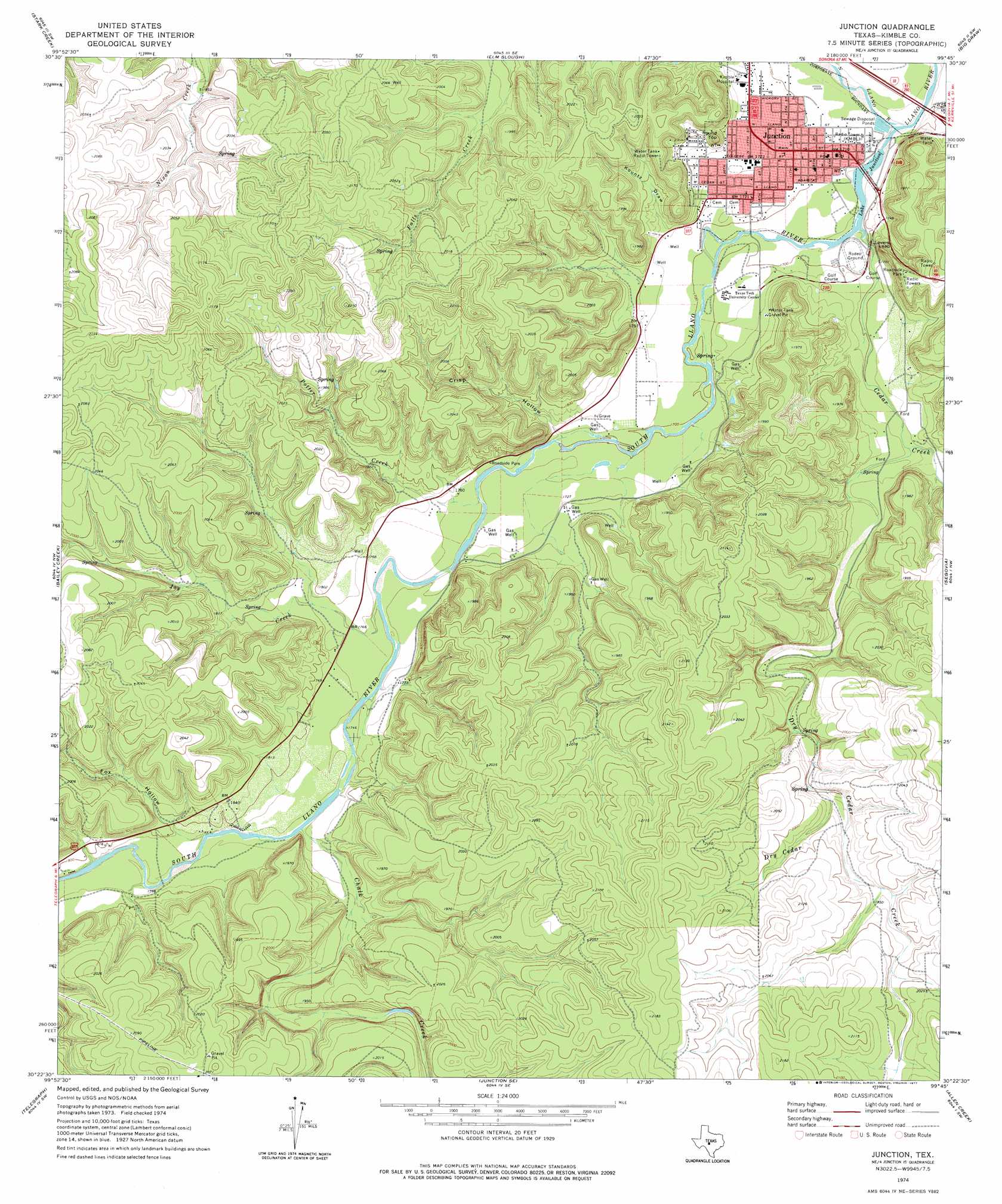
USGS Topo Quad 30099d7 - 1:24,000 scale
| Topo Map Name: | Junction |
| USGS Topo Quad ID: | 30099d7 |
| Print Size: | ca. 21 1/4" wide x 27" high |
| Southeast Coordinates: | 30.375° N latitude / 99.75° W longitude |
| Map Center Coordinates: | 30.4375° N latitude / 99.8125° W longitude |
| U.S. State: | TX |
| Filename: | o30099d7.jpg |
| Download Map JPG Image: | Junction topo map 1:24,000 scale |
| Map Type: | Topographic |
| Topo Series: | 7.5´ |
| Map Scale: | 1:24,000 |
| Source of Map Images: | United States Geological Survey (USGS) |
| Alternate Map Versions: |
Junction TX 1974, updated 1977 Download PDF Buy paper map Junction TX 2010 Download PDF Buy paper map Junction TX 2012 Download PDF Buy paper map Junction TX 2016 Download PDF Buy paper map |
1:24,000 Topo Quads surrounding Junction
Mckegan Draw Ne |
Rust Ranch |
Julio Draw |
Brewer Hollow |
London |
Mckegan Draw |
Stark Creek |
Elm Slough |
Big Draw |
Yates |
Roosevelt |
Bailey Creek |
Junction |
Segovia |
Tobe Branch |
Hill Ranch |
Telegraph |
Junction Se |
Allen Creek |
Mudge Draw |
Paint Rock Spring |
Bradford Creek |
Horse Camp Waterhole |
Y O Ranch |
Live Oak Ranch |
> Back to 30099a1 at 1:100,000 scale
> Back to 30098a1 at 1:250,000 scale
> Back to U.S. Topo Maps home
Junction topo map: Gazetteer
Junction: Bridges
State Highway 27 Bridge elevation 518m 1699′Junction: Cliffs
Lovers Leap elevation 584m 1916′Junction: Dams
Lake Junction Dam elevation 510m 1673′Junction: Parks
Schreiner Park elevation 566m 1856′Schrier Park elevation 511m 1676′
South Llano River State Park elevation 529m 1735′
Walter Buck Wildlife Management Area elevation 579m 1899′
Junction: Populated Places
Junction elevation 519m 1702′Junction: Reservoirs
Kimble County WCID Lake elevation 513m 1683′Lake Junction elevation 506m 1660′
Junction: Streams
Cedar Creek elevation 512m 1679′Chalk Creek elevation 536m 1758′
Dry Cedar Creek elevation 530m 1738′
Joy Creek elevation 526m 1725′
North Llano River elevation 505m 1656′
Potter Creek elevation 523m 1715′
South Llano River elevation 505m 1656′
Junction: Summits
Round Top elevation 604m 1981′Junction: Trails
Walter Buck Wildlife Management Area Trail elevation 588m 1929′Junction: Valleys
Crisp Hollow elevation 529m 1735′Fox Hollow elevation 541m 1774′
Kountz Draw elevation 528m 1732′
Junction digital topo map on disk
Buy this Junction topo map showing relief, roads, GPS coordinates and other geographical features, as a high-resolution digital map file on DVD: