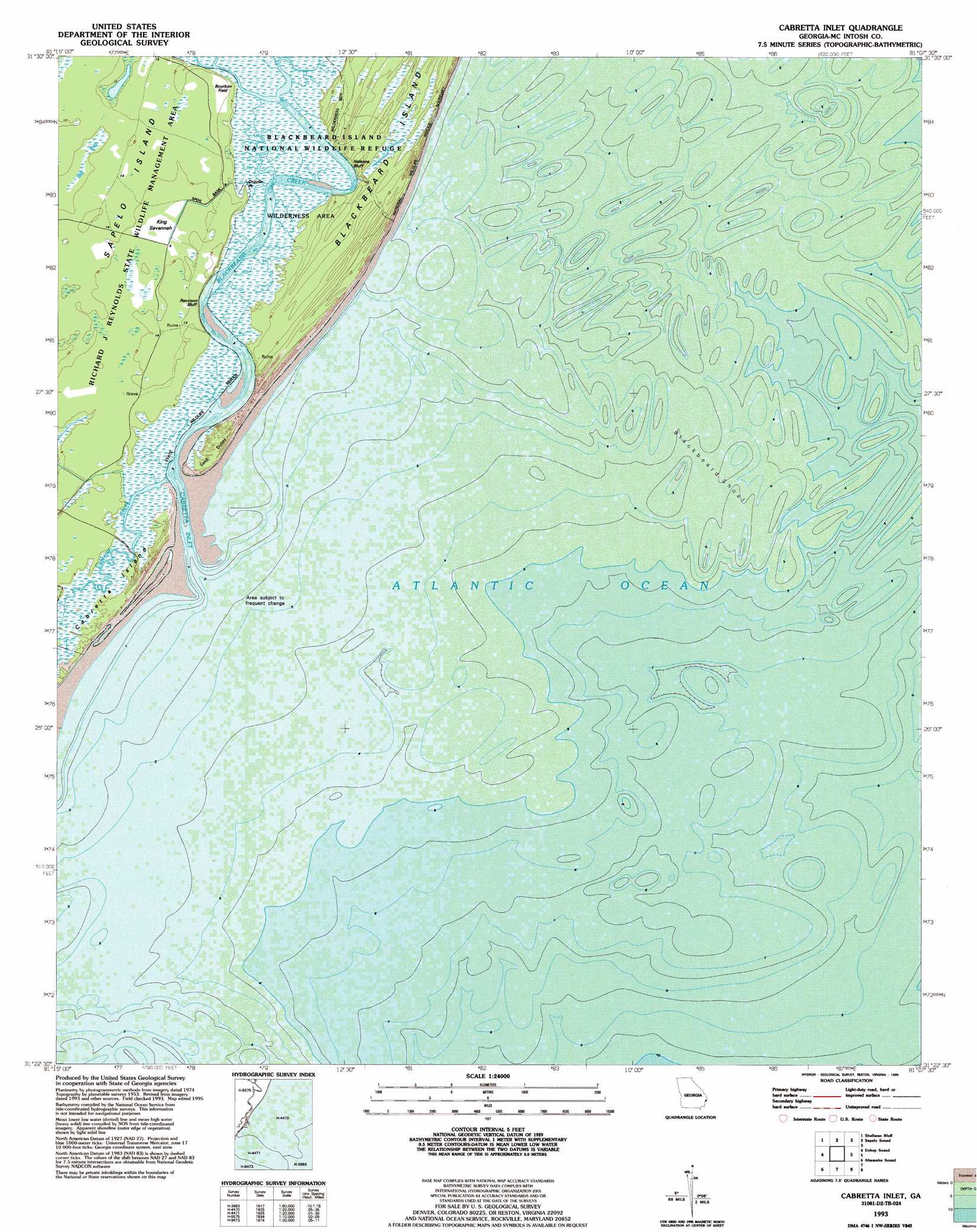
Cabretta Inlet Topo Map Georgia
To zoom in, hover over the map of Cabretta Inlet
USGS Topo Quad 31081d2 - 1:24,000 scale
| Topo Map Name: | Cabretta Inlet |
| USGS Topo Quad ID: | 31081d2 |
| Print Size: | ca. 21 1/4" wide x 27" high |
| Southeast Coordinates: | 31.375° N latitude / 81.125° W longitude |
| Map Center Coordinates: | 31.4375° N latitude / 81.1875° W longitude |
| U.S. State: | GA |
| Filename: | o31081d2.jpg |
| Download Map JPG Image: | Cabretta Inlet topo map 1:24,000 scale |
| Map Type: | Topographic |
| Topo Series: | 7.5´ |
| Map Scale: | 1:24,000 |
| Source of Map Images: | United States Geological Survey (USGS) |
| Alternate Map Versions: |
Cabretta Inlet GA 1954, updated 1959 Download PDF Buy paper map Cabretta Inlet GA 1979, updated 1979 Download PDF Buy paper map Cabretta Inlet GA 1993, updated 1995 Download PDF Buy paper map Cabretta Inlet GA 2011 Download PDF Buy paper map Cabretta Inlet GA 2014 Download PDF Buy paper map |
1:24,000 Topo Quads surrounding Cabretta Inlet
Riceboro |
Seabrook |
Saint Catherines Sound |
||
Eulonia |
Shellman Bluff |
Sapelo Sound |
||
Ridgeville |
Doboy Sound |
Cabretta Inlet |
||
Darien |
Altamaha Sound |
|||
Brunswick East |
Sea Island |
> Back to 31081a1 at 1:100,000 scale
> Back to 31080a1 at 1:250,000 scale
> Back to U.S. Topo Maps home
Cabretta Inlet topo map: Gazetteer
Cabretta Inlet: Bars
Blackbeard Shoal elevation 0m 0′Cabretta Inlet: Channels
Blackbeard Creek elevation 0m 0′Cabretta Inlet elevation 0m 0′
Cabretta Inlet: Cliffs
Nelsons Bluff elevation 3m 9′Cabretta Inlet: Flats
King Savannah elevation 3m 9′Cabretta Inlet: Islands
Cabretta Island elevation 1m 3′Sapelo Island elevation 3m 9′
Cabretta Inlet: Populated Places
Raccoon Bluff elevation 3m 9′Cabretta Inlet: Streams
Cabretta Creek elevation 0m 0′Cabretta Inlet digital topo map on disk
Buy this Cabretta Inlet topo map showing relief, roads, GPS coordinates and other geographical features, as a high-resolution digital map file on DVD: