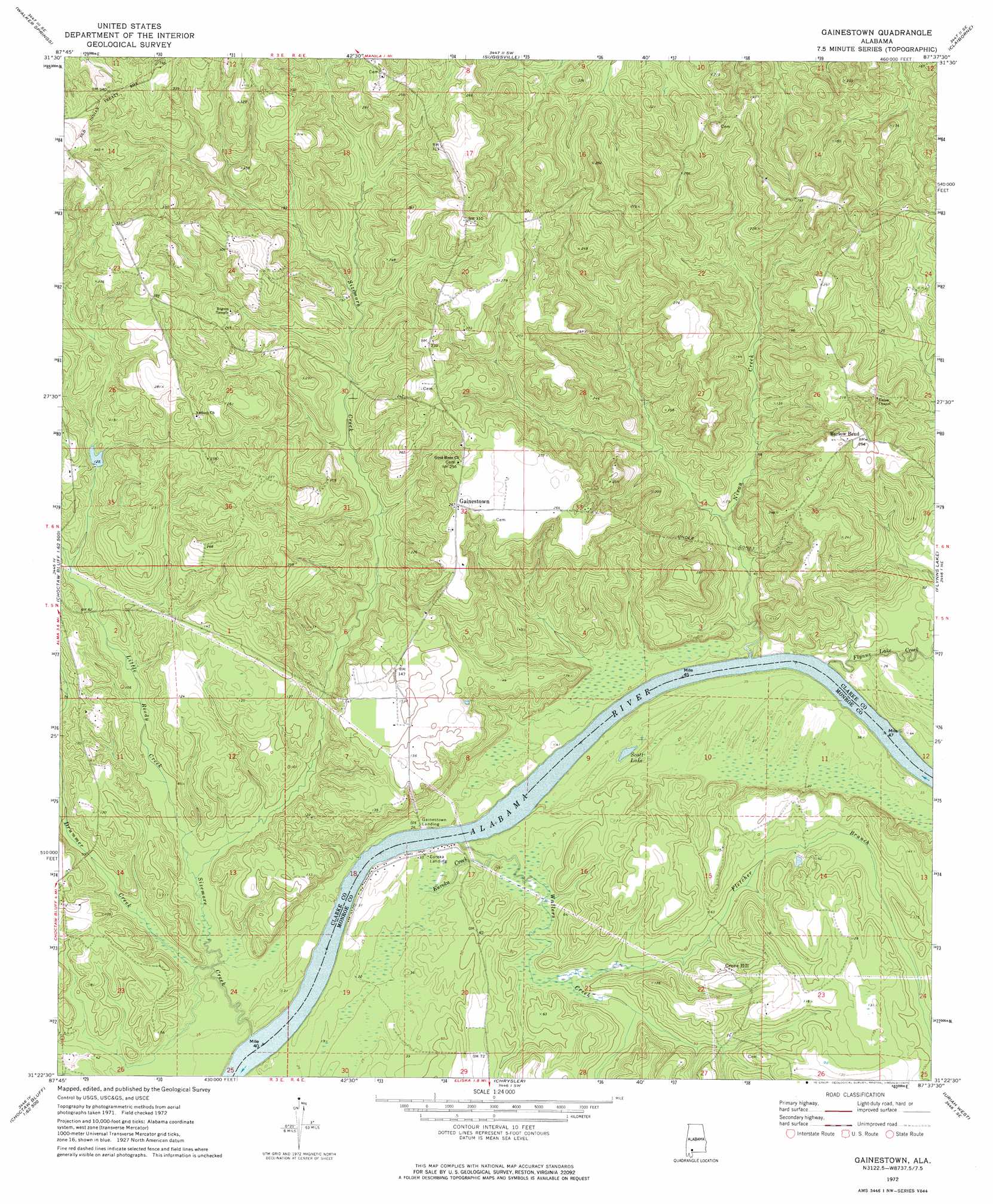
Gainestown Topo Map Alabama
To zoom in, hover over the map of Gainestown
USGS Topo Quad 31087d6 - 1:24,000 scale
| Topo Map Name: | Gainestown |
| USGS Topo Quad ID: | 31087d6 |
| Print Size: | ca. 21 1/4" wide x 27" high |
| Southeast Coordinates: | 31.375° N latitude / 87.625° W longitude |
| Map Center Coordinates: | 31.4375° N latitude / 87.6875° W longitude |
| U.S. State: | AL |
| Filename: | o31087d6.jpg |
| Download Map JPG Image: | Gainestown topo map 1:24,000 scale |
| Map Type: | Topographic |
| Topo Series: | 7.5´ |
| Map Scale: | 1:24,000 |
| Source of Map Images: | United States Geological Survey (USGS) |
| Alternate Map Versions: |
Gainestown AL 1972, updated 1975 Download PDF Buy paper map Gainestown AL 2011 Download PDF Buy paper map Gainestown AL 2014 Download PDF Buy paper map |
1:24,000 Topo Quads surrounding Gainestown
Winn |
Grove Hill |
Whatley |
Chance |
Franklin |
Jackson |
Walker Springs |
Suggsville |
Claiborne |
Mexia |
Prestwick |
Choctaw Bluff |
Gainestown |
Flynns Lake |
Frisco City |
Gin House Island |
Carlton |
Chrysler |
Uriah West |
Uriah East |
Bilbo Island |
Tensaw |
Blacksher |
Mccullough |
Huxford |
> Back to 31087a1 at 1:100,000 scale
> Back to 31086a1 at 1:250,000 scale
> Back to U.S. Topo Maps home
Gainestown topo map: Gazetteer
Gainestown: Bars
California Bar elevation 1m 3′Irvin Bar elevation 1m 3′
Gainestown: Crossings
Gainestown Ferry (historical) elevation 1m 3′Gainestown: Lakes
Scott Lake elevation 8m 26′Gainestown: Populated Places
Barlow Bend elevation 76m 249′Gainestown elevation 81m 265′
Gainestown: Streams
Baileys Creek elevation 3m 9′Drummer Creek elevation 6m 19′
Eureka Creek elevation 4m 13′
Fletcher Branch elevation 8m 26′
Flynns Lake Creek elevation 2m 6′
Little Reedy Creek elevation 8m 26′
Nixon Creek elevation 2m 6′
Sizemore Creek elevation 2m 6′
Wallers Creek elevation 2m 6′
Gainestown: Summits
Grove Hill elevation 31m 101′Gainestown digital topo map on disk
Buy this Gainestown topo map showing relief, roads, GPS coordinates and other geographical features, as a high-resolution digital map file on DVD:
Gulf Coast (LA, MS, AL, FL) & Southwestern Georgia
Buy digital topo maps: Gulf Coast (LA, MS, AL, FL) & Southwestern Georgia
 & Southwestern Georgia map DVD")