Latanier Topo Map Louisiana
To zoom in, hover over the map of Latanier
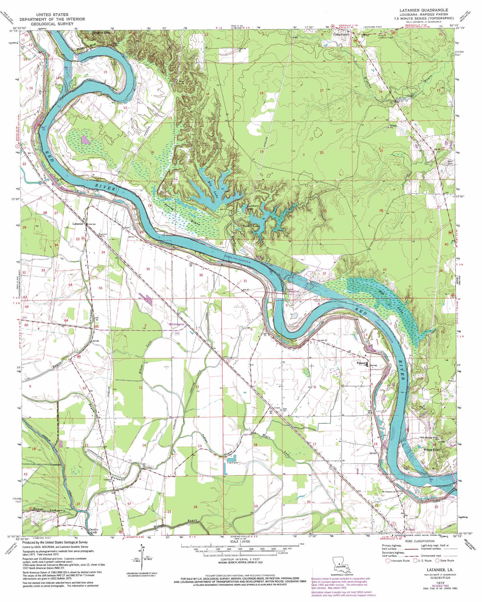
USGS Topo Quad 31092b3 - 1:24,000 scale
| Topo Map Name: | Latanier |
| USGS Topo Quad ID: | 31092b3 |
| Print Size: | ca. 21 1/4" wide x 27" high |
| Southeast Coordinates: | 31.125° N latitude / 92.25° W longitude |
| Map Center Coordinates: | 31.1875° N latitude / 92.3125° W longitude |
| U.S. State: | LA |
| Filename: | o31092b3.jpg |
| Download Map JPG Image: | Latanier topo map 1:24,000 scale |
| Map Type: | Topographic |
| Topo Series: | 7.5´ |
| Map Scale: | 1:24,000 |
| Source of Map Images: | United States Geological Survey (USGS) |
| Alternate Map Versions: |
Latanier LA 1972, updated 1974 Download PDF Buy paper map Latanier LA 1972, updated 1993 Download PDF Buy paper map Latanier LA 2012 Download PDF Buy paper map Latanier LA 2015 Download PDF Buy paper map |
1:24,000 Topo Quads surrounding Latanier
Rock Hill |
Ball |
Green Gables |
Holloway |
Buckeye Ne |
Rapides |
Alexandria |
Libuse |
Buckeye |
Powell Point |
Woodworth West |
Woodworth East |
Latanier |
Effie |
Marksville North |
Forest Hill |
Lecompte |
Cheneyville |
Belle D'Eau |
Marksville South |
Glenmora |
Cocodrie Lake |
Lone Pine |
Bunkie |
Cottonport |
> Back to 31092a1 at 1:100,000 scale
> Back to 31092a1 at 1:250,000 scale
> Back to U.S. Topo Maps home
Latanier topo map: Gazetteer
Latanier: Canals
Compton Lake Canal elevation 18m 59′Latanier: Cliffs
Miller Bluff elevation 22m 72′Latanier: Crossings
Harris Ferry (historical) elevation 14m 45′Wilsons Ferry (historical) elevation 19m 62′
Latanier: Dams
Overton Lock and Dam elevation 27m 88′Latanier: Lakes
Big Lake elevation 19m 62′Chatlin Lake elevation 19m 62′
Compton Lake (historical) elevation 19m 62′
Hog Lake elevation 20m 65′
Lockhart Lake elevation 20m 65′
Tarkill Lake elevation 20m 65′
Latanier: Populated Places
Cedar Grove elevation 31m 101′Latanier elevation 21m 68′
Magda (historical) elevation 18m 59′
Poland elevation 21m 68′
Richland (historical) elevation 19m 62′
Stonewalls (historical) elevation 28m 91′
Whittington elevation 19m 62′
Wilson Point elevation 28m 91′
Wises (historical) elevation 24m 78′
Latanier: Streams
Bayou Lamourie elevation 16m 52′Bayou Latanier elevation 15m 49′
Elbow Lake elevation 19m 62′
Indian Bayou elevation 16m 52′
Lick Bayou elevation 19m 62′
Tiger Lake elevation 17m 55′
Wilson Bayou elevation 15m 49′
Latanier: Swamps
Spring Bayou elevation 20m 65′Latanier digital topo map on disk
Buy this Latanier topo map showing relief, roads, GPS coordinates and other geographical features, as a high-resolution digital map file on DVD: