Centralia Topo Map Texas
To zoom in, hover over the map of Centralia
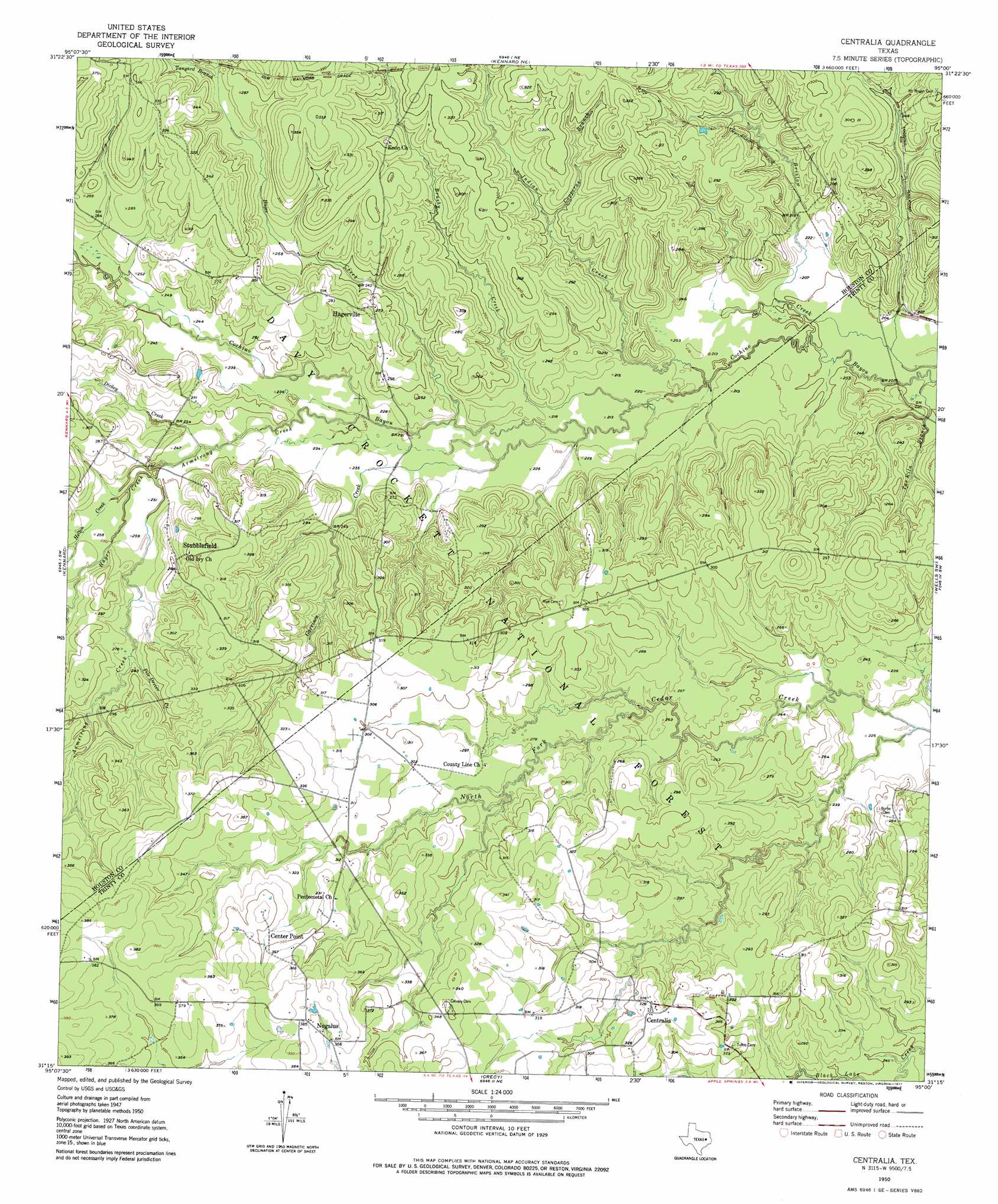
USGS Topo Quad 31095c1 - 1:24,000 scale
| Topo Map Name: | Centralia |
| USGS Topo Quad ID: | 31095c1 |
| Print Size: | ca. 21 1/4" wide x 27" high |
| Southeast Coordinates: | 31.25° N latitude / 95° W longitude |
| Map Center Coordinates: | 31.3125° N latitude / 95.0625° W longitude |
| U.S. State: | TX |
| Filename: | o31095c1.jpg |
| Download Map JPG Image: | Centralia topo map 1:24,000 scale |
| Map Type: | Topographic |
| Topo Series: | 7.5´ |
| Map Scale: | 1:24,000 |
| Source of Map Images: | United States Geological Survey (USGS) |
| Alternate Map Versions: |
Centralia TX 1950, updated 1977 Download PDF Buy paper map Centralia TX 1951 Download PDF Buy paper map Centralia TX 2004, updated 2006 Download PDF Buy paper map Centralia TX 2010 Download PDF Buy paper map Centralia TX 2013 Download PDF Buy paper map Centralia TX 2016 Download PDF Buy paper map |
| FStopo: | US Forest Service topo Centralia is available: Download FStopo PDF Download FStopo TIF |
1:24,000 Topo Quads surrounding Centralia
Augusta |
Weches |
Forest |
Durst Lakes |
Lake Nacogdoches South |
Crockett Ne |
Ratcliff |
Kennard Ne |
Wells |
Clawson |
Berea |
Kennard |
Centralia |
Wells Sw |
Keltys |
Fodice |
Pennington |
Crecy |
Apple Springs |
Diboll |
Glendale |
Groveton West |
Groveton East |
Trevat |
Wakefield |
> Back to 31095a1 at 1:100,000 scale
> Back to 31094a1 at 1:250,000 scale
> Back to U.S. Topo Maps home
Centralia topo map: Gazetteer
Centralia: Forests
Davy Crockett National Forest elevation 70m 229′Centralia: Populated Places
Center Point elevation 115m 377′Centralia elevation 99m 324′
Hagerville elevation 83m 272′
Nogalus elevation 115m 377′
Stubblefield elevation 87m 285′
Centralia: Post Offices
Hagerville Post Office (historical) elevation 84m 275′Lundy Post Office (historical) elevation 79m 259′
Centralia: Streams
Armstrong Creek elevation 67m 219′Brushy Creek elevation 63m 206′
Copperas Branch elevation 73m 239′
Dickey Creek elevation 73m 239′
Garrison Creek elevation 64m 209′
Hager Creek elevation 73m 239′
Hager Creek elevation 67m 219′
Helton Creek elevation 76m 249′
Indian Creek elevation 61m 200′
Pile Driver Creek elevation 83m 272′
Tanyard Branch elevation 85m 278′
Tar Kiln Branch elevation 58m 190′
Centralia: Summits
Brown Lee Hill (historical) elevation 75m 246′Sugar Mounds elevation 73m 239′
Centralia: Trails
4 - C National Recreation Hiking Trail elevation 76m 249′Centralia digital topo map on disk
Buy this Centralia topo map showing relief, roads, GPS coordinates and other geographical features, as a high-resolution digital map file on DVD: