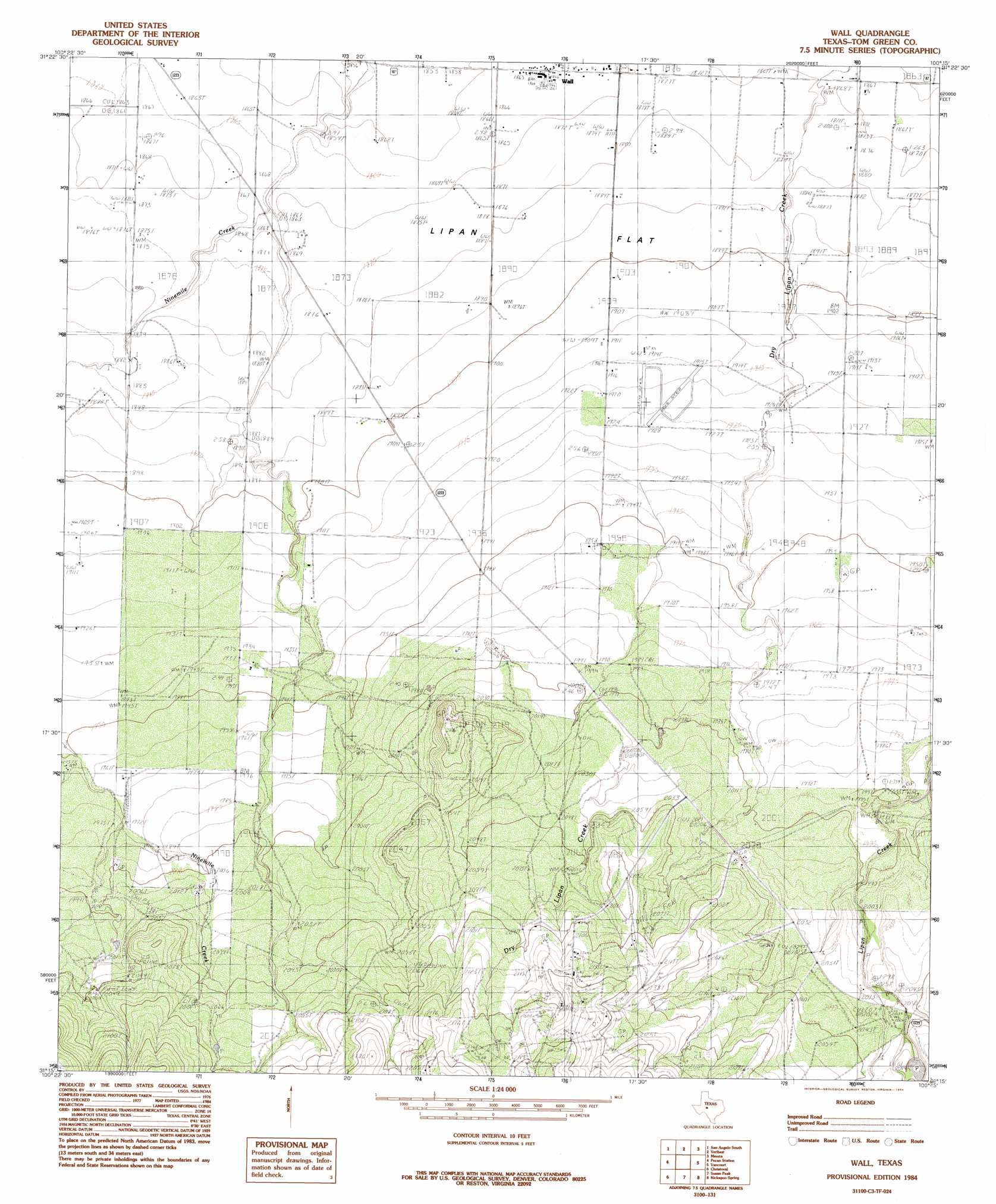
Wall Topo Map Texas
To zoom in, hover over the map of Wall
USGS Topo Quad 31100c3 - 1:24,000 scale
| Topo Map Name: | Wall |
| USGS Topo Quad ID: | 31100c3 |
| Print Size: | ca. 21 1/4" wide x 27" high |
| Southeast Coordinates: | 31.25° N latitude / 100.25° W longitude |
| Map Center Coordinates: | 31.3125° N latitude / 100.3125° W longitude |
| U.S. State: | TX |
| Filename: | o31100c3.jpg |
| Download Map JPG Image: | Wall topo map 1:24,000 scale |
| Map Type: | Topographic |
| Topo Series: | 7.5´ |
| Map Scale: | 1:24,000 |
| Source of Map Images: | United States Geological Survey (USGS) |
| Alternate Map Versions: |
Wall TX 1984, updated 1984 Download PDF Buy paper map Wall TX 2010 Download PDF Buy paper map Wall TX 2012 Download PDF Buy paper map Wall TX 2016 Download PDF Buy paper map |
1:24,000 Topo Quads surrounding Wall
Mount Nebo |
San Angelo North |
Harriet |
Miles |
Lowake |
Twin Buttes |
San Angelo South |
Veribest |
Mereta |
Eola |
Knickerbocker |
Pecan Station |
Wall |
Vancourt |
Vick |
Cold Creek Spring |
Christoval |
Susan Peak |
Kickapoo Spring |
Burr Oak Creek |
Hulldale |
Cave Spring |
Christoval Se |
Rocking Chair Ranch |
Del Venado Ranch |
> Back to 31100a1 at 1:100,000 scale
> Back to 31100a1 at 1:250,000 scale
> Back to U.S. Topo Maps home
Wall topo map: Gazetteer
Wall: Dams
Whitehead Dam elevation 624m 2047′Wall: Oilfields
Susan Peak Oil Field elevation 659m 2162′Wall: Populated Places
Wall elevation 569m 1866′Wall: Reservoirs
Whitehead Reservoir elevation 624m 2047′Wall: Springs
Lipan Spring elevation 621m 2037′Wall digital topo map on disk
Buy this Wall topo map showing relief, roads, GPS coordinates and other geographical features, as a high-resolution digital map file on DVD: