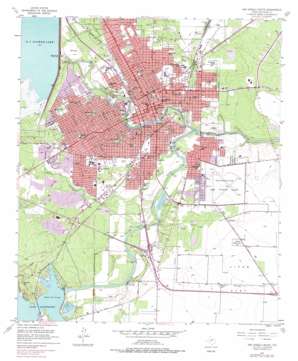
San Angelo South Topo Map Texas
To zoom in, hover over the map of San Angelo South
USGS Topo Quad 31100d4 - 1:24,000 scale
| Topo Map Name: | San Angelo South |
| USGS Topo Quad ID: | 31100d4 |
| Print Size: | ca. 21 1/4" wide x 27" high |
| Southeast Coordinates: | 31.375° N latitude / 100.375° W longitude |
| Map Center Coordinates: | 31.4375° N latitude / 100.4375° W longitude |
| U.S. State: | TX |
| Filename: | o31100d4.jpg |
| Download Map JPG Image: | San Angelo South topo map 1:24,000 scale |
| Map Type: | Topographic |
| Topo Series: | 7.5´ |
| Map Scale: | 1:24,000 |
| Source of Map Images: | United States Geological Survey (USGS) |
| Alternate Map Versions: |
San Angelo South TX 1957, updated 1958 Download PDF Buy paper map San Angelo South TX 1957, updated 1973 Download PDF Buy paper map San Angelo South TX 1957, updated 1978 Download PDF Buy paper map San Angelo South TX 1957, updated 1978 Download PDF Buy paper map San Angelo South TX 2010 Download PDF Buy paper map San Angelo South TX 2013 Download PDF Buy paper map San Angelo South TX 2016 Download PDF Buy paper map |
1:24,000 Topo Quads surrounding San Angelo South
> Back to 31100a1 at 1:100,000 scale
> Back to 31100a1 at 1:250,000 scale
> Back to U.S. Topo Maps home
San Angelo South topo map: Gazetteer
San Angelo South: Airports
Angelo Community Hospital Heliport elevation 582m 1909′San Angelo South: Bridges
Lone Wolf Bridge elevation 551m 1807′Lone Wolf Crossing Bridge elevation 551m 1807′
Pat Murphy Bridge elevation 555m 1820′
San Angelo South: Dams
Bell Street Dam elevation 546m 1791′Ben Ficklin Dam elevation 557m 1827′
Johnson Dam elevation 549m 1801′
Kirby Dam elevation 558m 1830′
Lone Wolf Dam elevation 552m 1811′
Metcalfe Dam elevation 558m 1830′
Nasworthy Dam elevation 565m 1853′
O C Fisher Dam elevation 591m 1938′
San Angelo South: Parks
Angelo State Multipurpose Sports Complex elevation 582m 1909′Angelo State Soccer Field elevation 583m 1912′
Angelo State University Softball Field elevation 581m 1906′
Belvedere Memorial Park elevation 585m 1919′
Bobcat Stadium elevation 571m 1873′
Bradford Park elevation 572m 1876′
Brentwood Park elevation 566m 1856′
Civic League Park elevation 551m 1807′
College Hills Park elevation 570m 1870′
Delta Memorial Park elevation 586m 1922′
Foster Field elevation 580m 1902′
Glenmore Park elevation 552m 1811′
Guinn Field elevation 569m 1866′
Kiwanis Park elevation 583m 1912′
Lakeview Park elevation 577m 1893′
Monogram Square elevation 559m 1833′
North Concho Park elevation 558m 1830′
Picnic Bend Park elevation 557m 1827′
Rio Concho Park elevation 552m 1811′
Rio Vista Park elevation 560m 1837′
San Angelo City Park elevation 568m 1863′
San Angelo High School Stadium elevation 571m 1873′
Santa Fe Park elevation 555m 1820′
Santa Rita Park elevation 565m 1853′
South Concho Park elevation 552m 1811′
Spanish Park elevation 557m 1827′
Sulphur Springs Park elevation 558m 1830′
Sunken Gardens elevation 554m 1817′
The Junell Center elevation 581m 1906′
San Angelo South: Populated Places
Alvery Junction elevation 567m 1860′S N Junction elevation 570m 1870′
San Angelo elevation 562m 1843′
San Angelo South: Post Offices
San Angelo Post Office -- Downtown Branch elevation 562m 1843′San Angelo Post Office - Southwest Station elevation 576m 1889′
San Angelo South: Reservoirs
Bell Street Reservoir elevation 546m 1791′Ben Ficklin Reservoir elevation 558m 1830′
Johnson Reservoir elevation 558m 1830′
Lake Nasworthy elevation 565m 1853′
Lone Wolf Reservoir elevation 552m 1811′
Metcalfe Lake elevation 561m 1840′
Municipal Swimming Pool A1767 elevation 562m 1843′
O C Fisher Lake elevation 591m 1938′
San Angelo South: Springs
Sulphur Springs elevation 565m 1853′San Angelo South: Streams
North Concho River elevation 548m 1797′South Concho River elevation 548m 1797′
San Angelo South: Summits
Nasworthy Hill elevation 601m 1971′San Angelo South: Valleys
Red Arroyo elevation 548m 1797′Sulphur Draw elevation 555m 1820′
San Angelo South digital topo map on disk
Buy this San Angelo South topo map showing relief, roads, GPS coordinates and other geographical features, as a high-resolution digital map file on DVD:


