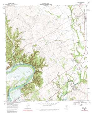
Blum Topo Map Texas
To zoom in, hover over the map of Blum
USGS Topo Quad 32097b4 - 1:24,000 scale
| Topo Map Name: | Blum |
| USGS Topo Quad ID: | 32097b4 |
| Print Size: | ca. 21 1/4" wide x 27" high |
| Southeast Coordinates: | 32.125° N latitude / 97.375° W longitude |
| Map Center Coordinates: | 32.1875° N latitude / 97.4375° W longitude |
| U.S. State: | TX |
| Filename: | o32097b4.jpg |
| Download Map JPG Image: | Blum topo map 1:24,000 scale |
| Map Type: | Topographic |
| Topo Series: | 7.5´ |
| Map Scale: | 1:24,000 |
| Source of Map Images: | United States Geological Survey (USGS) |
| Alternate Map Versions: |
Blum TX 1968, updated 1971 Download PDF Buy paper map Blum TX 1968, updated 1985 Download PDF Buy paper map Blum TX 2010 Download PDF Buy paper map Blum TX 2012 Download PDF Buy paper map Blum TX 2016 Download PDF Buy paper map |
1:24,000 Topo Quads surrounding Blum
> Back to 32097a1 at 1:100,000 scale
> Back to 32096a1 at 1:250,000 scale
> Back to U.S. Topo Maps home
Blum topo map: Gazetteer
Blum: Airports
Circle 'A' Ranch Airport elevation 182m 597′Grand Valley Lands Airport elevation 202m 662′
Smith Ranch-First State Bank Airport elevation 226m 741′
Blum: Bends
Kimball Bend elevation 174m 570′Blum: Cliffs
Bluff Mills elevation 218m 715′Broke Rock elevation 198m 649′
Blum: Parks
Chisholm Trail Park elevation 167m 547′Ham Creek Park elevation 168m 551′
Blum: Populated Places
Blum elevation 180m 590′Retreat elevation 185m 606′
Blum: Springs
Big Ham Hole Spring elevation 217m 711′Little Ham Hole Spring elevation 215m 705′
Blum: Streams
Belnap Creek elevation 169m 554′Darr Branch elevation 174m 570′
Falls Branch elevation 161m 528′
Gourd Neck Branch elevation 177m 580′
Haley Branch elevation 196m 643′
Ham Creek elevation 161m 528′
Mustang Creek elevation 179m 587′
Pilot Branch elevation 186m 610′
Blum: Valleys
Bailey Hollow elevation 161m 528′Broke Rock Hollow elevation 160m 524′
Elm Hollow elevation 161m 528′
Opossum Hollow elevation 162m 531′
Owl Hollow elevation 161m 528′
Blum digital topo map on disk
Buy this Blum topo map showing relief, roads, GPS coordinates and other geographical features, as a high-resolution digital map file on DVD:


