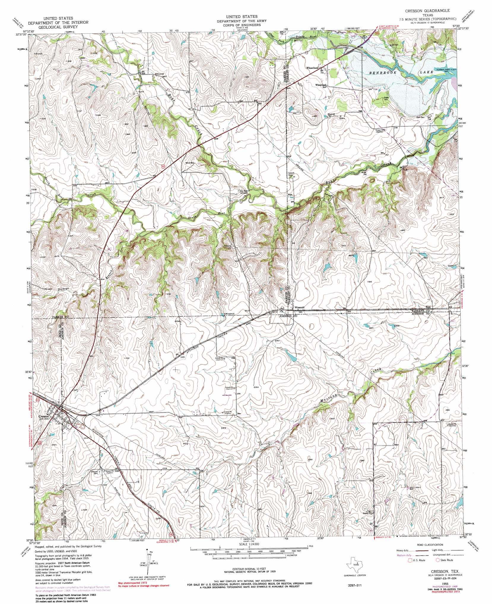
Cresson Topo Map Texas
To zoom in, hover over the map of Cresson
USGS Topo Quad 32097e5 - 1:24,000 scale
| Topo Map Name: | Cresson |
| USGS Topo Quad ID: | 32097e5 |
| Print Size: | ca. 21 1/4" wide x 27" high |
| Southeast Coordinates: | 32.5° N latitude / 97.5° W longitude |
| Map Center Coordinates: | 32.5625° N latitude / 97.5625° W longitude |
| U.S. State: | TX |
| Filename: | o32097e5.jpg |
| Download Map JPG Image: | Cresson topo map 1:24,000 scale |
| Map Type: | Topographic |
| Topo Series: | 7.5´ |
| Map Scale: | 1:24,000 |
| Source of Map Images: | United States Geological Survey (USGS) |
| Alternate Map Versions: |
Cresson TX 1955, updated 1956 Download PDF Buy paper map Cresson TX 1955, updated 1969 Download PDF Buy paper map Cresson TX 1955, updated 1985 Download PDF Buy paper map Cresson TX 2010 Download PDF Buy paper map Cresson TX 2013 Download PDF Buy paper map Cresson TX 2016 Download PDF Buy paper map |
1:24,000 Topo Quads surrounding Cresson
Weatherford North |
Lake Weatherford |
Springtown Se |
Lake Worth |
Haltom City |
Weatherford South |
Anneta |
Aledo |
Benbrook |
Fort Worth |
Tin Top |
Chapin |
Cresson |
Primrose |
Burleson |
Granbury |
Acton |
Godley |
Joshua |
Keene |
Hill City |
Nemo |
Bono |
Cleburne West |
Cleburne East |
> Back to 32097e1 at 1:100,000 scale
> Back to 32096a1 at 1:250,000 scale
> Back to U.S. Topo Maps home
Cresson topo map: Gazetteer
Cresson: Airports
Bourland Field elevation 259m 849′Cresson: Dams
Clark Dam elevation 269m 882′Cresson: Populated Places
Boss elevation 255m 836′Cresson elevation 321m 1053′
Wheatland elevation 226m 741′
Winscott elevation 290m 951′
Cresson: Reservoirs
Clark Lake elevation 269m 882′Cresson: Streams
Dickeys Branch elevation 249m 816′South Bear Creek elevation 230m 754′
Cresson digital topo map on disk
Buy this Cresson topo map showing relief, roads, GPS coordinates and other geographical features, as a high-resolution digital map file on DVD: