Hunting Shirt Creek Topo Map Texas
To zoom in, hover over the map of Hunting Shirt Creek
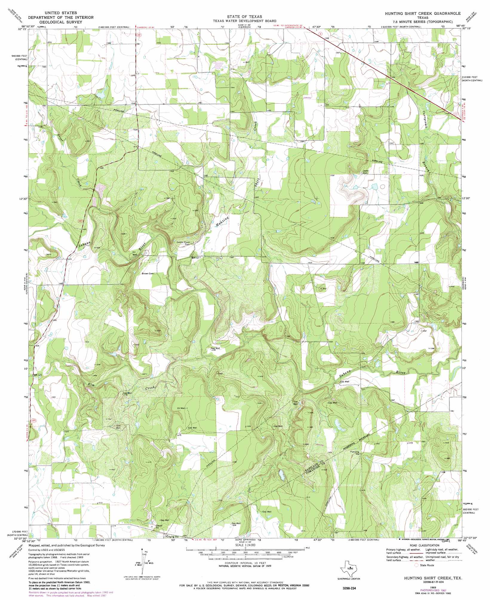
USGS Topo Quad 32098b7 - 1:24,000 scale
| Topo Map Name: | Hunting Shirt Creek |
| USGS Topo Quad ID: | 32098b7 |
| Print Size: | ca. 21 1/4" wide x 27" high |
| Southeast Coordinates: | 32.125° N latitude / 98.75° W longitude |
| Map Center Coordinates: | 32.1875° N latitude / 98.8125° W longitude |
| U.S. State: | TX |
| Filename: | o32098b7.jpg |
| Download Map JPG Image: | Hunting Shirt Creek topo map 1:24,000 scale |
| Map Type: | Topographic |
| Topo Series: | 7.5´ |
| Map Scale: | 1:24,000 |
| Source of Map Images: | United States Geological Survey (USGS) |
| Alternate Map Versions: |
Hunting Shirt Creek TX 1969, updated 1972 Download PDF Buy paper map Hunting Shirt Creek TX 1969, updated 1987 Download PDF Buy paper map Hunting Shirt Creek TX 2010 Download PDF Buy paper map Hunting Shirt Creek TX 2012 Download PDF Buy paper map Hunting Shirt Creek TX 2016 Download PDF Buy paper map |
1:24,000 Topo Quads surrounding Hunting Shirt Creek
Bernie Lake |
Cisco North |
Eastland |
Ranger |
Bear Mountain |
Scranton |
Cisco South |
Carbon |
Kokomo |
Desdemona |
Sabanno |
Union Center |
Hunting Shirt Creek |
Gorman |
Rucker |
Pioneer |
Rising Star |
Sipe Springs |
Duster |
De Leon |
Byrds |
May |
Star Mountain |
Sidney |
Comanche |
> Back to 32098a1 at 1:100,000 scale
> Back to 32098a1 at 1:250,000 scale
> Back to U.S. Topo Maps home
Hunting Shirt Creek topo map: Gazetteer
Hunting Shirt Creek: Dams
Hamner Dam elevation 471m 1545′Truett Spruill Dam elevation 461m 1512′
Whiteside Estate Lake Dam elevation 435m 1427′
Hunting Shirt Creek: Reservoirs
Hammer Lake elevation 471m 1545′Truett Spruill Lake elevation 461m 1512′
Whiteside Estate Lake elevation 435m 1427′
Hunting Shirt Creek: Streams
Elm Creek elevation 419m 1374′Greer Creek elevation 440m 1443′
Hunting Shirt Creek elevation 423m 1387′
Hunting Shirt Creek digital topo map on disk
Buy this Hunting Shirt Creek topo map showing relief, roads, GPS coordinates and other geographical features, as a high-resolution digital map file on DVD: