Monument North Topo Map New Mexico
To zoom in, hover over the map of Monument North
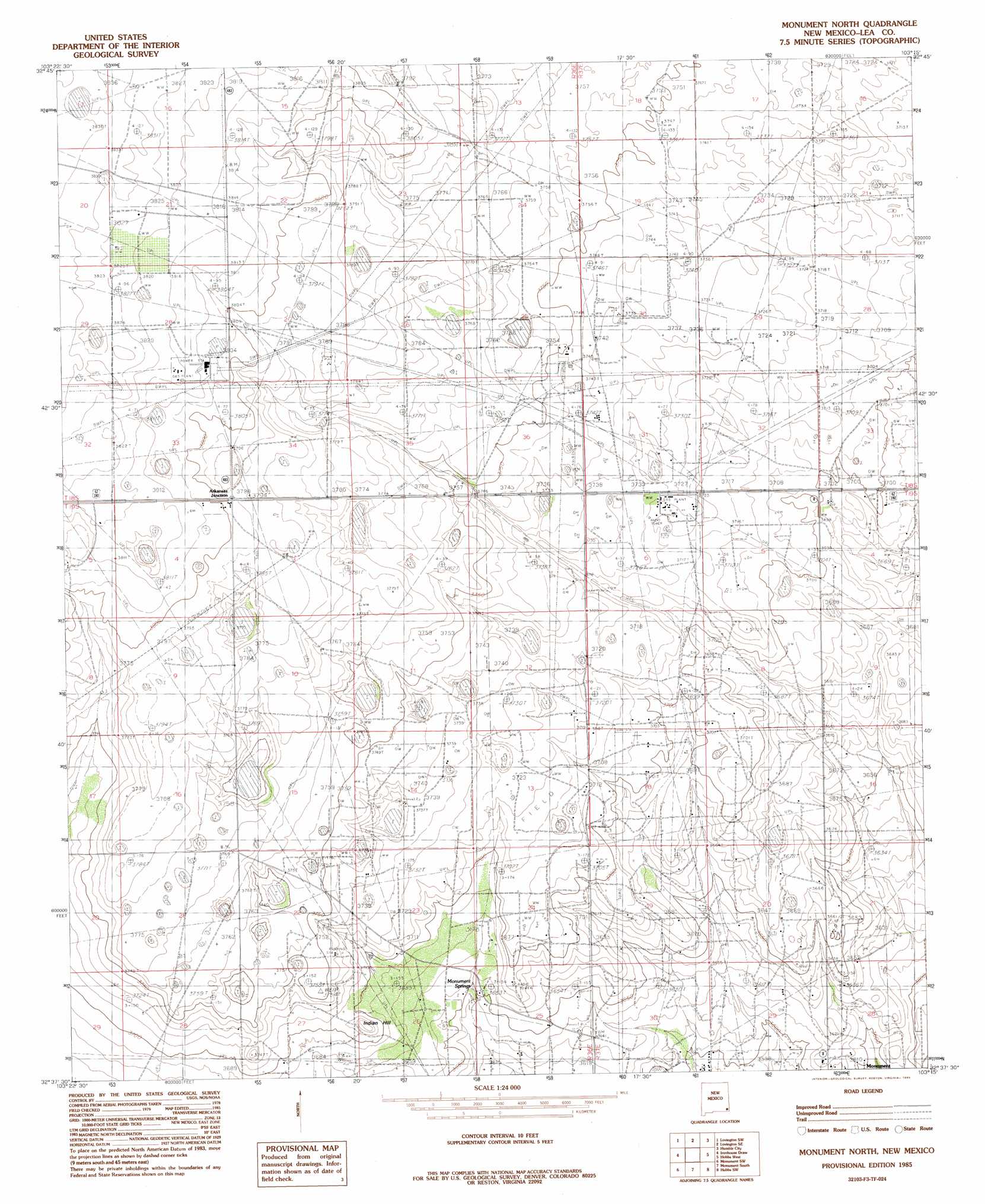
USGS Topo Quad 32103f3 - 1:24,000 scale
| Topo Map Name: | Monument North |
| USGS Topo Quad ID: | 32103f3 |
| Print Size: | ca. 21 1/4" wide x 27" high |
| Southeast Coordinates: | 32.625° N latitude / 103.25° W longitude |
| Map Center Coordinates: | 32.6875° N latitude / 103.3125° W longitude |
| U.S. State: | NM |
| Filename: | o32103f3.jpg |
| Download Map JPG Image: | Monument North topo map 1:24,000 scale |
| Map Type: | Topographic |
| Topo Series: | 7.5´ |
| Map Scale: | 1:24,000 |
| Source of Map Images: | United States Geological Survey (USGS) |
| Alternate Map Versions: |
Monument North NM 1985, updated 1985 Download PDF Buy paper map Monument North NM 2010 Download PDF Buy paper map Monument North NM 2013 Download PDF Buy paper map Monument North NM 2017 Download PDF Buy paper map |
1:24,000 Topo Quads surrounding Monument North
Buckeye Ne |
Lovington Nw |
Lovington |
Humble City Nw |
Humble City Ne |
Buckeye |
Lovington Sw |
Lovington Se |
Humble City |
Humble City Se |
Ironhouse Well |
Ironhouse Draw |
Monument North |
Hobbs West |
Hobbs East |
Lea |
Monument Sw |
Monument South |
Hobbs Sw |
Hobbs Se |
Grama Ridge |
San Simon Ranch |
Oil Center |
Eunice |
Eunice Ne |
> Back to 32103e1 at 1:100,000 scale
> Back to 32102a1 at 1:250,000 scale
> Back to U.S. Topo Maps home
Monument North topo map: Gazetteer
Monument North: Mines
Arkansas Junction M18847 Mine elevation 1155m 3789′Hobbs Natural Gas Plant elevation 1132m 3713′
New Mexico Project Number SP-2-76 elevation 1155m 3789′
Monument North: Populated Places
Arkansas Junction elevation 1158m 3799′Monument North: Springs
Monument Springs elevation 1110m 3641′Monument North: Summits
Indian Hill elevation 1139m 3736′Monument North digital topo map on disk
Buy this Monument North topo map showing relief, roads, GPS coordinates and other geographical features, as a high-resolution digital map file on DVD: