Newman Sw Topo Map New Mexico
To zoom in, hover over the map of Newman Sw
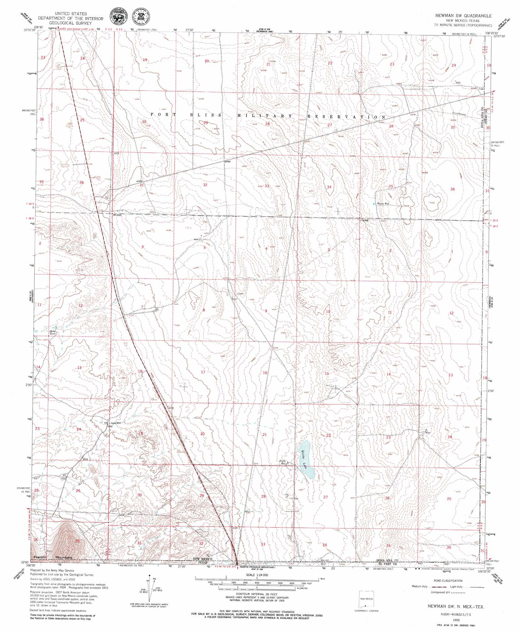
USGS Topo Quad 32106a4 - 1:24,000 scale
| Topo Map Name: | Newman Sw |
| USGS Topo Quad ID: | 32106a4 |
| Print Size: | ca. 21 1/4" wide x 27" high |
| Southeast Coordinates: | 32° N latitude / 106.375° W longitude |
| Map Center Coordinates: | 32.0625° N latitude / 106.4375° W longitude |
| U.S. States: | NM, TX |
| Filename: | o32106a4.jpg |
| Download Map JPG Image: | Newman Sw topo map 1:24,000 scale |
| Map Type: | Topographic |
| Topo Series: | 7.5´ |
| Map Scale: | 1:24,000 |
| Source of Map Images: | United States Geological Survey (USGS) |
| Alternate Map Versions: |
Newman SW NM 1955, updated 1962 Download PDF Buy paper map Newman SW NM 2010 Download PDF Buy paper map Newman SW NM 2013 Download PDF Buy paper map Newman SW NM 2017 Download PDF Buy paper map |
1:24,000 Topo Quads surrounding Newman Sw
Tortugas Mountain |
Organ Peak |
Davies Tank |
White Sands Se |
Elwood |
San Miguel |
Bishop Cap |
Newman Nw |
Newman Ne |
Desert |
La Mesa |
Anthony |
Newman Sw |
Newman |
Desert Sw |
La Union |
Canutillo |
North Franklin Mountain |
Fort Bliss Ne |
Nations East Well |
Strauss |
Smeltertown |
El Paso |
Fort Bliss Se |
Nations South Well |
> Back to 32106a1 at 1:100,000 scale
> Back to 32106a1 at 1:250,000 scale
> Back to U.S. Topo Maps home
Newman Sw topo map: Gazetteer
Newman Sw: Lakes
Quirke Lake elevation 1226m 4022′Newman Sw: Populated Places
Chaparral elevation 1239m 4064′Chapparal elevation 1239m 4064′
Newman Sw: Reservoirs
Sand Tank elevation 1275m 4183′Newman Sw: Wells
Blythe Well elevation 1230m 4035′Jessie Well elevation 1277m 4189′
Wessly Well elevation 1242m 4074′
Newman Sw digital topo map on disk
Buy this Newman Sw topo map showing relief, roads, GPS coordinates and other geographical features, as a high-resolution digital map file on DVD: