Peppersauce Wash Topo Map Arizona
To zoom in, hover over the map of Peppersauce Wash
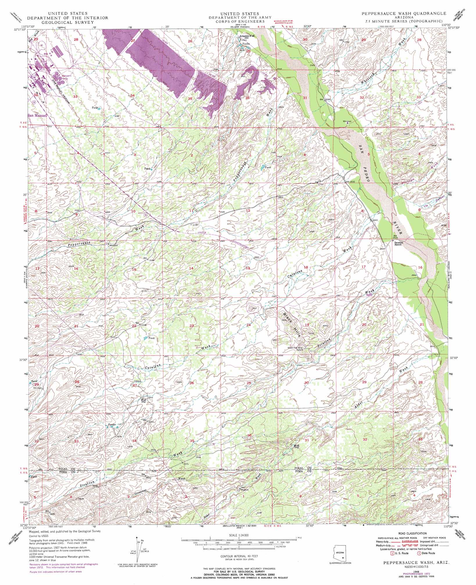
USGS Topo Quad 32110e5 - 1:24,000 scale
| Topo Map Name: | Peppersauce Wash |
| USGS Topo Quad ID: | 32110e5 |
| Print Size: | ca. 21 1/4" wide x 27" high |
| Southeast Coordinates: | 32.5° N latitude / 110.5° W longitude |
| Map Center Coordinates: | 32.5625° N latitude / 110.5625° W longitude |
| U.S. State: | AZ |
| Filename: | o32110e5.jpg |
| Download Map JPG Image: | Peppersauce Wash topo map 1:24,000 scale |
| Map Type: | Topographic |
| Topo Series: | 7.5´ |
| Map Scale: | 1:24,000 |
| Source of Map Images: | United States Geological Survey (USGS) |
| Alternate Map Versions: |
Peppersauce Wash AZ 1948, updated 1965 Download PDF Buy paper map Peppersauce Wash AZ 1948, updated 1973 Download PDF Buy paper map Peppersauce Wash AZ 1948, updated 1974 Download PDF Buy paper map Peppersauce Wash AZ 1949 Download PDF Buy paper map Peppersauce Wash AZ 1996, updated 2003 Download PDF Buy paper map Peppersauce Wash AZ 2011 Download PDF Buy paper map Peppersauce Wash AZ 2014 Download PDF Buy paper map |
1:24,000 Topo Quads surrounding Peppersauce Wash
Putnam Wash |
Lookout Mountain |
Holy Joe Peak |
Oak Grove Canyon |
Klondike |
North Of Oracle |
Mammoth |
Clark Ranch |
Rhodes Peak |
Kennedy Peak |
Oracle |
Campo Bonito |
Peppersauce Wash |
Kielberg Canyon |
Bassett Peak |
Mount Lemmon |
Mount Bigelow |
Buehman Canyon |
Redington |
Cherry Spring Peak |
Sabino Canyon |
Agua Caliente Hill |
Piety Hill |
Soza Canyon |
Soza Mesa |
> Back to 32110e1 at 1:100,000 scale
> Back to 32110a1 at 1:250,000 scale
> Back to U.S. Topo Maps home
Peppersauce Wash topo map: Gazetteer
Peppersauce Wash: Mines
Black Hills Mine elevation 953m 3126′Peppersauce Wash: Streams
Alder Wash elevation 812m 2664′Catalina Wash elevation 793m 2601′
Cienega Wash elevation 793m 2601′
Geesaman Wash elevation 935m 3067′
Little Gust James Wash elevation 769m 2522′
Peppersauce Wash elevation 779m 2555′
Stratton Wash elevation 805m 2641′
Whitlock Wash elevation 778m 2552′
Peppersauce Wash: Summits
Little Black Hills elevation 979m 3211′Peppersauce Wash: Valleys
Alder Canyon elevation 1009m 3310′YLE Canyon elevation 816m 2677′
Peppersauce Wash digital topo map on disk
Buy this Peppersauce Wash topo map showing relief, roads, GPS coordinates and other geographical features, as a high-resolution digital map file on DVD: