Woodville Topo Map Georgia
To zoom in, hover over the map of Woodville
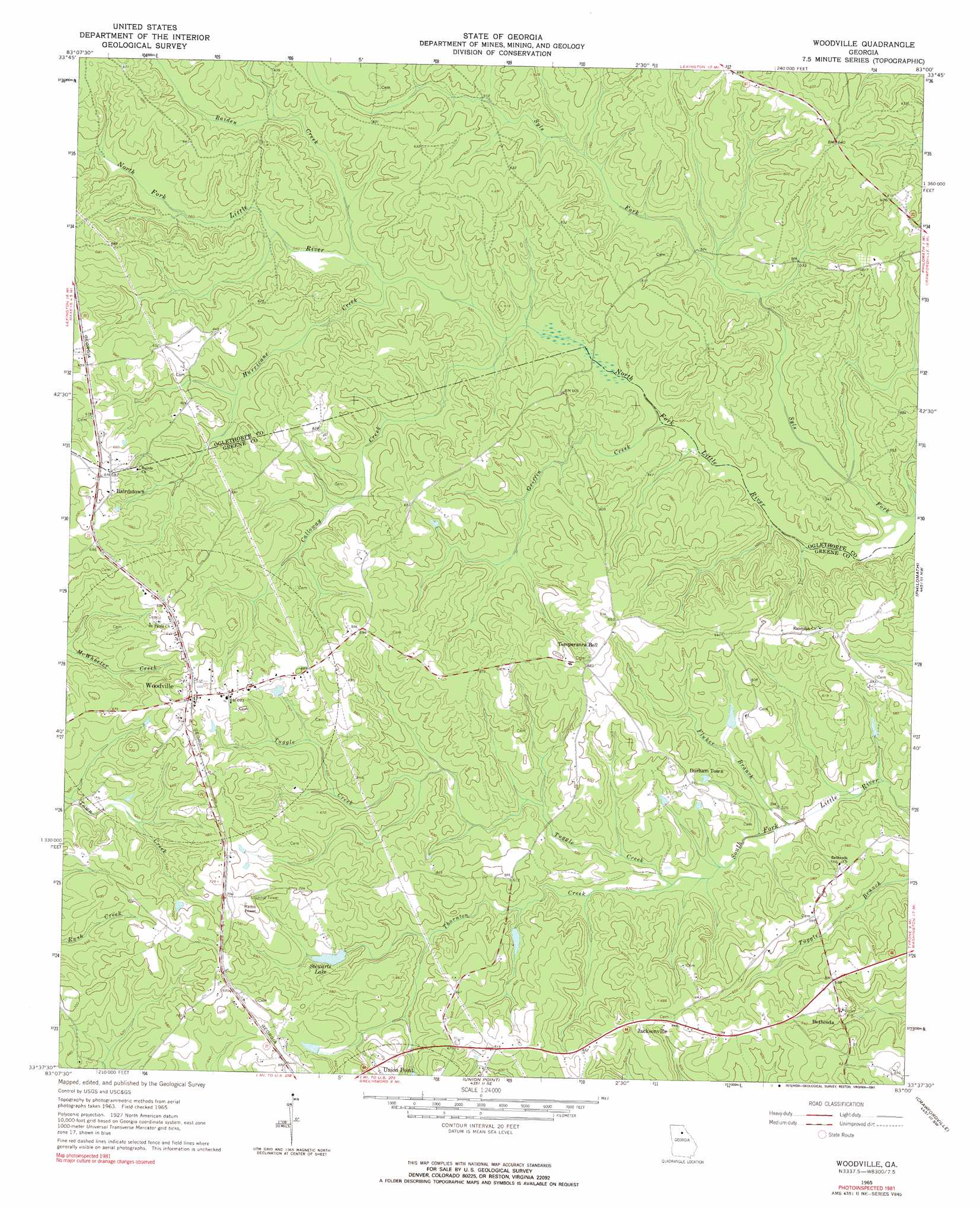
USGS Topo Quad 33083f1 - 1:24,000 scale
| Topo Map Name: | Woodville |
| USGS Topo Quad ID: | 33083f1 |
| Print Size: | ca. 21 1/4" wide x 27" high |
| Southeast Coordinates: | 33.625° N latitude / 83° W longitude |
| Map Center Coordinates: | 33.6875° N latitude / 83.0625° W longitude |
| U.S. State: | GA |
| Filename: | o33083f1.jpg |
| Download Map JPG Image: | Woodville topo map 1:24,000 scale |
| Map Type: | Topographic |
| Topo Series: | 7.5´ |
| Map Scale: | 1:24,000 |
| Source of Map Images: | United States Geological Survey (USGS) |
| Alternate Map Versions: |
Woodville GA 1965, updated 1966 Download PDF Buy paper map Woodville GA 2011 Download PDF Buy paper map Woodville GA 2014 Download PDF Buy paper map |
1:24,000 Topo Quads surrounding Woodville
Athens East |
Crawford |
Sandy Cross |
Vesta |
Jacksons Crossroads |
Barnett Shoals |
Maxeys |
Lexington |
Rayle |
Celeste |
Greshamville |
Penfield |
Woodville |
Philomath |
Washington West |
Buckhead |
Greensboro |
Union Point |
Crawfordville |
Sharon |
Harmony |
Liberty |
White Plains |
Sparta Nw |
Sparta Ne |
> Back to 33083e1 at 1:100,000 scale
> Back to 33082a1 at 1:250,000 scale
> Back to U.S. Topo Maps home
Woodville topo map: Gazetteer
Woodville: Bridges
Watts Bridge elevation 159m 521′Woodville: Dams
Stewarts Lake Dam elevation 183m 600′Woodville: Populated Places
Bairdstown elevation 207m 679′Bethesda elevation 195m 639′
Durham Town elevation 178m 583′
Grantville (historical) elevation 195m 639′
Jacksonville elevation 198m 649′
Temperance Bell elevation 207m 679′
Woodville elevation 214m 702′
Woodville: Reservoirs
Reservoir 26 elevation 170m 557′Reservoir 31 elevation 168m 551′
Stewarts Lake elevation 183m 600′
Woodville: Streams
Calloway Creek elevation 159m 521′Fluker Branch elevation 153m 501′
Griffin Creek elevation 152m 498′
Hurricane Creek elevation 165m 541′
Raiden Creek elevation 165m 541′
Thornton Creek elevation 165m 541′
Tuggle Creek elevation 159m 521′
Woodville digital topo map on disk
Buy this Woodville topo map showing relief, roads, GPS coordinates and other geographical features, as a high-resolution digital map file on DVD:
South Carolina, Western North Carolina & Northeastern Georgia
Buy digital topo maps: South Carolina, Western North Carolina & Northeastern Georgia