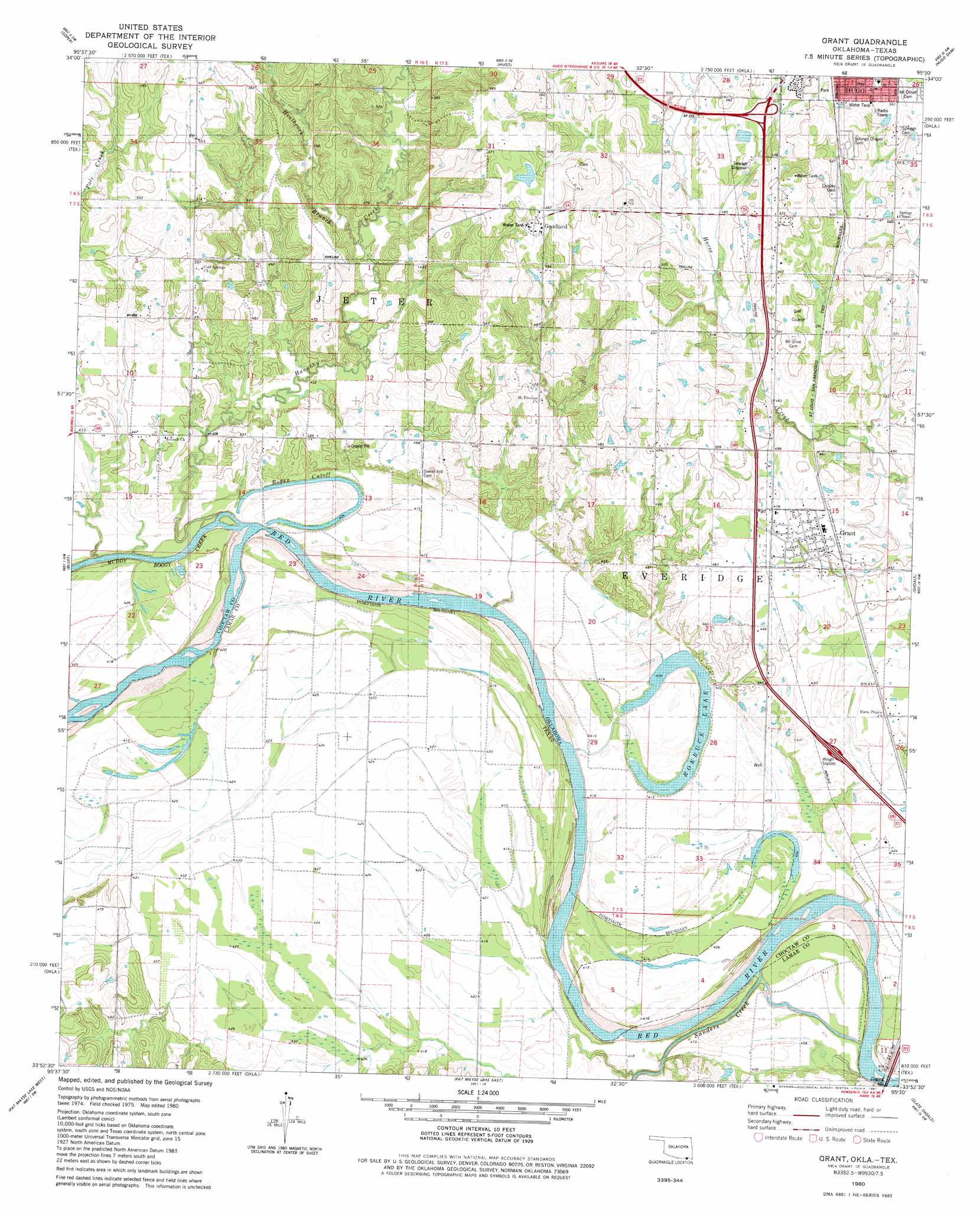
Grant Topo Map Oklahoma
To zoom in, hover over the map of Grant
USGS Topo Quad 33095h5 - 1:24,000 scale
| Topo Map Name: | Grant |
| USGS Topo Quad ID: | 33095h5 |
| Print Size: | ca. 21 1/4" wide x 27" high |
| Southeast Coordinates: | 33.875° N latitude / 95.5° W longitude |
| Map Center Coordinates: | 33.9375° N latitude / 95.5625° W longitude |
| U.S. States: | OK, TX |
| Filename: | o33095h5.jpg |
| Download Map JPG Image: | Grant topo map 1:24,000 scale |
| Map Type: | Topographic |
| Topo Series: | 7.5´ |
| Map Scale: | 1:24,000 |
| Source of Map Images: | United States Geological Survey (USGS) |
| Alternate Map Versions: |
Grant OK 1980, updated 1981 Download PDF Buy paper map Grant OK 2012 Download PDF Buy paper map Grant OK 2012 Download PDF Buy paper map Grant OK 2016 Download PDF Buy paper map |
1:24,000 Topo Quads surrounding Grant
Darwin |
Antlers West |
Antlers East |
Rattan |
Spencerville |
Boswell |
Soper |
Hugo |
Hugo Dam |
Fort Towson |
New Oberlin |
Bluff |
Grant |
Shoals |
Frogville |
Direct |
Pat Mayse Lake West |
Pat Mayse Lake East |
Slate Shoals |
Woodland |
Tigertown |
Toco |
Paris |
Blossom |
Detroit |
> Back to 33095e1 at 1:100,000 scale
> Back to 33094a1 at 1:250,000 scale
> Back to U.S. Topo Maps home
Grant topo map: Gazetteer
Grant: Bends
Pitts Bend elevation 126m 413′Grant: Channels
Boggy Cutoff elevation 125m 410′Grant: Islands
Allen Island elevation 125m 410′Grant: Lakes
Grassy Lake elevation 129m 423′Roebuck Lake elevation 125m 410′
Grant: Populated Places
Gay elevation 135m 442′Goodland elevation 170m 557′
Grant elevation 142m 465′
Grant: Streams
Hanubby Creek elevation 122m 400′Heathcock Branch elevation 131m 429′
Muddy Boggy Creek elevation 120m 393′
Sanders Creek elevation 122m 400′
Grant digital topo map on disk
Buy this Grant topo map showing relief, roads, GPS coordinates and other geographical features, as a high-resolution digital map file on DVD: